MTB - Rodltal tour
Mountainbike 2,7
Navigare
Navigare
Scarica questo tour sul tuo cellulare
Mappa
MTB - Rodltal tour
Mountainbike
31,48 km
Scansionate il codice QR e avviate la navigazione nell'app bergfex.
QR Code
Escursioni e tracking
Scarica per iOS
Scaricare per Android

MTB - Rodltal tour

Distanza
31,48 km
Durata
03:25 h
Salita
728 m
Livello del mare
258 - 529 m
Scarica la traccia
Mappa
MTB - Rodltal tour
Mountainbike
31,48 km

From the Walding Sports Park, the Rodltal tour leads past the Walding Zoo to the Mursberg, until a short single trail leads down to the Saurüsselbach and over the Oberstraßer Höhenrücken to the idyllic...


Descrizione del

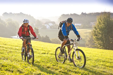
From the Walding Sports Park, the Rodltal tour leads past the Walding Zoo to the Mursberg, until a short single trail leads down to the Saurüsselbach and over the Oberstraßer Höhenrücken to the idyllic Eschelbach, where you meet the connection to the Granitlandrunde or Hansbergland-Südrunde. Further along the tour, the beautiful onion tower of the St. Gotthard church soon comes into view. From the valley of the Kleine Rodl, the route leads up to Limberg, where a breathtaking view of the Danube valley and the Alps can be enjoyed, before it goes down in serpentines to the Große Rodl and you can let the bike run easily to Rottenegg. But still in the village it goes up to the next viewpoint to Jörgensbühl and finally along the Brandstätterbach back to the sports park Walding.

The variant E1 leads from the parking lot in the Rottenegg sports field street over the old stone-paved trade route, the Krumauer Reichsstraße, to the Oberstraßer Höhenrücken and there joins the Rodltal tour E. If you finish this in Rottenegg, you are back at the starting point of the variant E1.
Descrizione del

The tour leads up to panoramic heights and through five river valleys. You can start with parking in Walding at the Sportpark or in St. Gotthard at the Musikheim. Also at the sports field Rottenegg can be entered into the variant E1.

Tecnologia
n.d.
Condizione
n.d.
Paesaggio
5 / 6
Esperienza
5 / 6
Il periodo migliore dell'anno
Gen
Feb
Mar
Apr
Mag
Giu
Lug
Ago
Set
Ott
Nov
Dic
Condividi tour
Mappa
MTB - Rodltal tour
Mountainbike
31,48 km
Errore
Si è verificato un errore. Si prega di riprovare.
Valutazioni
2,7
5
(0)
4
(1)
3
(1)
2
(0)
1
(1)
1 Commento
Avatar da Georg M.
Georg M.
09. apr. 2024
Verificato andato
Gute Tour auch mit dem Gravelbike machbar.
Utile (0) |
Rapporto
Errore
Si è verificato un errore. Si prega di riprovare.
Scrivi una recensione

Le recensioni aiutano gli altri utenti a scegliere la loro prossima avventura. Si prega di valutare solo il tour, non il tempo o lo spuntino.

Selezionare una delle stelle per valutare il tour
Brutto tour
Tour debole
Tour mediocre
Buon tour
Un tour eccellente
bergfex logoApprofondisciSempre in diretta sul posto con oltre 9.500 webcam. bergfex In qualità di utente Pro, ora è possibile vedere le webcam corrispondenti a molti tour nell'app tour da. In questo modo è possibile visualizzare direttamente le condizioni attuali.
Escursioni e tracking

Escursioni e tracking

scaricare per iOSscaricare per Android
Escursioni e tracking
Oltre 550.000 proposte di escursioni, mappe dettagliate e un intuitivo pianificatore di itinerari rendono l'app un must per tutti gli appassionati di natura.
Escursioni e tracking