Gasthof Eibl - St. Michael - Pfarrkirche St. Josef - Kastenberg
pesante
Navigare
Navigare
Scarica questo tour sul tuo cellulare
Gasthof Eibl - St. Michael - Pfarrkirche St. Josef - Kastenberg
pesante
Bicicletta
74,21
km
Scansionate il codice QR e avviate la navigazione nell'app bergfex.

Escursioni e tracking


Gasthof Eibl - St. Michael - Pfarrkirche St. Josef - Kastenberg
pesante
Distanza
74,21
km
Durata
06:29
h
Salita
1.397
m
Livello del mare
293 -
509
m
Scarica la traccia
Gasthof Eibl - St. Michael - Pfarrkirche St. Josef - Kastenberg
pesante
Bicicletta
74,21
km


Percorso
St. Michael
(438 m)
Luogo di culto
0,1 km
Tittling
(529 m)
Città
18,9 km
Kastenberg
(386 m)
Vertice
37,0 km
Spitalkirche "St. Johann"
(301 m)
Luogo di culto
46,4 km
Angl
(432 m)
Quartiere
54,1 km
Straßkirchen
(442 m)
Villaggio
57,1 km
St. Michael
(438 m)
Luogo di culto
74,0 km
Percorso
Gasthof Eibl - St. Michael - Pfarrkirche St. Josef - Kastenberg
pesante
Bicicletta
74,21
km
Gasthof Eibl
(432 m)
Ristorante
0,0 km
Röhrnbach
(434 m)
Villaggio
0,1 km
St. Michael
(438 m)
Luogo di culto
0,1 km
Köpplmühl
(385 m)
Insediamento
2,1 km
Hochgstaudert
(446 m)
Insediamento
2,7 km
Niederpretz
(440 m)
Insediamento
3,6 km
Prag
(457 m)
Villaggio
6,0 km
XXL Dorfschänke Prag
(456 m)
Ristorante
6,0 km
Ramling
(419 m)
Insediamento
8,1 km
Kalteneck
(333 m)
Villaggio
10,0 km
Saag
(342 m)
Insediamento
11,1 km
Enzersdorf
(453 m)
Villaggio
14,6 km
Witzmannsberg
(495 m)
Villaggio
16,0 km
Roitham
(492 m)
Insediamento
17,4 km
Tittling
(529 m)
Città
18,9 km
Preming
(497 m)
Insediamento
19,4 km
Pirking
(409 m)
Insediamento
21,7 km
Pizzeria Al Tiglio
(466 m)
Ristorante
24,8 km
Neukirchen vorm Wald
(466 m)
Villaggio
24,9 km
Trasham
(424 m)
Villaggio
27,0 km
Sittenberg
(470 m)
Villaggio
27,3 km
Fillasöd
(464 m)
Insediamento
28,1 km
Pfarrkirche St. Josef
(445 m)
Luogo di culto
29,7 km
Taverna Metaxa
(440 m)
Ristorante
29,9 km
Landgasthof "Zum Müller"
(437 m)
Ristorante
29,9 km
Pizzeria Palermo
(437 m)
Ristorante
30,0 km
Ruderting
(449 m)
Villaggio
30,6 km
Tiefenbach
(366 m)
Villaggio
34,1 km
Pizzeria Vesuvio
(368 m)
Ristorante
34,3 km
Kastenberg
(386 m)
Vertice
37,0 km
Fatting
(417 m)
Insediamento
39,0 km
Patriching
(432 m)
Villaggio
39,4 km
Dietzing
(433 m)
Insediamento
40,9 km
Unterdietzing
(417 m)
Insediamento
41,5 km
Sportgaststätte Hacklberg
(319 m)
Ristorante
44,0 km
Hacklberg
(335 m)
Quartiere
44,5 km
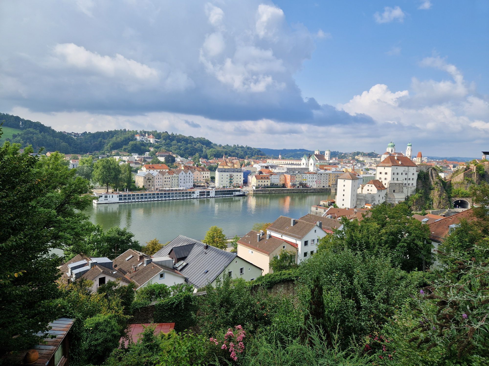
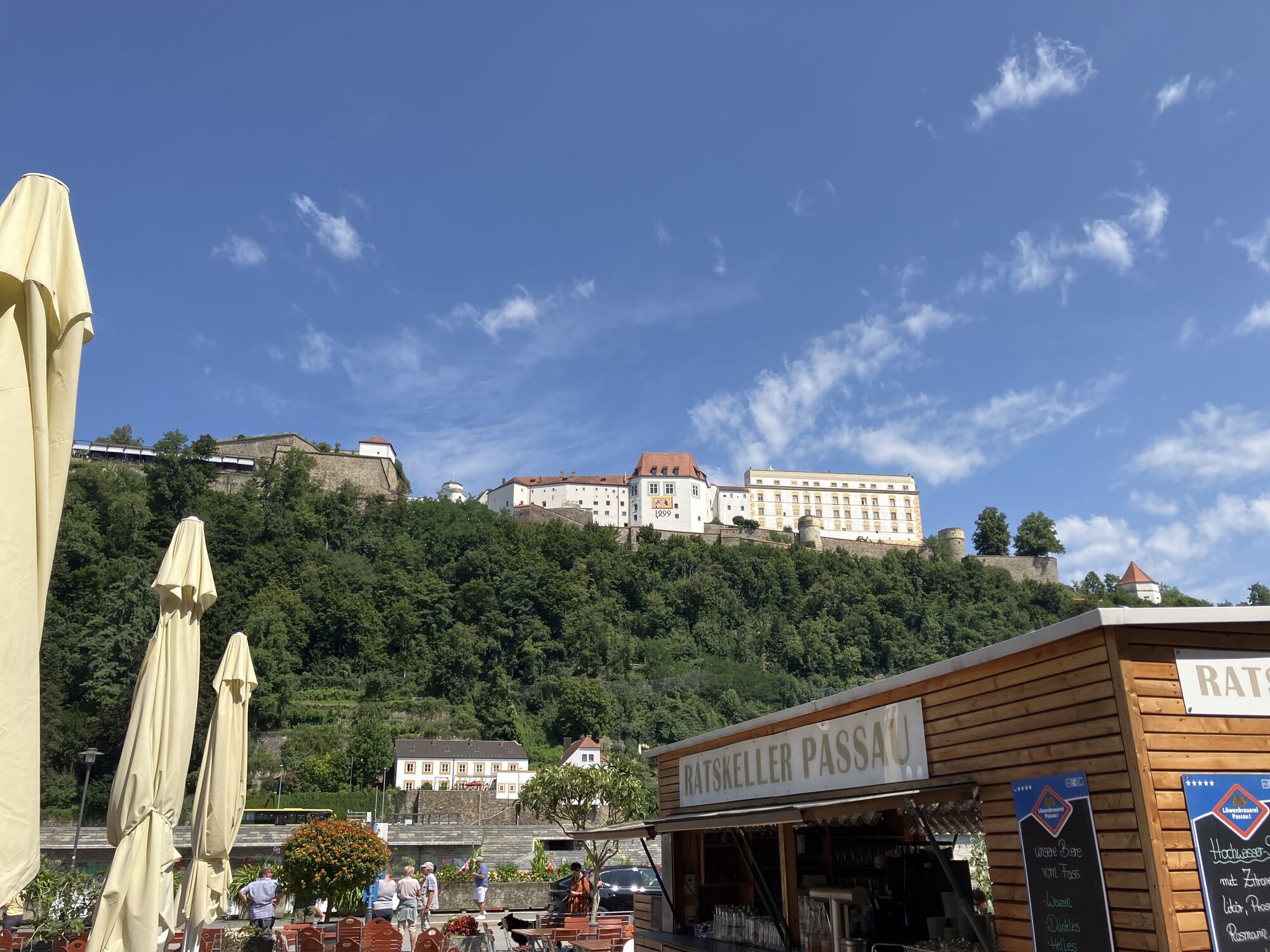
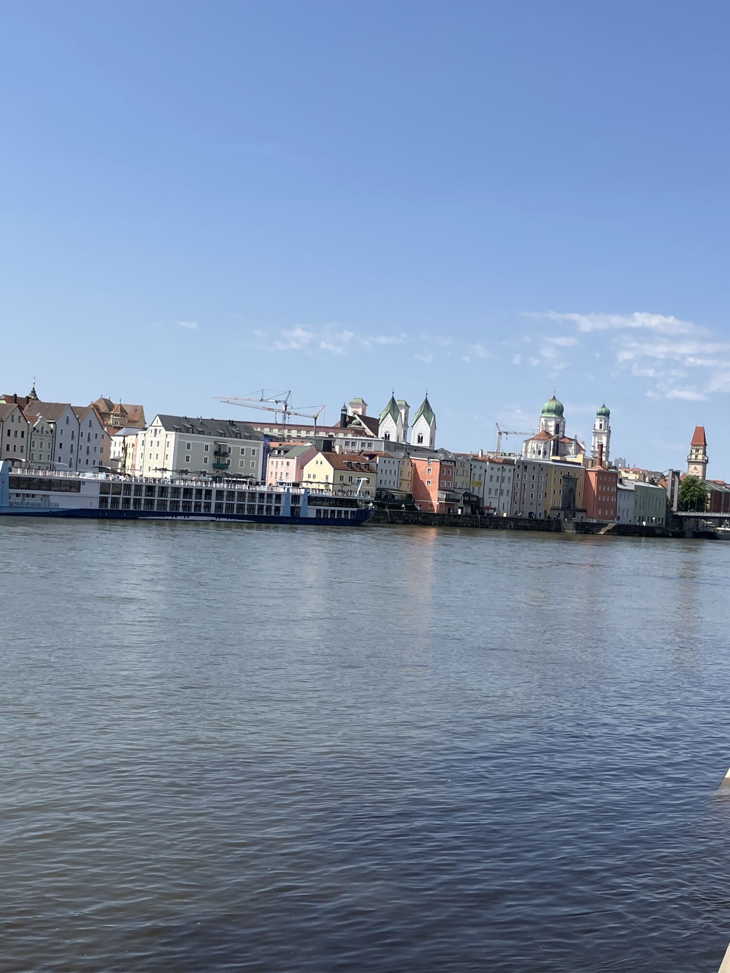
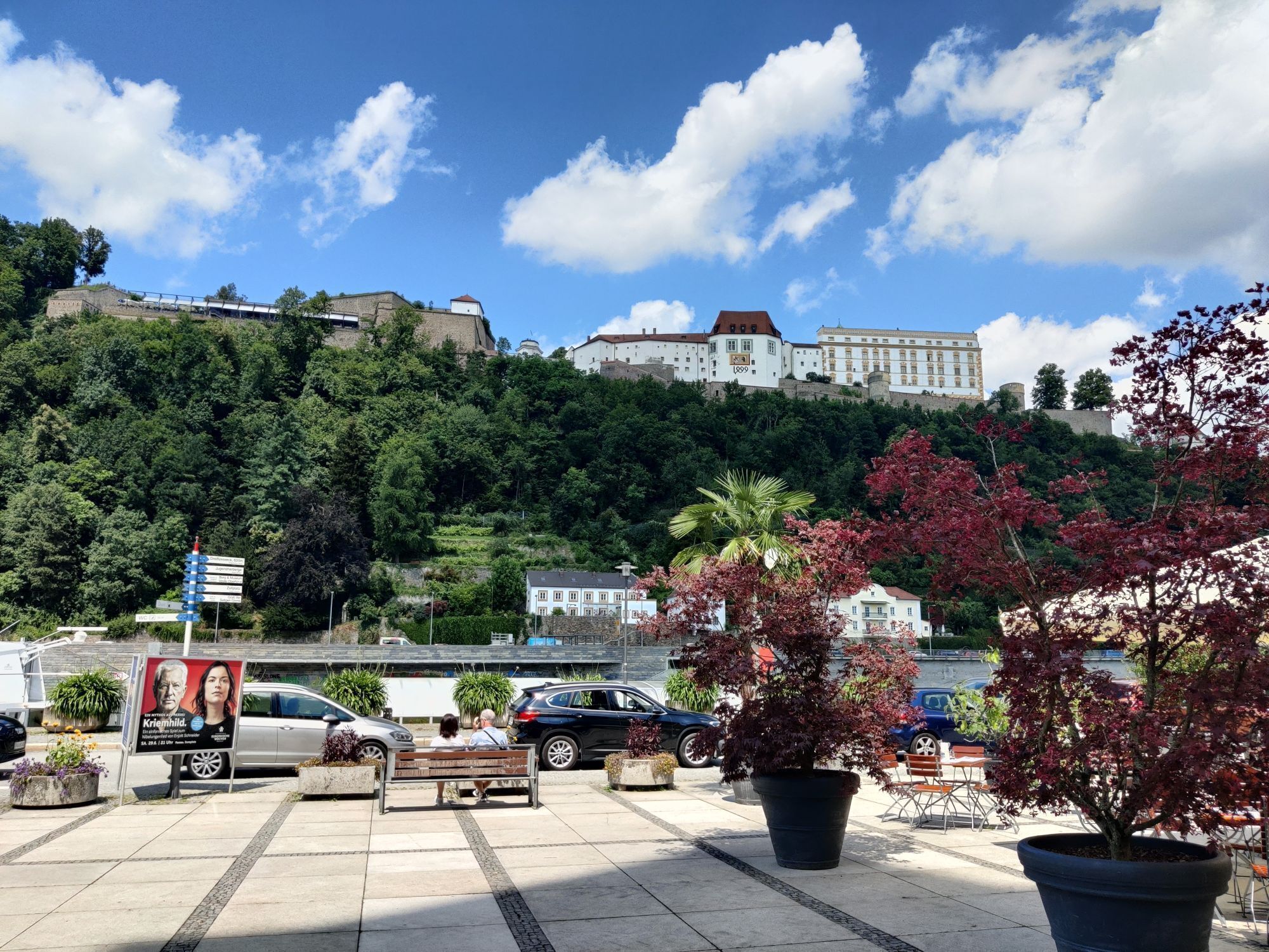
Passau
(312 m)
Città
46,4 km
Islamische Gemeinschaft Passau
(297 m)
Luogo di culto
46,4 km
Spitalkirche "St. Johann"
(301 m)
Luogo di culto
46,4 km
Schiffanlegestelle Wurm+Noe
(292 m)
Imbarcadero per traghetti
46,7 km
Altstadt
(312 m)
Quartiere
46,7 km
Ilzstadt
(306 m)
Quartiere
47,6 km
Rosencafe Aschenbrenner
(297 m)
Ristorante
49,0 km
Lindau
(323 m)
Quartiere
50,4 km
Hotel-Restaurant Burgwald
(430 m)
Ristorante
52,8 km
Angl
(432 m)
Quartiere
54,1 km
Salzweg
(446 m)
Villaggio
54,8 km
Gasthof Spetzinger
(456 m)
Ristorante
55,2 km
Straßkirchen
(442 m)
Villaggio
57,1 km
Schlott
(446 m)
Insediamento
58,1 km
Neuhäuser
(409 m)
Insediamento
58,9 km
Bärnbach
(400 m)
Insediamento
59,3 km
Gasthaus Fuchs
(403 m)
Ristorante
60,3 km
Leoprechting
(406 m)
Insediamento
60,4 km
Hutthurm
(460 m)
Villaggio
62,4 km
Lebersberg
(431 m)
Insediamento
63,5 km
Kalteneck
(333 m)
Villaggio
64,8 km
Ramling
(419 m)
Insediamento
66,1 km
Prag
(457 m)
Villaggio
68,1 km
XXL Dorfschänke Prag
(456 m)
Ristorante
68,1 km
Niederpretz
(440 m)
Insediamento
70,6 km
Hochgstaudert
(446 m)
Insediamento
71,5 km
Köpplmühl
(385 m)
Insediamento
72,0 km
St. Michael
(438 m)
Luogo di culto
74,0 km
Röhrnbach
(434 m)
Villaggio
74,1 km
Gasthof Eibl
(432 m)
Ristorante
74,2 km
Ancora nessuna recensione
I tour più popolari nelle vicinanze
-
4,7
Ilztalwanderweg
medioEscursionismo 15,2 km -
4,5
Waldkirchen Saußbachklamm Rundweg
luceEscursionismo 4,99 km -
4,5
Von Hals nach Mausmühle
luceEscursionismo 12,2 km -
5,0
Freinberg: Passaublick-Severinsweg
luceEscursionismo 9,52 km -
Passau: percorso urbano dalla natura alla cultura
luceEscursionismo 6,82 km -
3,0
Freudensee - Oberfrauenwald
medioEscursionismo 11,7 km -
4,7
Staffelberg (793m) mit Freudenseerunde
luceEscursioni in montagna 9 km -
5,0
Steinbruch
medioEscursionismo 9,42 km -
Donau-Bayerwald Radroute
Mountainbike 51,1 km -
Donausteig tappa 1_S01 Passau - Kasten "Attraverso il Sauwald nella vallata del Danubio"
pesantePercorso a piedi di lunga distanza 20,4 km
Escursioni e tracking

Oltre 550.000 proposte di escursioni, mappe dettagliate e un intuitivo pianificatore di itinerari rendono l'app un must per tutti gli appassionati di natura.

Non perdete le offerte e le ispirazioni per le vostre prossime vacanze
Iscriviti alla newsletter
Errore
Si è verificato un errore. Si prega di riprovare.
Grazie per la vostra registrazione
Il vostro indirizzo e-mail è stato aggiunto alla mailing list.
Tour in tutta Europa
Austria
Svizzera
Germania
Italia
Slovenia
Francia
Paesi Bassi
Belgio
Polonia
Liechtenstein
Repubblica Ceca
Slovacchia
Spagna
Croazia
Bosnia ed Erzegovina
Lussemburgo
Andorra
Portogallo
Islanda
Regno Unito
Irlanda
Grecia
Albania
Macedonia del Nord
Malta
Norvegia
Montenegro
Moldavia
Kosovo
Ungheria
San Marino
Romania
Estonia
Lettonia
Bielorussia
Cipro
Lituania
Serbia
Bulgaria
Monaco
Danimarca
Svezia
Finlandia