
Altezze neve & Rapporti neve
- Bollettino della neve
- Ieri, 15:08
- Montagna (Pista, 3.600m)
- 295 cm
- Condizioni neve
- nessun messaggio
- Ultima nevicata Regione
- Ieri
- Livello d'allarme slavine
- Livello 3 a 4: Rischio da marcato ad alto
Previsione neve Alvernia-Rodano-Alpi
Piste e Impianti
- Orario
- ogni giorno
- Orario d'apertura
- 07:00 - 19:30
- Condizioni delle piste
- nessun messaggio
- Impianti aperti
- 9 da 42
- Piste aperte
-
4
da 96
- Discesa a valle
- chiuse
- Funpark
- aperto
- Fonte
- anmsm.fr
Meteo
- Meteo Montagna
- pioggia mista a neve
- Nota
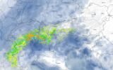
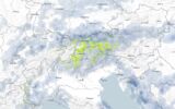
RAIN EARLY IN THE DAY, FOLLOWED BY CLEAR SPELLS AND LOCALISED THUNDERSHOWERS.<br><br>Early in the day, the sky will be overcast, and the heavy localised rain from overnight will linger over our region. Then, as the morning progresses, it will clear away to the north, giving way to slightly more changeable weather, with the return of localised sunny spells and showers taking over, becoming locally stormy from midday onwards. A few gusts of wind are possible as they pass through. The air will cool and the rain-snow line will drop to around 1,800–2,000 metres. By late afternoon, the stormy showers may begin to become more sporadic and less frequent, but the risk will persist into the evening.<br>Accumulations for the day and into the evening: 5 to 15 mm in places during the heaviest showers (sometimes within a short period), with accumulations likely to vary significantly over distances of just a few kilometres.<br><br>Maximum temperatures: 16 to 19°C in the lowlands, 12°C at around 1000m, 4°C at around 2000m.<br>0°C isotherm: around 2100/2300m<br>Wind at 2000m: South-westerly 15–30 km/h (locally 40 km/h early in the day).<br>Wind at 3000m: South-westerly 30–40 km/h, then 20 km/h by the end of the day.
Webcam
- Val Thorens / Les 3 Vallées
- Chamonix Mont-Blanc
- Tignes
- Les 2 Alpes
- Val d'Isère
- La Plagne / Paradiski
- Alpe d'Huez / Espace Alpe d'Huez
- Les Arcs - Bourg-Saint-Maurice / Paradiski
- Méribel / Les 3 Vallées
- La Rosière - Espace San Bernardo
- Les Menuires / Les 3 Vallées
- Avoriaz 1800 / Portes du Soleil
- Thollon les Mémises
- Châtel / Portes du Soleil
- Grands Montets / Argentière
- Val Cenis
- Courchevel / Les 3 Vallées
- Flaine / Le Grand Massif
- Valmorel - Le Grand Domaine
- Super Besse - Massif du Sancy
