


Vent - Breslauer Hut - Vent


From Vent you walk to Stablein Alm (lift's top station) either along a very broad and permanently ascending trail or on a steeper trail right below the chair lift. At Stableinalm you take the rising footpath...
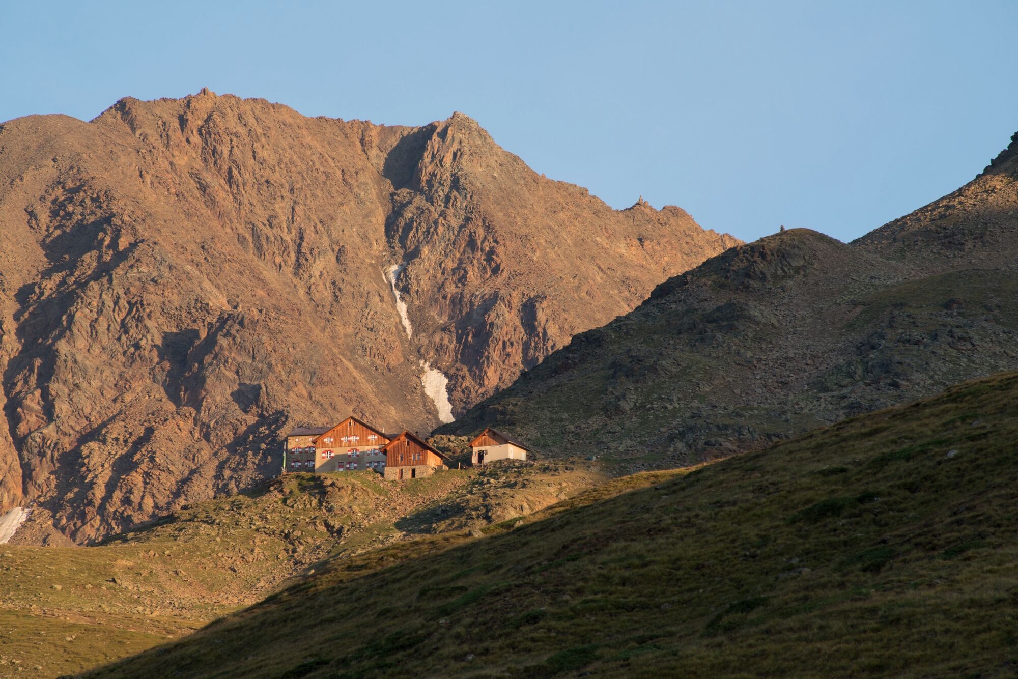
From Vent you walk to Stablein Alm (lift's top station) either along a very broad and permanently ascending trail or on a steeper trail right below the chair lift. At Stableinalm you take the rising footpath – which becomes very steep and narrow at the end – towards Breslauer Hütte.


From Vent you walk to Stablein Alm (lift's top station) either along a very broad and permanently ascending trail or on a steeper trail right below the chair lift. At Stableinalm you take the rising footpath – which becomes very steep and narrow at the end – towards Breslauer Hütte.
Appropriate equipment such as breathable suitable outdoor clothes for the weather, ankle-high walking boots, wind-, rain- & sun protection, hat, possibly gloves, is for all hikes and tours necessary. Please bring a first-aid box, a mobile phone, a walking map and if there is no hut on the way a snack and enough to drink.
Moderate mountain trail; for sure-footed and experienced hikers. Good physical condition, mountain experience & mountain equipment (see notice equipment) necessary. Please pay attention to the current weather report: www.oetztal.com
The car drive to the Ötztal valley. Situated in Tirol, the Ötztal valley set off in southerly direction and is the longest side valley in the Eastern Alps. The journey with the car leads you through the Inntal valley to the entrance of the valley and further on through the valley. Among the toll motorways you can also use the country roads. A route planner will show you the easiest and most convenient way: www.google.at/maps
Travel safe and comfortable with the train to the Ötztal Bahnhof train station. Last stop and exit point is the train station Ötztal Bahnhof. Afterwards you can travel smoothly and quick with the public transport or our local taxi companies through the valley to your desired destination. Please find the current bus timetable here: fahrplan.vvt.at
The following parking options are available in the mountaineering village Vent
- In summertime in front of the village (parking machine, only coins or EC card) and at the chairlift (at the ticket office of the mountain railways)
- In wintertime only at the chairlift
Cost: € 6,00 per day/car
Summer Mountain lifts Vent:
Chairlift Wildspitze 2.354 m and 6-seater chairlift Wildes Mannle 2.646 m
I tour più popolari nelle vicinanze
- 4,8
Vent - Martin Busch Hütte - Similaunhütte
medioEscursionismo13,7 km - 4,5
Lake Gaislachsee
medioEscursionismo4,04 km - 4,9
Pfossental - vom Vorderkaser auf die Stettinerhütte
medioEscursionismo23,7 km - 5,0
07. 19.07.19 - Langeggbahn-Rotkogel–Schwarzsee-Schwarzkogel-Giggijochbahn
medioEscursionismo6,67 km - 5,0
Weißkugel 3738m - Kurzras über Schöne Aussicht zur Weißkugel
pesanteAlta via14,7 km - 4,8
Aufstieg zur Rüsselsheimer Hütte
luceEscursionismo3,28 km - 4,0
E5 - 4. Etappe: Zams - Braunschweiger Hütte
medioPercorso a piedi di lunga distanza5 km - 5,0
Similaun-Hütte
medioEscursioni in montagna14 km - 5,0
Rotkoglhütte
luceEscursionismo3,67 km - 5,0
Kurzras - Schöne Aussicht - ins hintere Eis
medioEscursionismo13,0 km
Escursioni e tracking


Non perdete le offerte e le ispirazioni per le vostre prossime vacanze
Il vostro indirizzo e-mail è stato aggiunto alla mailing list.