


Frauenalm-Runde (SW 32)


Foto dei nostri utenti
-
 © Manuel RiedelCreato il 15.09.2025
 -

 © Olariu AdrianCreato il 18.08.2025
 -
 © Jonny BlackCreato il 13.06.2023
 -

 © Josef LeebCreato il 26.10.2025
 -
 © Josef LeebCreato il 26.10.2025
 -
 © Reinhard FlorreitherCreato il 01.09.2025
 -
 © Bernhard Gruber 1Creato il 12.07.2025
 -
 © Bernhard Gruber 1Creato il 12.07.2025
 -
 © Adam JuřicaCreato il 27.06.2025
 -

 © Noah RoeCreato il 09.05.2025
 -
 © Noah RoeCreato il 01.05.2025
 -
 © Niels van dorssenCreato il 19.01.2025


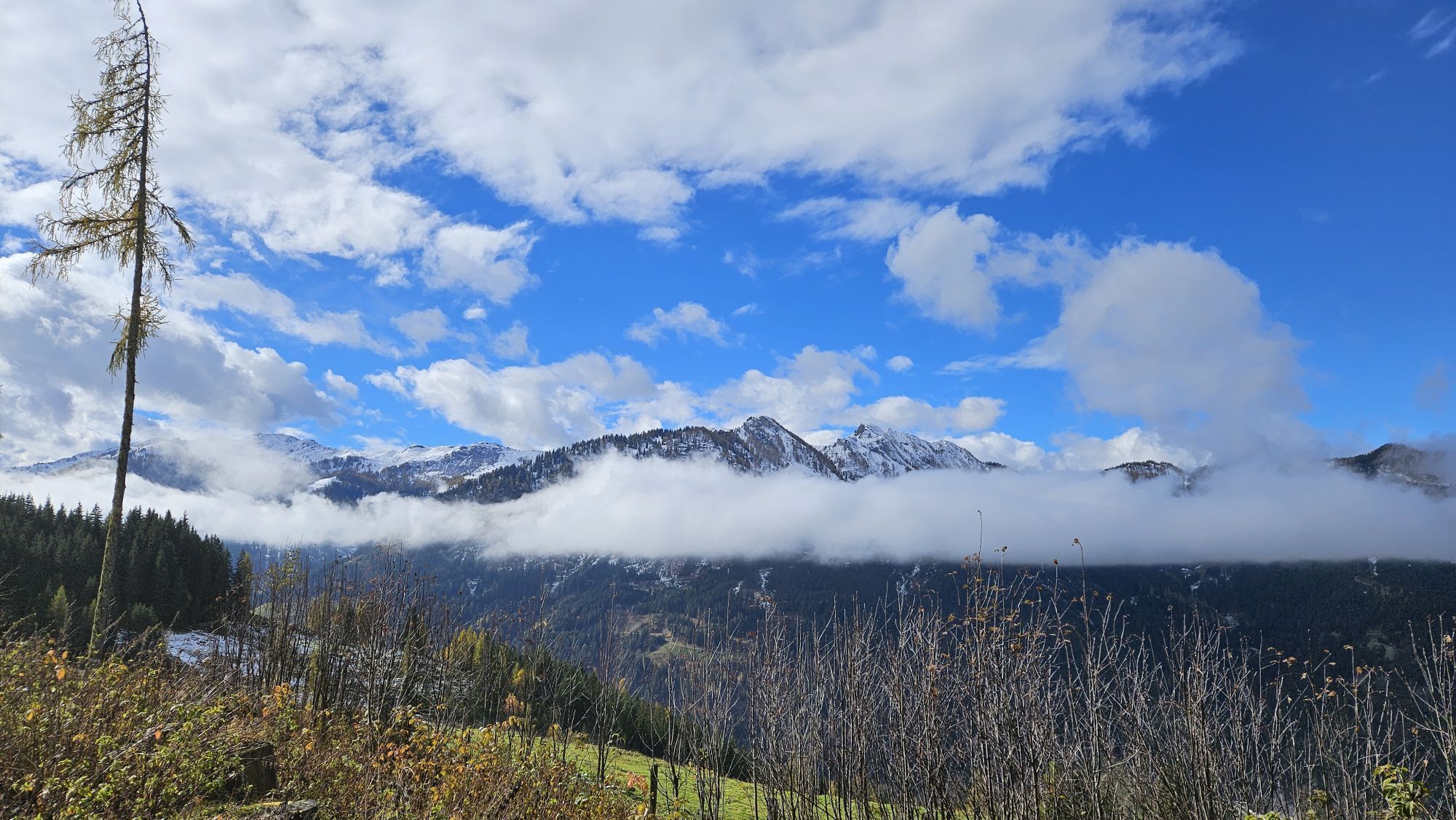
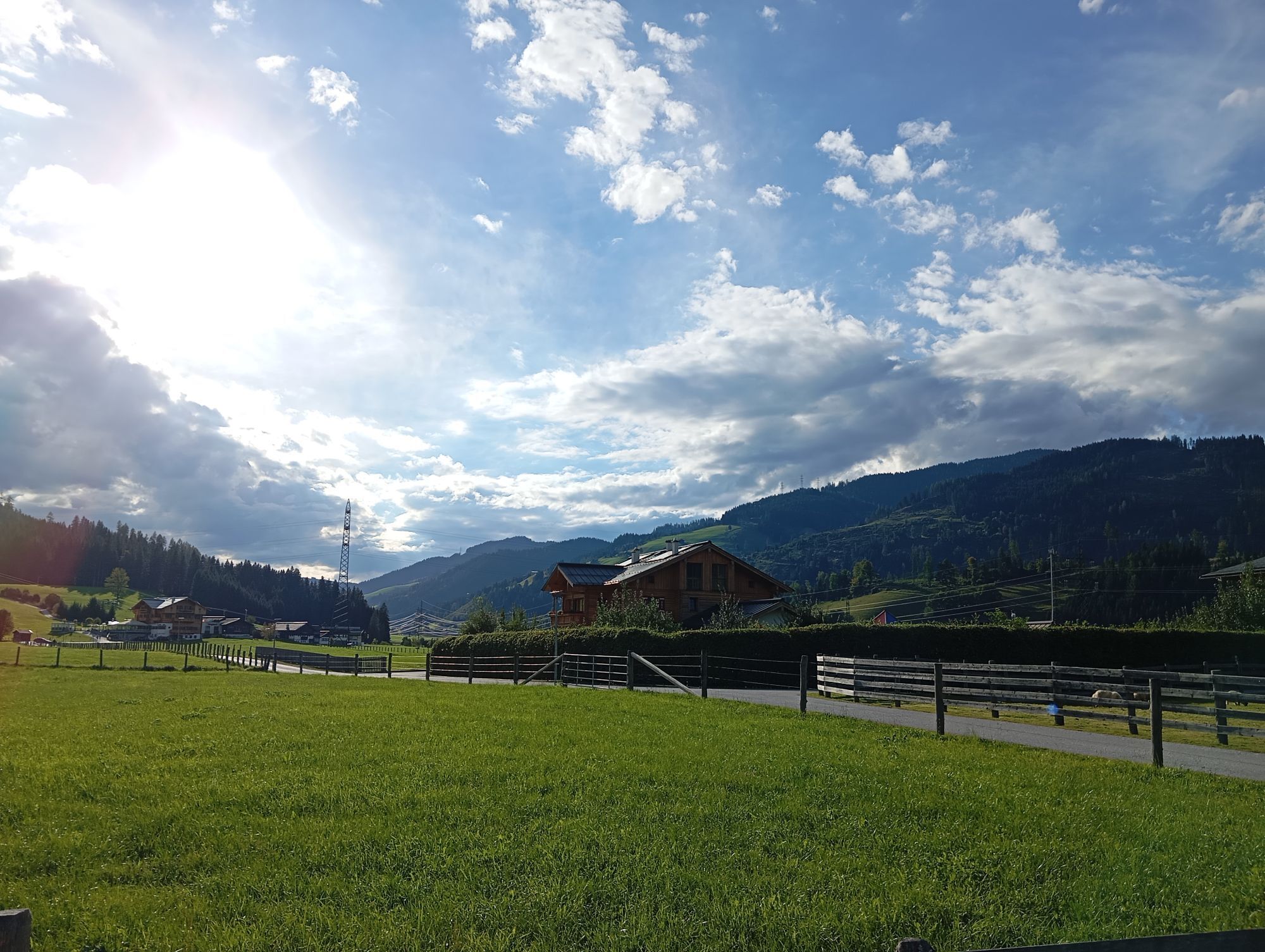


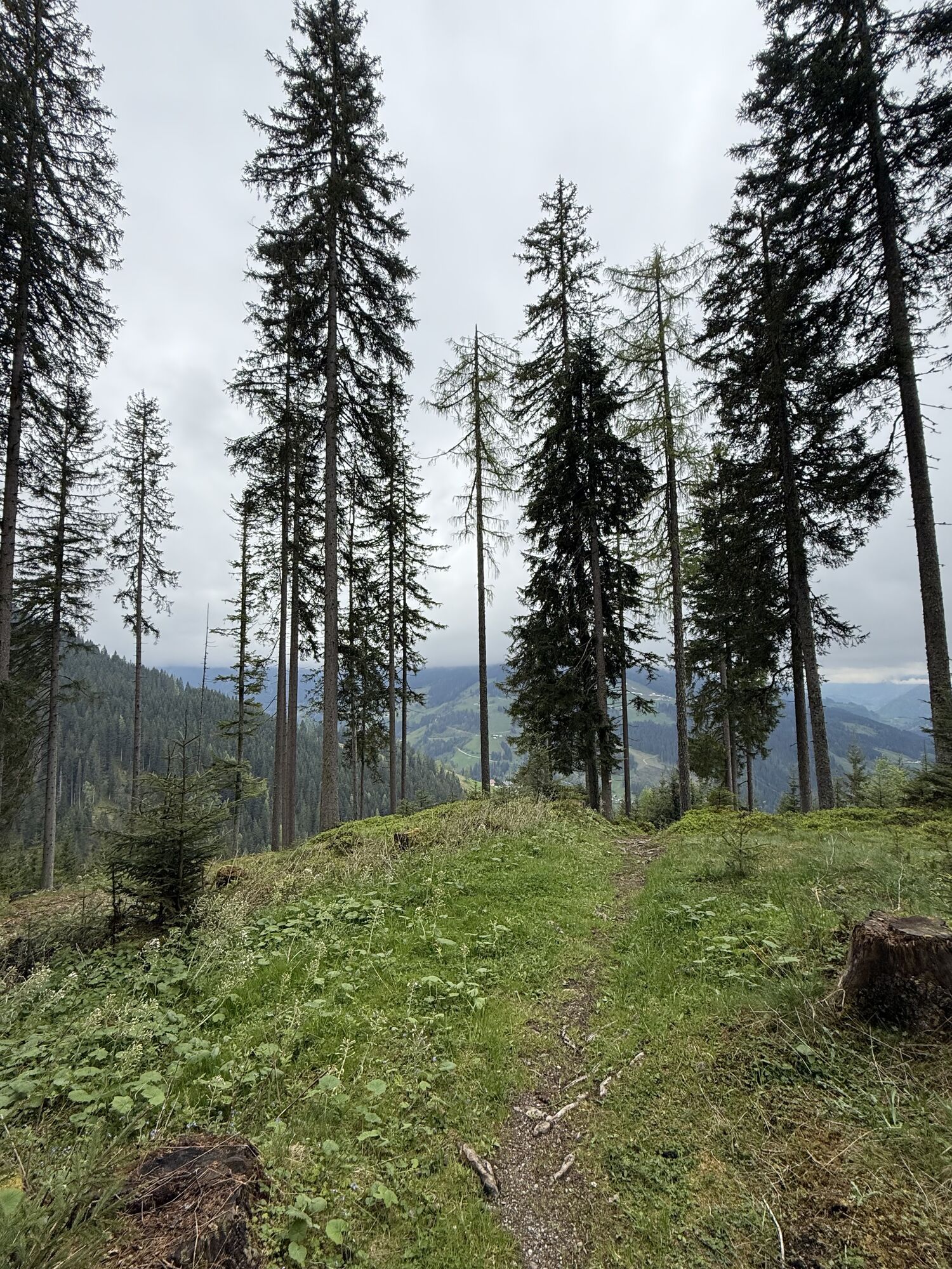
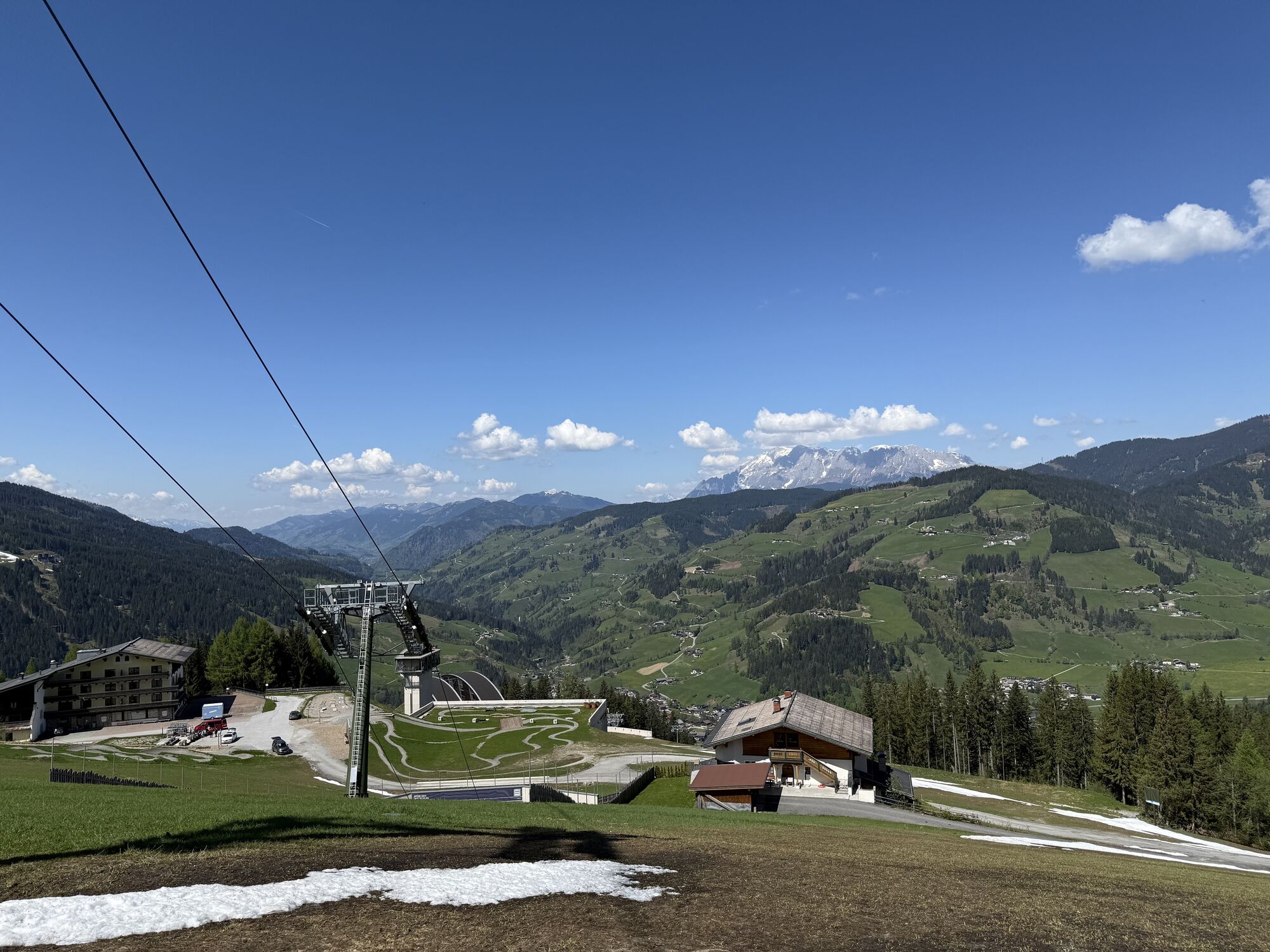

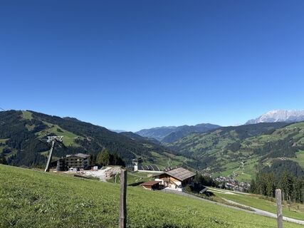
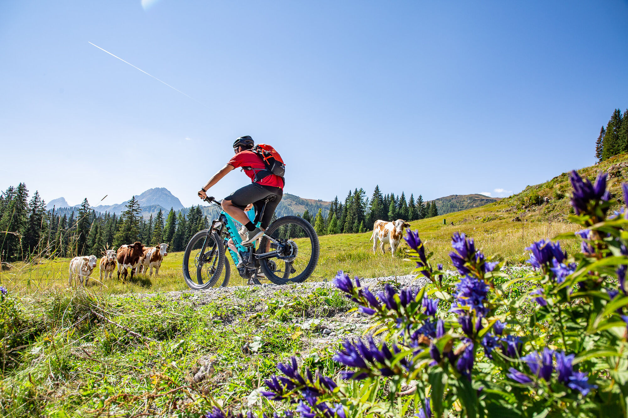
Along the Ennsradweg we start into the valley in the direction of Flachauwinkl. After a little more than 5km we leave the Enns and a long ascent of more than 800 metres in altitude begins. From here on...
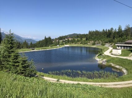
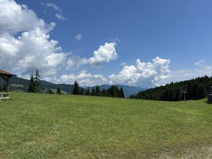
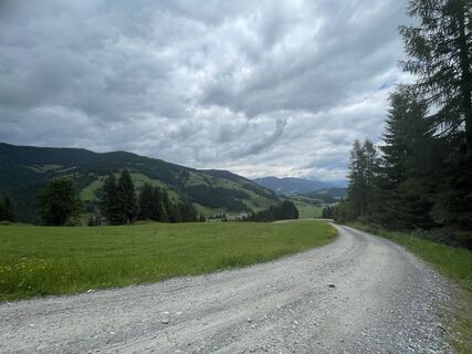
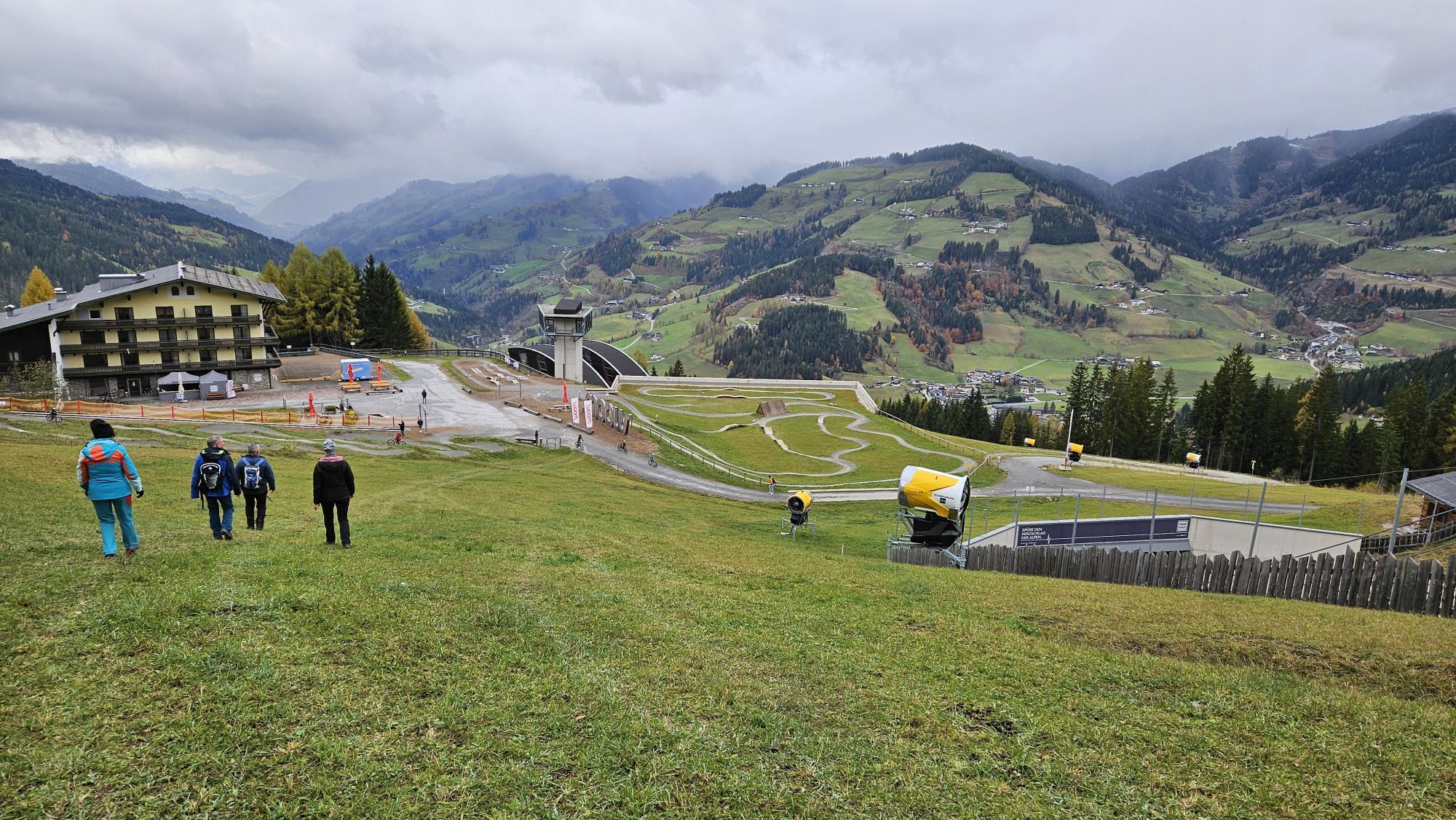
Along the Ennsradweg we start into the valley in the direction of Flachauwinkl. After a little more than 5km we leave the Enns and a long ascent of more than 800 metres in altitude begins. From here on gravel forest paths we first go through the forest, later along ski slopes of the Shuttleberg ski area in a constant ascent uphill. More and more we come to panoramic alpine meadows with the Frauenalm (refreshment stop) and have reached the highest point of the tour at about 1850m. After a short descent, you can either take a break at the Schüttalm (refreshment stop) or at the idyllically situated Weissenhofalm (refreshment stop). A very long descent follows in varying gradients, past the Flying Mozart middle station and the Red 8-seater cable car, before you reach the bottom of the valley and ride flat on cycle paths back to Flachau.


Start at Flachau Tourismus - follow the road in the direction of the end of the valley to Flachauwinkel for approx. 200m - at the second bridge turn left and then immediately right - past the old sawmill and follow the cycle path to the motorway maintenance office and then turn left at km 2.3 and follow the marked cycle path further - after approx. 300m cross the main road and follow the cycle path along the Enns, past the bathing lake Flachauwinkl - at km 5 turn right towards Frauenalm (connection MTB- Route 14) - the evenly rising gravel path, which runs through the forest, follow the Frauenalm (refreshment stop) - downhill past the transformer house, lift crossing - at the next fork right, then left - downhill on the gravel road to the connection Baierwald Runde (MTB- Route 20) - turn right - at km 17,9 fork left, at km 19 turn right - from km 20,1 slight gradient - following connection to Fyling Mozart Runde (MTB- Route 17) - from km 21,7 again gradient, passing the connections to Grießenkar Runde (km 22,3) and Flying Mozart Runde (km 23,4) - lift station - follow the forest road to the lift valley station - towards the car park and follow the cycle path running parallel to the main road towards Flachau - straight ahead at the first roundabout, turn right at the second - back to the starting point to Flachau.
A mountainbiker's basic equipment:
protective gear enough to drink and eat for inbetween sunglasses, optionally sun cream or rain cover mobile phone
Check the functionality of your mountain bike before each ride and inform yourself in about the current weather on site. For your own safety, we recommend to wear a helmet.
to Flachau Center / Flachau Tourist Office
From June to September, the Sportweltbus is the ideal shuttle service for your bike tours in the entire region (Flachau, Wagrain-Kleinarl, St. Johann-Alpendorf, Radstadt, Altenmarkt-Zauchensee, Eben, Filzmoos, Obertauern, Großarl & Hüttschlag).
With the Flachau Summer Card you can use the Sportweltbus for only Euro 1,00 per person and route. Children under 6 years travel free!
More information at: https://www.flachau.com/en/more/information/sportweltbus.html
Further connections: www.salzburg-verkehr.at
Parking space near the starting point
The mountain bike tour SW31 is also suitable for e-bikes! Charging stations are available in the village center at Flachau.
Here you'll find more about mountainbiking in Flachau: https://www.flachau.com/en/sport/hiking-biking/mountain-bike.html
Info on the current weather on site: https://www.flachau.com/en
At the tourist info Flachau you get a bike map with information to this tour.
Webcam del tour
-
Bergstation achterjet
-
Gamskogelhütte
-
Grafenberg
-
Radstadt - Simonyhof
-
Altenmarkt - Sinnhubbauer
-
Altenmarkt - Schartner
-
Absolut Shuttle Bergstation
-
Flachau /Hotel Starjet
-
Kemahdhöhe
-
Chill House / Jib Park
-
Bergstation Bubble Shuttle - Powder Shuttle
-
Reitlehenalm
-
Zauchensee
-
Kemahdhöhe
-
Kemahdhöhe
-
Kemahdhöhe
-
Kemahdhöhe
-
Altenmarkt-Zauchensee
-
Lumberjack Shuttle
-
Zauchensee - Rosskopf
-
SUN HOUSE Flachauwinkl/Mittelstation
-
Ferienbauernhof Habersattgut
-
Wagrain / Hotel Wagrainerhof
-
Mooslehen Berg
-
Snow Space Salzburg - Flying Mozart
I tour più popolari nelle vicinanze
-
4,5
Mosermandl Windischscharte, Salzburger Land/Österreich
pesanteEscursionismo 14,6 km -
4,2
Ennskraxn (2410m)
pesanteEscursionismo 14,7 km -
4,6
Escursione sciistica Lackenkogel
medioSciescursionismo 7,82 km -
4,2
Großarl: Unterwandalm - Karseggalm - Breitenebenalm
medioEscursionismo 5,93 km -
4,4
Sci alpinismo Liebeseck
pesanteSciescursionismo 14,1 km -
4,8
Großarl: Mooslehenalm – Niggeltalalm – Viehhausalm
medioEscursionismo 5,44 km -
4,5
Penkkopf via Kleinarlerhütte da Kleinarl
medioSciescursionismo 4,35 km -
4,2
Wasserfallweg (UNESCO-Geopark Erz der Alpen)
luceSentiero tematico 4 km -
2,6
Glöcknerin
medioEscursionismo 9,87 km -
4,8
Liechtensteinklamm mit Helix
luceSentiero tematico 3 km

Escursioni e tracking


Non perdete le offerte e le ispirazioni per le vostre prossime vacanze
Il vostro indirizzo e-mail è stato aggiunto alla mailing list.