


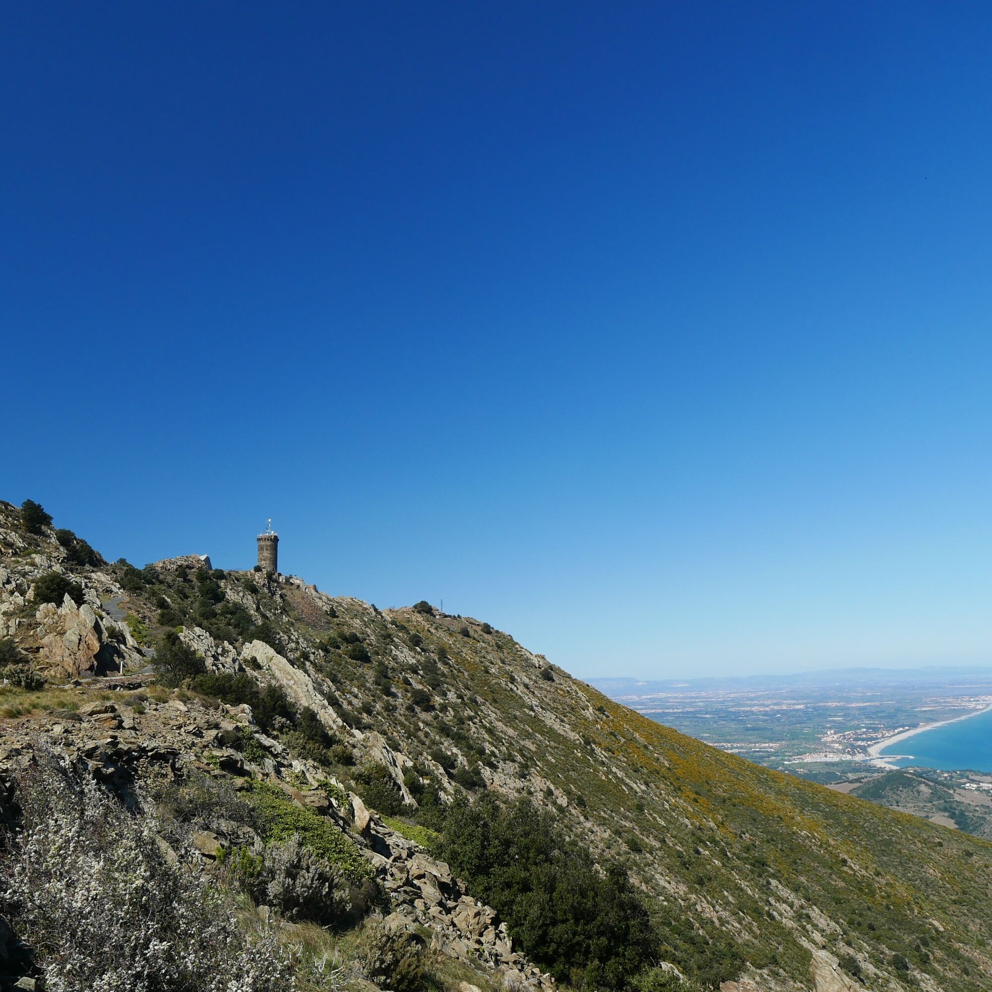
The Madeloc tower


This loop around the Madeloc Tower offers you superb views of the coast as well as an overview of the military defense system.


From the Col de la Serre, head towards the Batterie de Taillefer then towards the Col de Taillefer.
After the pass, continue in the direction of the Madeloc Tower.
Go back down to the Battery 500.
Take the path which joins the GR10 (white and red markings) Follow the GR 10 to the right, pass the ruins of the old Cave Reig. Pass the Col de Formigo towards Col de la Vallauria.
At Col de la Vallauria, turn right and take the water path (yellow markings) to Col de la Serre, the starting point.
Sì
Sì
D914, D86
Col de la Serre car park
Do not forget to take water, a hat or cap and good walking shoes. Do not throw waste into the environment. This hike is not recommended in strong winds.
I tour più popolari nelle vicinanze
Trail hauts des forts (version longue)
medioTrailrunning21,8 km[Connection] Elne-Argelès-sur-Mer
medioCiclismo12,3 kmRallye-enquête : Le linteau millénaire de Saint-Genis-des-Fontaines
medioCiclismo28,6 kmMadeloc
medioEscursionismo8,83 kmGR10 Pyrenäenweg Etappe 55
medioPercorso a piedi di lunga distanza23,2 km[Stroll] "the balconies" of Cosprons
luceMountainbike6,77 kmCatalan Getaway in the Pyrenees Mediterranean
medioCiclismo62,4 km"La Retirada" and the paths of exile
medioEscursionismo5,26 kmFrom Lavail to Valmy via the Tour de la Massane
medioEscursionismo10,3 kmorienteering course of Laroque-des-Albères
luceTrailrunning3,71 km
Escursioni e tracking


Non perdete le offerte e le ispirazioni per le vostre prossime vacanze
Il vostro indirizzo e-mail è stato aggiunto alla mailing list.