


A saute montagne


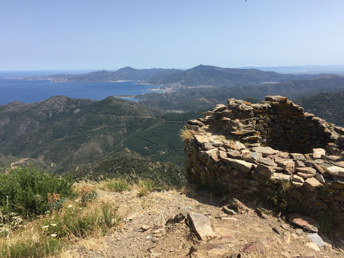
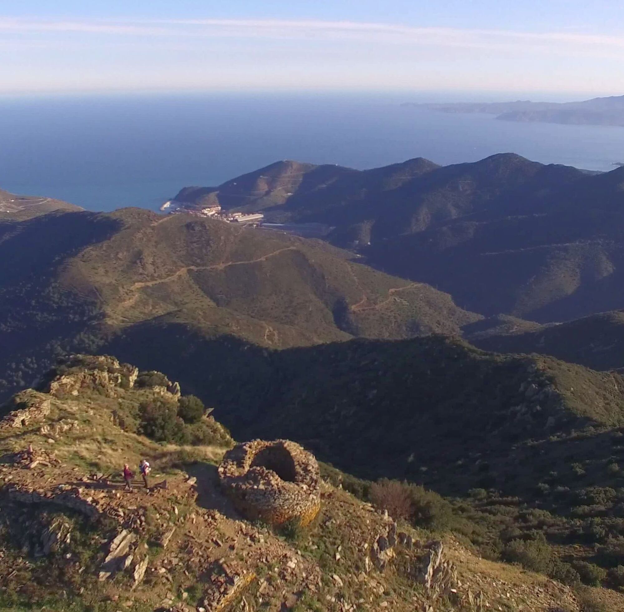
This loop begins first on the heights of Banyuls then above Cerbère. This is where the ruins of the tower and castle of Querroig appear. The view is magnificent. On the return, the passes follow one after...
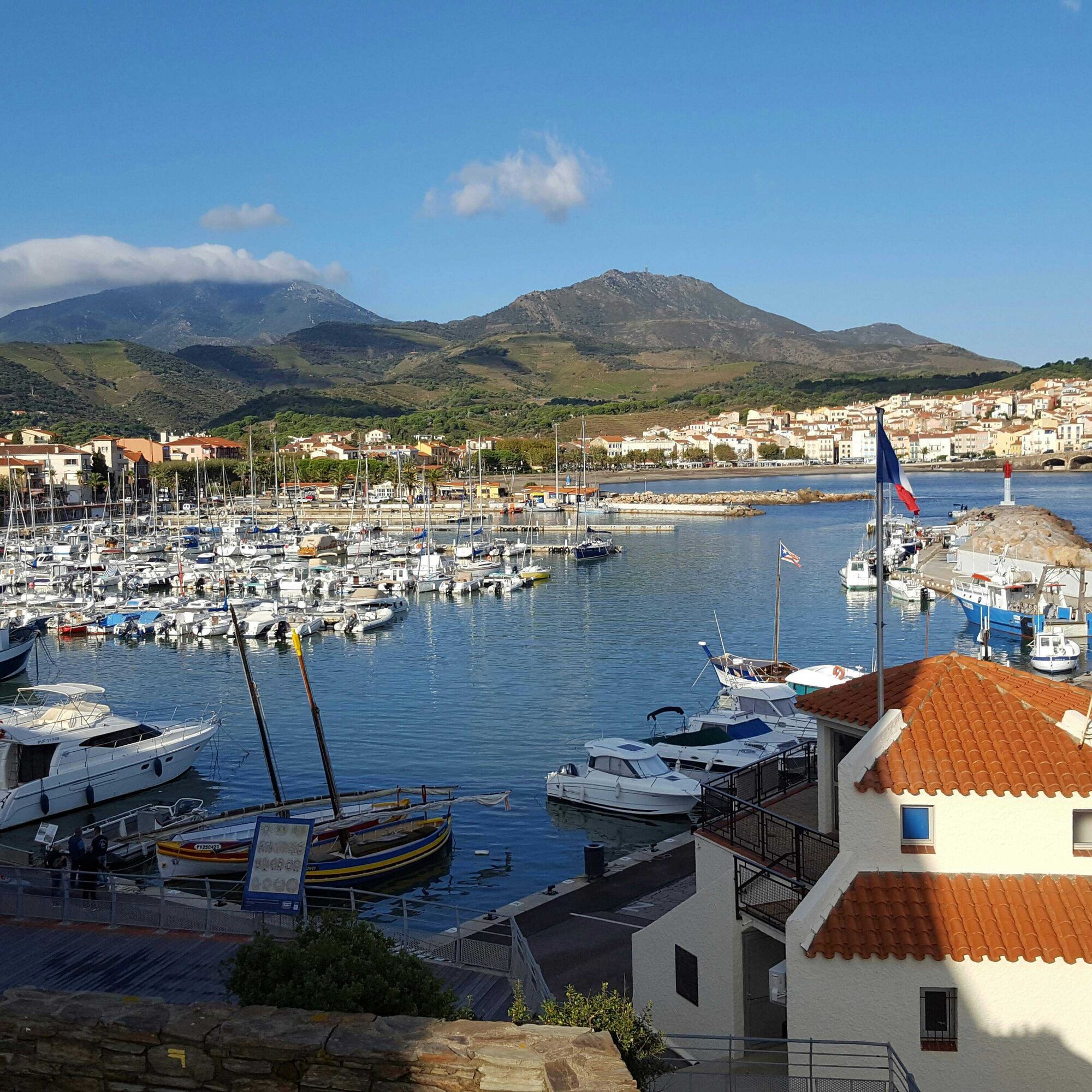
This loop begins first on the heights of Banyuls then above Cerbère. This is where the ruins of the tower and castle of Querroig appear. The view is magnificent. On the return, the passes follow one after the other, the panorama remains exceptional.
Departure from the Banyuls-sur-Mer Tourist Office.
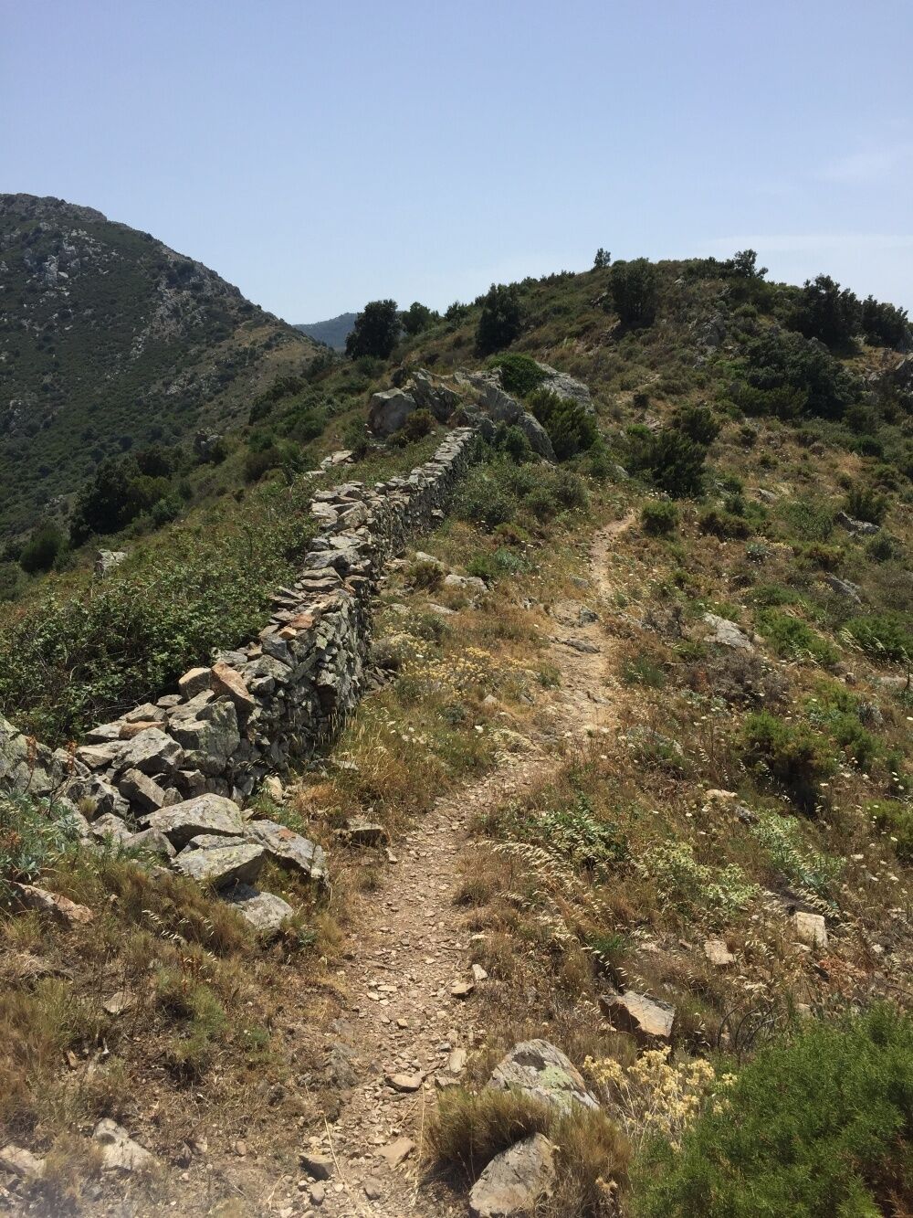
Go up the Avenue of Général de Gaulle towards Puig del Mas, then cross the River "La Baillaury" by the bridge. Continue on the Avenue Pierre de Marca, until you reach the Abel Pages Square on your left. From the carpark, continue towards the dirt track that leads to a path through the vineyards on the outskirts of Mas Guillaume. Follow the road and turn left up to the Col del Bast. At the pass, take the trail that goes up to the right and follow the path for 500 meters. The trail follows the ridges of the massif. Walk past an electric pylon and take the stony path that crosses several scree towards the Col de Rumpissar at 538 metres above sea level. Turn left and take the trail that goes up to the tower of Querroig at 672 meters which offers an exceptional 360 ° panorama. Take the path that goes down to the right, that follows the ridge towards the Cerbere Pass (433 metres). Take the trail towards the fire watch tower. Leave it on your right to continue to the electric pylon. Follow the trail on the ridge until you get to the Col de la Creu. By turning to your left you will see that the trail leads to a tarmaced path. Continue the trail to the Tower of Pagès. go down the path for 500m, take the trail on your left which bypasses the Mas Ramonet. Once you get to the ‘La colline des Oliviers’ housing estate, take the avenue Pierre de Marca to the tourist Office.
Sì
At the Banyuls-sur-Mer Tourist Office of, take the direction of Puig del Mas.
Puig del Mas car park
Hydrate regularly, take walking shoes, cap and windbreaker.
Check the weather before departure.
Respect nature by bringing back your waste.
Itinerary included in the Departmental Plan of Walking and Hiking Routes of the Pyrénées-Orientales
The PDIPR is a tool for the legal protection of routes which lists the routes open to hiking, horseback riding and mountain biking. It aims to promote the discovery of natural sites and rural landscapes by developing the practice of hiking. To be included in this plan, a route must meet a set of quality criteria in terms of development and management.
I tour più popolari nelle vicinanze
Trail hauts des forts (version longue)
medioTrailrunning21,8 kmMadeloc
medioEscursionismo8,83 kmGR10 Pyrenäenweg Etappe 55
medioPercorso a piedi di lunga distanza23,2 kmLes balcons de Cosprons (VTT)
luceMountainbike6,77 kmDe Lavail à Valmy par la Tour de la Massane
medioEscursionismo10,3 kmLa Retirada et les chemins de l'Exil
medioEscursionismo5,26 kmEurovélo 8 Tranche Argelès-sur-Mer / Sorède
medioCiclismo15,8 kmFrom Château de Valmy to Château Royal via the Madeloc Tower
pesanteEscursionismo22,6 kmLa Tour de la Massane
medioEscursionismo12,4 kmTrail the tops of the forts (short version)
medioTrailrunning12,4 km
Escursioni e tracking


Non perdete le offerte e le ispirazioni per le vostre prossime vacanze
Il vostro indirizzo e-mail è stato aggiunto alla mailing list.