


WAB - Regional Route H: Kranichberger Schwaig - Kirchberg/Wechsel


Foto dei nostri utenti
 © Mario HolekCreato il 18.01.2024
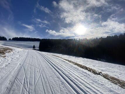 © Mario HolekCreato il 18.01.2024
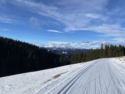 © Mario HolekCreato il 18.01.2024
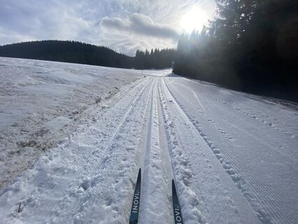 © Mario HolekCreato il 18.01.2024
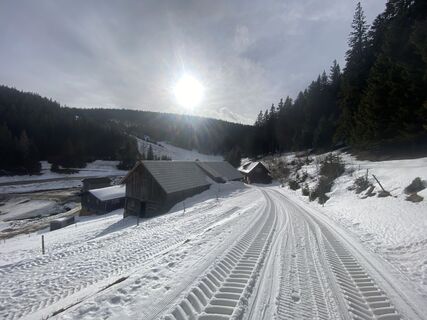 © Mario HolekCreato il 18.01.2024
 © Friedrich Bauer 1Creato il 06.10.2022
 © Friedrich Bauer 1Creato il 06.10.2022
 © Friedrich Bauer 1Creato il 06.10.2022
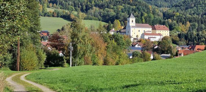 © Friedrich Bauer 1Creato il 06.10.2022
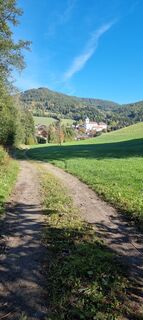 © Friedrich Bauer 1Creato il 06.10.2022


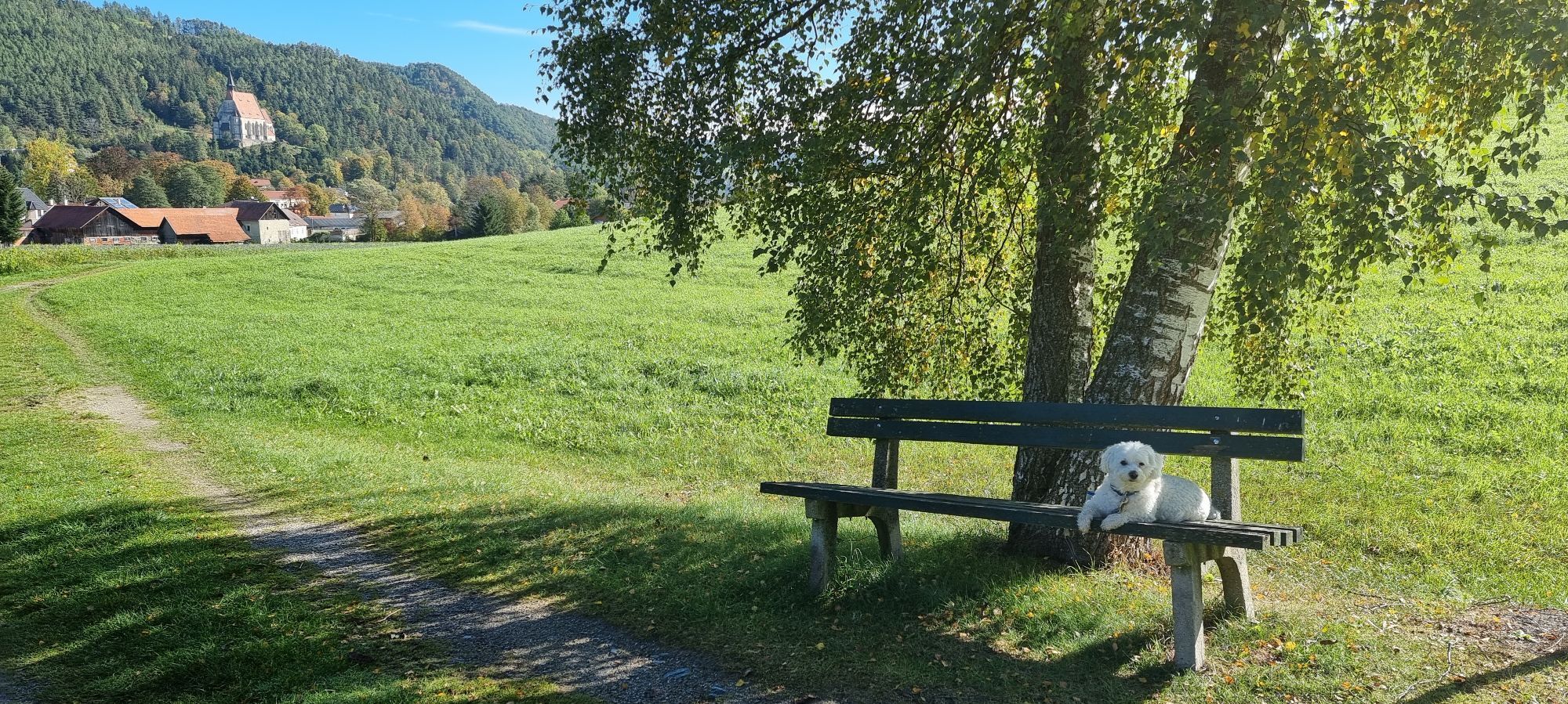
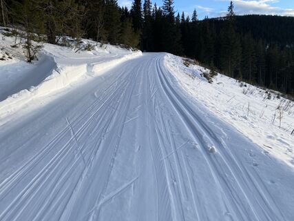
The Schwaigen and the descent from the mountaintop to the valley is a key feature of this stretch. For prolonged spells, this route goes downhill. The Kranichberger Schwaig and Steyersberger Schwaig with...
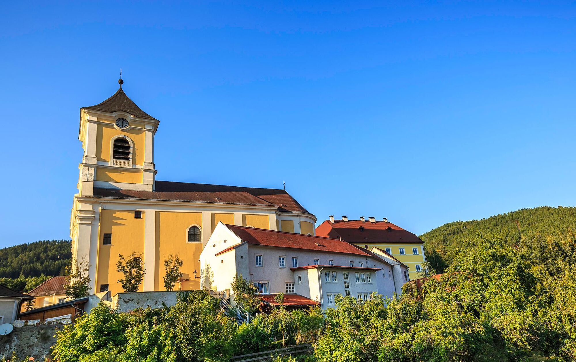
The Schwaigen and the descent from the mountaintop to the valley is a key feature of this stretch. For prolonged spells, this route goes downhill. The Kranichberger Schwaig and Steyersberger Schwaig with their lush mountain pastures appear like oases in the forest and are therefore quite the experience. For example, the Geister-Baum (ghost tree) can be found here. It appears like a ghostly hand against the sky in dense coniferous forest. The Schwaigen are central parts of this landscape and have been forested for generations. They are still sites of rural pioneering. The historic village of Kirchberg is the end of the tour, and is the spiritual centre of the area.
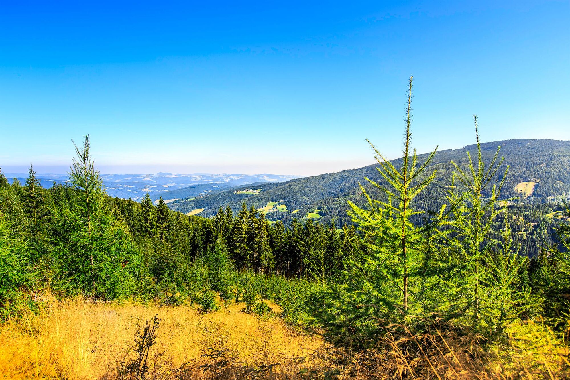

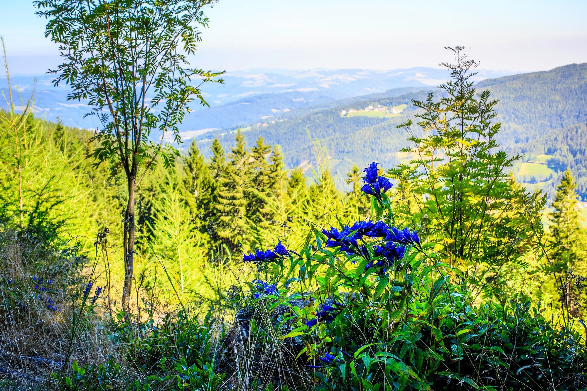
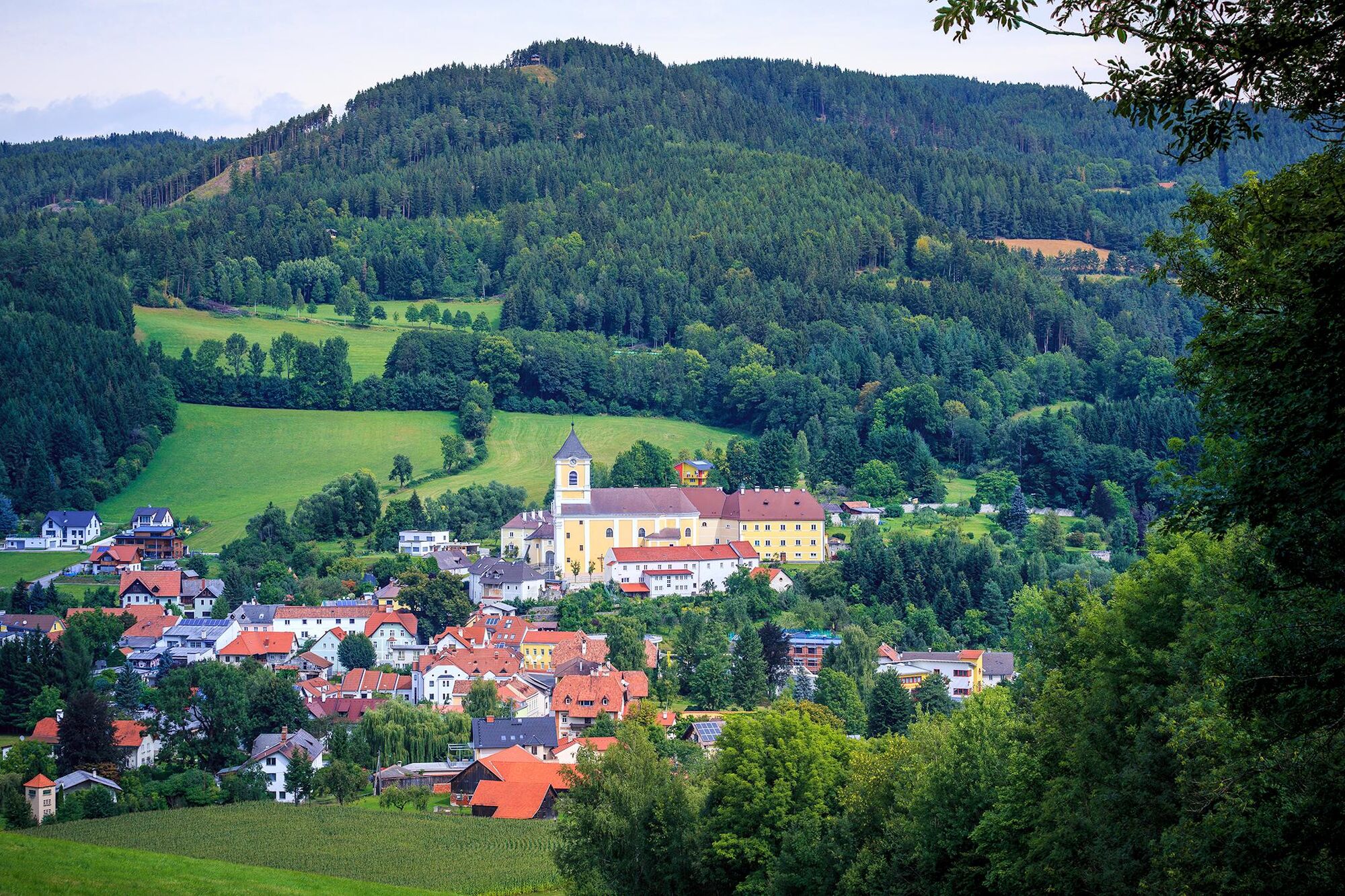
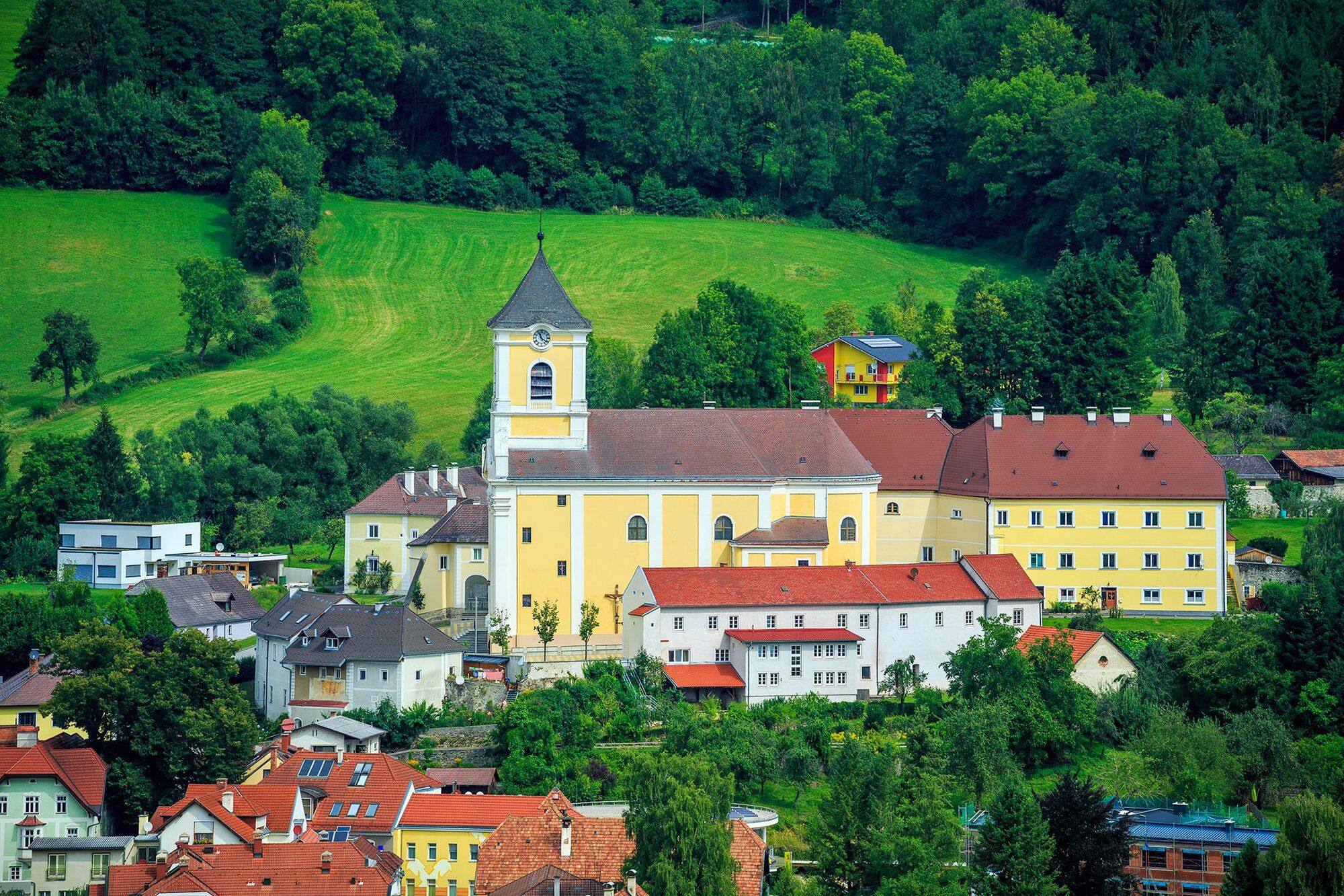
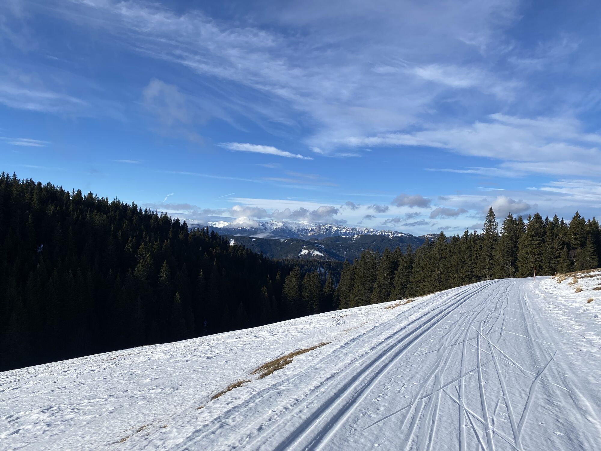
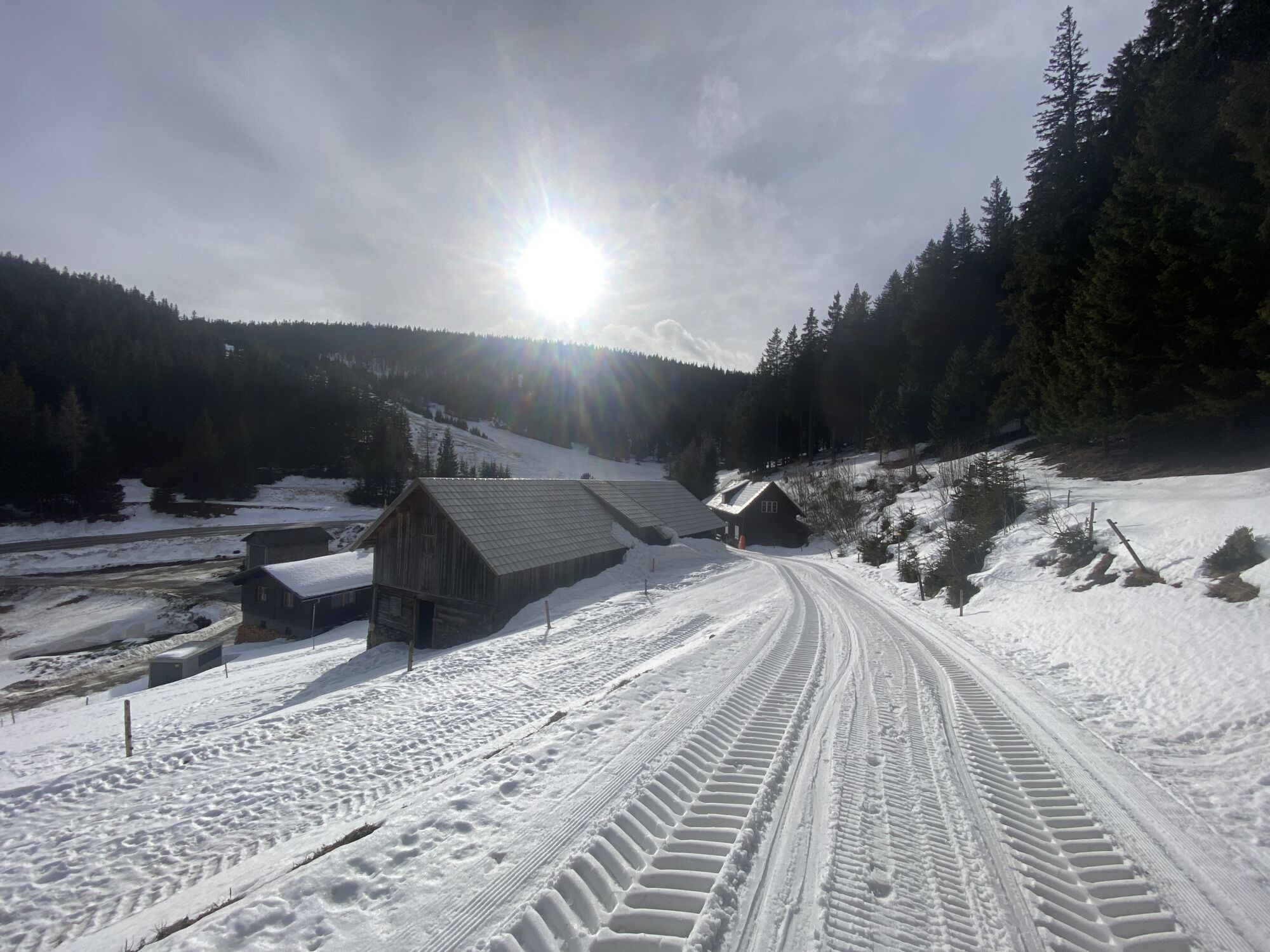
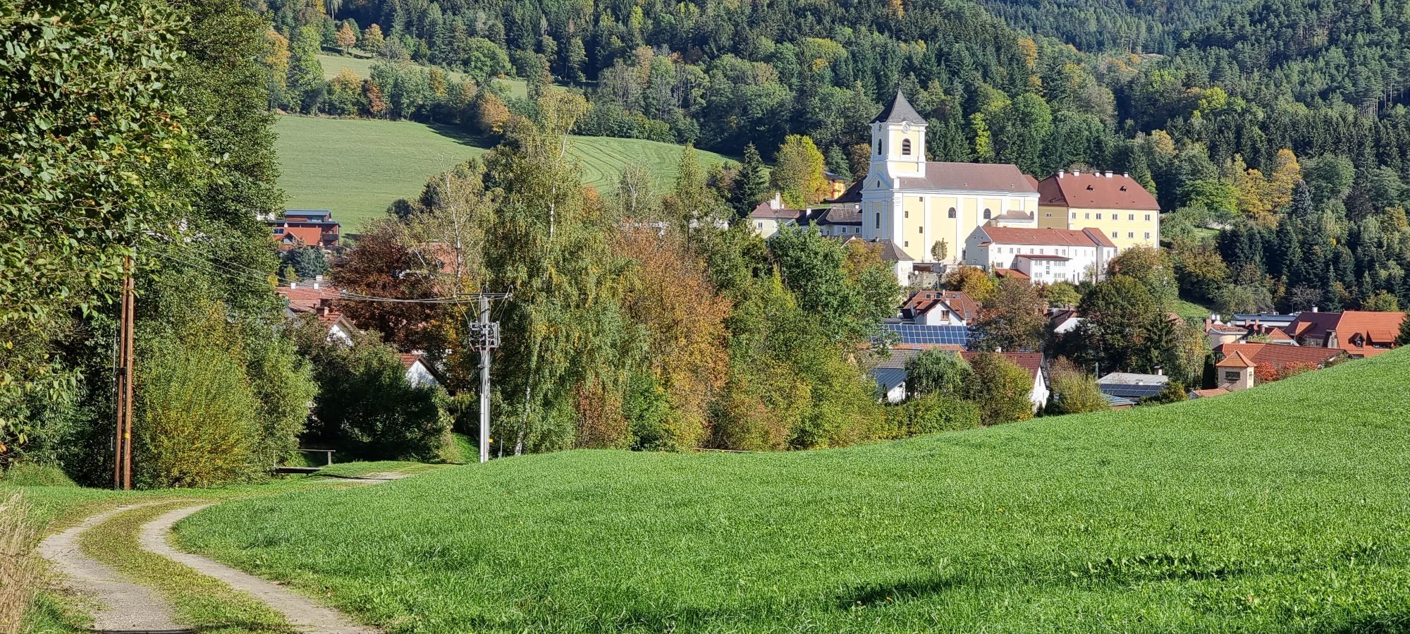
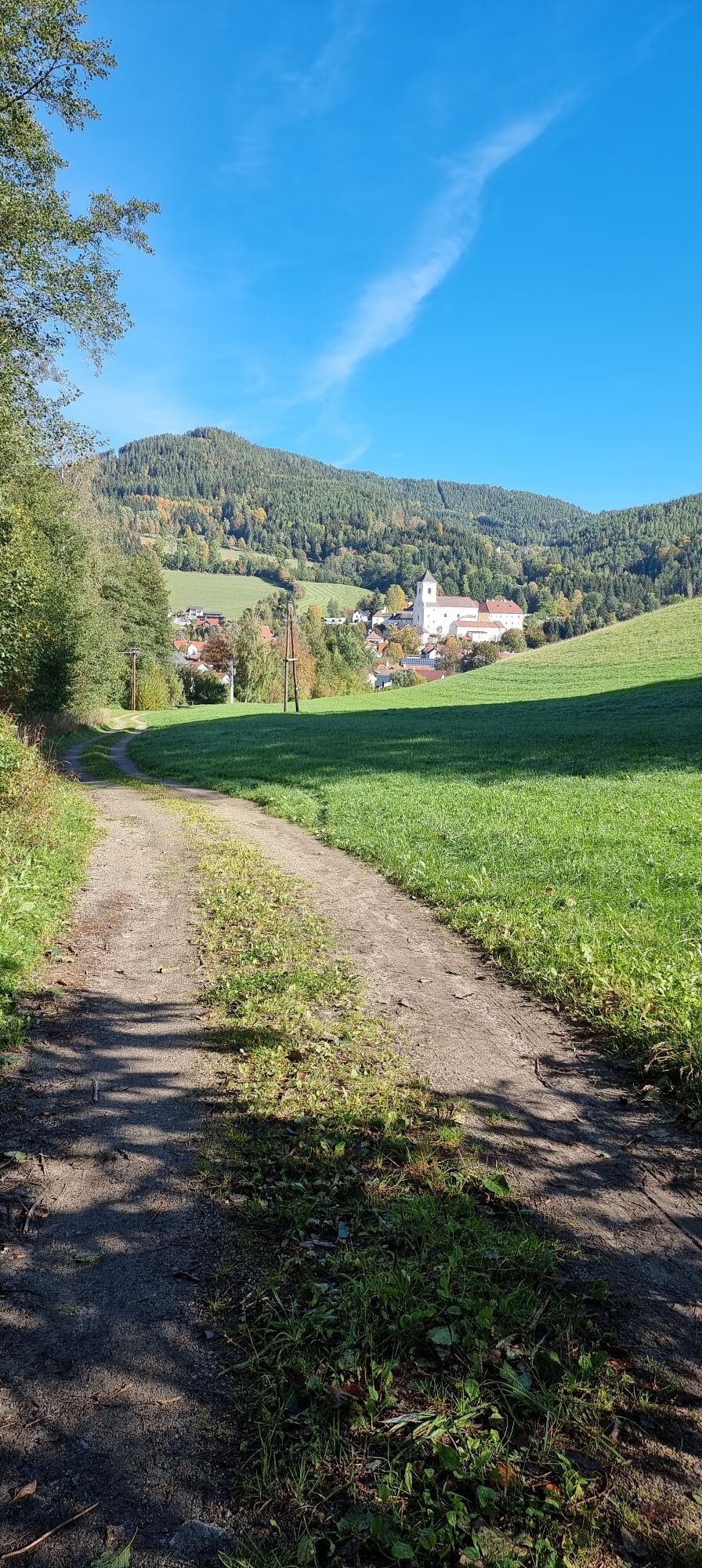
Rax, Sonnwendstein, Schneeberg. We can hardly get enough of the Kranichberger Schwaig; the view at the start of Regional Route H is splendid. However, our first target is another Schwaig. After going downhill slightly, we reach a gravel track and follow this northwards towards Steyersberger Schwaig (also marked in red). For the most part, the route goes downhill to Steyersberger Schwaig, a starting and meeting point for cross-country skiers in winter. We go past the Schwaig on the left and choose the right-hand fork, which goes downhill slightly in the direction of Kirchschlag. The path below the cables is extremely pleasant with lots of shadow and is largely slightly downhill. It has several waterways and the ghost tree also appears here. Many paths cross this hiking route, but we always remain on the designed route to Kirchberg. The descent down towards Kreuzbauern is somewhat steeper, and we continue along a track. After a sharp left-hand bend, we turn right from the track and wander downhill along a meadow path (marked in red) which soon goes down the right-hand side of a forest. We continue to descend towards Kirchberg, get to the edge of the village, and head further into it along the Postbach stream. At this point, we come across a road, cross the Feistritz on our right and soon reach the centre of Kirchberg am Wechsel.
It is possible to stay overnight at Gasthof Grüner Baum or to take the bus back either to Gloggnitz station or Aspang Markt station. Regional Route F is from Kirchberg to Grimmenstein and Maria Schnee, whilst Route G finishes at Mönichkirchner Schwaig and the destination of Route I is Maria Schutz.
Always bring suitable maps. Always wear appropriate, sturdy footwear, bring sun and rain protection and water, as well as a little something to eat. Bring your mobile phone with you and save the mountain rescue emergency number: 140
Your hiking experience in the Vienna Alps should be a thoroughly enjoyable and safe one. Therefore, please bear the following in mind:
Preparation
When choosing a route, make sure it corresponds to your mountain experience and physical fitness level. Check the weather forecast before you set off. The weather can change surprisingly quickly in the mountains. Always take appropriate equipment with you (e.g. rain protection).
Check whether the cabins and snack stations you intend to visit along the way are open. Inform someone before you set off of your chosen route and when you plan to return.
Kranichberger Schwaig cannot be reached directly by car. Drive up to the car park in Feistritz Saddle and then continue by foot to Kranichberger Schwaig. If you are travelling from Vienna take the A2 towards Wiener Neustadt, then change to the S6 as far as the Gloggnitz exit. Continue through Raach am Hochgebirge, Otterthal, and Trattenbach and up to Feistritz Saddle. If travelling from Graz take the B72 via hamlets on Feistritzsattelstraße to the Feistritz Saddle.
Kranichberger Schwaig cannot be reached directly by public transport. It is recommended to combine this Regional Route with Route 8 from Mönichkirchen - Feistritz Saddle on the Viennese Alps trail. Take the train via Wiener Neustadt to Aspang Markt. Then take the bus from there to Mönichkirchen. Alternatively, it is possible to take a taxi to Feistritz Saddle from Gloggnitz railway station.
More information at www.oebb.at
Car parking is available at Feistritz Saddle car park.
You may like to hike the adjoining routes:
WAB - Regional Route G: Kirchberg/Wechsel - Mönichkirchner Schwaig
WAB - Regional Route I: Kirchberg/Wechsel - Maria Schutz
Viennese Alps in Lower Austria, www.wieneralpen.at, +43 / 2622 / 78960
Market town of Kirchberg am Wechsel, www.kirchberg-am-wechsel.at, +43 / 2641 / 2226
Overnight stays are possible in Kirchberg am Wechsel at Gasthof Grüner Baum.
I tour più popolari nelle vicinanze
- 4,8
Escursione ad anello a Payerbach attraverso la vista dell'anniversario e la cappella Schedkapelle
medioEscursionismo8,84 km - 4,8
Karl Lechnerhaus - Stuhleck
medioEscursionismo7,81 km - 4,6
Mariensee - Wildwasserweg - Marienseer Schwaig
luceEscursionismo8 km - 4,2
Kummerbauerstadl-Erzkogel-Sonnwendstein-Maria Schutz-Kummerbauerstadl
luceEscursionismo12,2 km - 4,8
Percorso dell’acqua selvaggia Mariensee
medioSentiero tematico6,69 km - 5,0
Sonnwendstein Quicky: Gebirgsjägersteig bis Sonnwendstein und Almsteig runter
medioEscursionismo8,99 km - 4,5
Klamm - Speckbacherhütte - Breitenstein - Klamm
medioEscursionismo13,4 km - 4,5
Schanzkapelle - Kleiner Otter - Mitterotter - Großer Otter - Kummerbauerstadl - von Göstritz Göstritz, Niederösterreich
medioEscursionismo11,6 km - 4,5
Vom Semmering nach Breitenstein am Bahnwanderweg (September 2023)
luceEscursionismo9,94 km - 4,2
Sonnwendstein
medioEscursionismo9,40 km
Escursioni e tracking


Non perdete le offerte e le ispirazioni per le vostre prossime vacanze
Il vostro indirizzo e-mail è stato aggiunto alla mailing list.