


Kirveslammen Kierros Trail, Leivonmäki National Park


The Kirveslammen Kierros Trail is a 1.7-km long circular route which fascinates with its varied nature that consists of mires, woods and water. The trail is marked with blue paint marks and it is also...
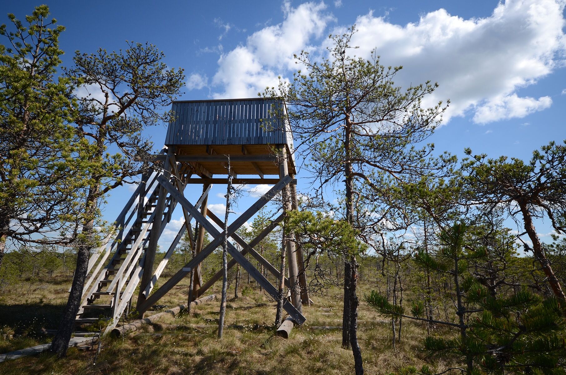
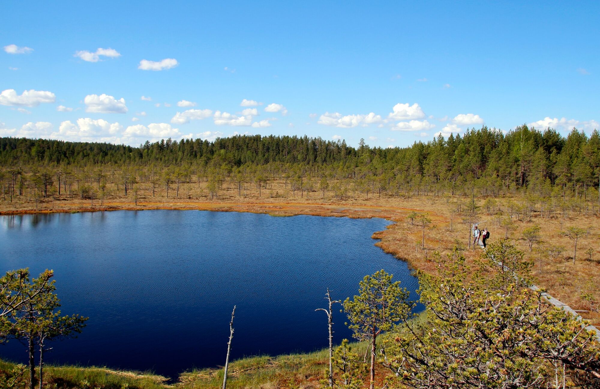
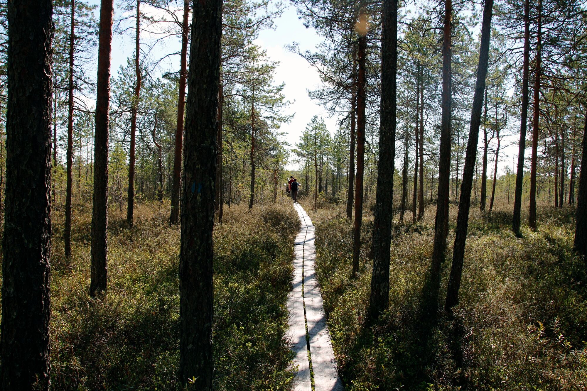
The Kirveslammen Kierros Trail is a 1.7-km long circular route which fascinates with its varied nature that consists of mires, woods and water. The trail is marked with blue paint marks and it is also suitable for children because the terrain is easy to walk on and the path has lengthy sections of duckboards. The observation tower is at the half way point; admiring the view from the top is the highlight of the trip.
Things to see
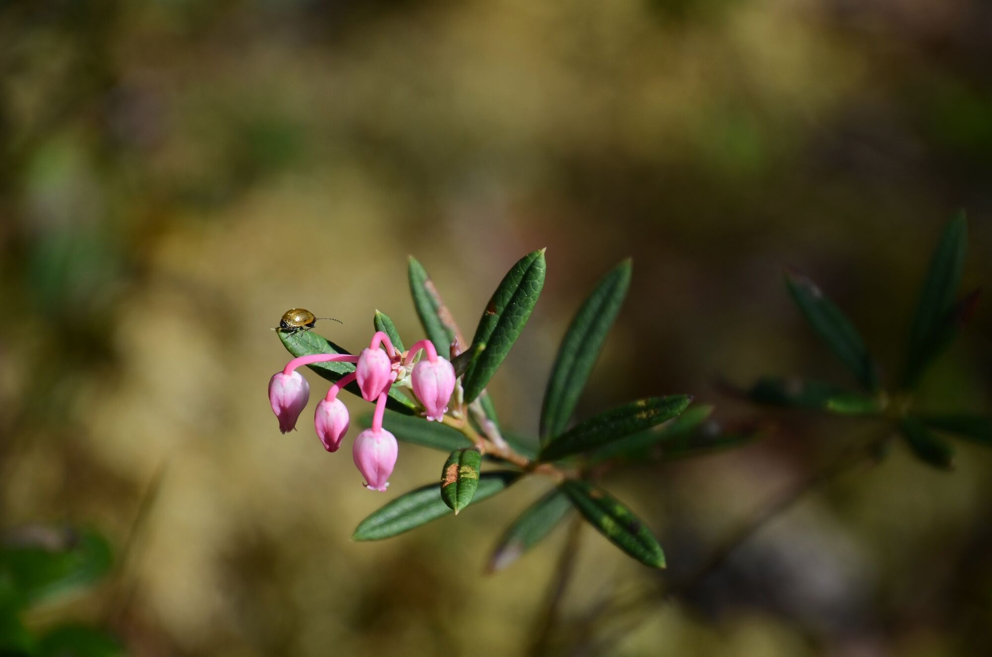
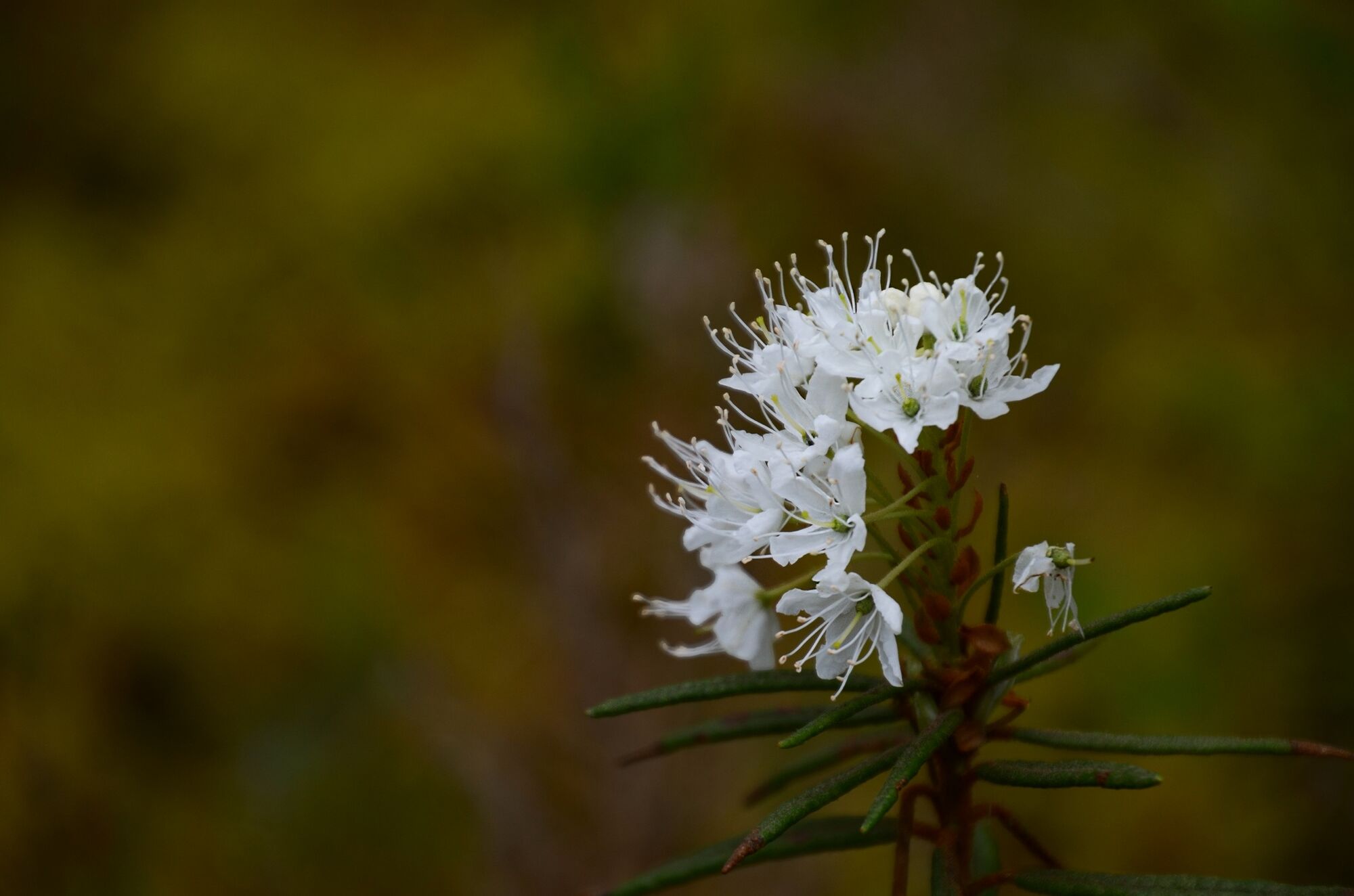
Fire scars in trees Sun-dews and rannoch-rush Observation tower Bog rosemary field
The route description was created in the #Keski-Suomen retkeilyreitit maailmankartalle project, funded by Central Finland's Centre for Economic Development, Transport and the Environment from the European Agricultural Fund for Rural Development.

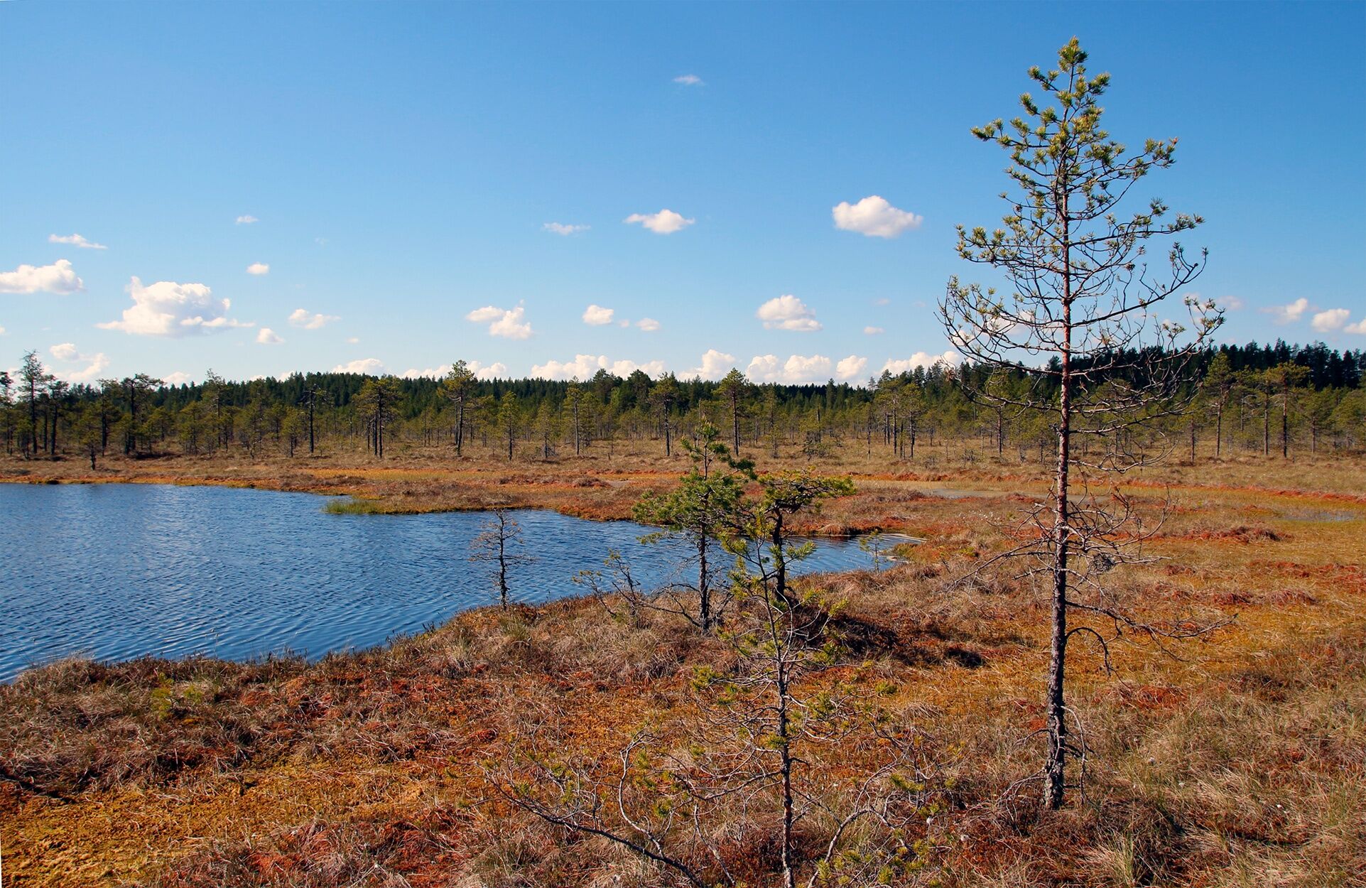
The trail begins at Kirveslampi parking area, following the blue paint marks to the pine forest. At the very beginning there are some mild ascents and descents but the terrain is very easy to walk. You may spot fire scars left by forest fires on some of the older pine trees.
After the pine forest, you will enter a mire and step from the needle-covered forest path on the grey wooden duckboards. Slow down and keep an eye on the plants as well as insects: you may spot sun-dews or rannoch-rush among the peat moss, or different kinds of butterflies or dragonflies.
Finally, you will arrive at the small lake of Kirveslampi where you can climb up to the observation tower at Haapasuo to admire the view over the mires. Towards the end of the trail there is a chance to see bog rosemary in bloom - if you are lucky enough to arrive when they are in season.
Sì
In dry weather, the trail can be walked in trainers. Dress according to the weather. In winter-time, snow shoes are recommended.
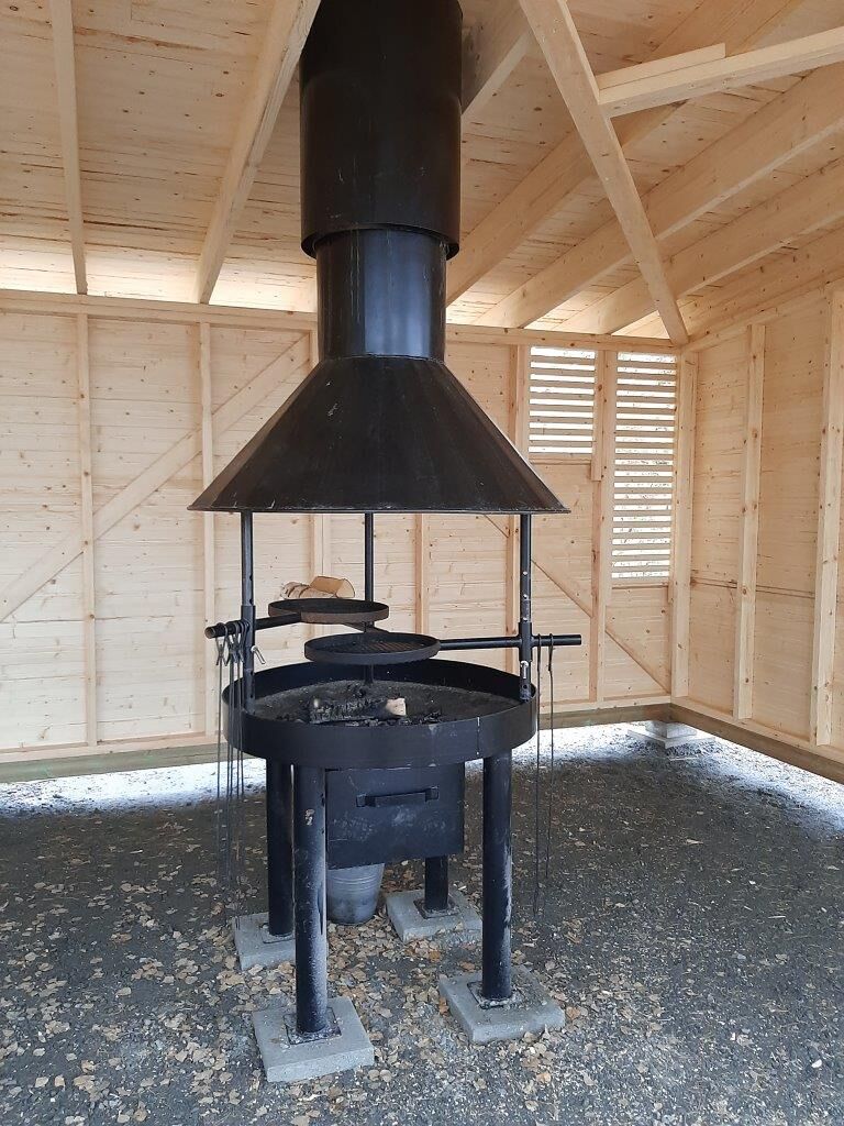
Making a fire
Campfire is only allowed at sites marked for this purpose. Please note that when the forest fire warning or the grass fire warning is in effect, fire lighting is allowed only in the campfire site of Harjujärvi cooking shelter, that has a flue. Check the current warnings.
Difficulty level
The trail is easy. The forest paths are easy to follow and the mires are crossed along wooden duckboards, which may however get slippery in rainy weather. The trail runs on level terrain and the route is also well suited for children. The best season for visiting the trail is when there is no snow on the ground.
Route markings
There is a trail map and clear signage to the trail from the Kirveslampi parking area. The trail is marked with blue paint marks and the recommended walking direction is anti-clockwise.
From highway 4 (Lahti-Jyväskylä):
At Leivonmäki, turn left to Harjunlahdentie road (sign: Kivisuo).
Drive on Harjulahdentie road for 6.5 km. Turn left to Vartiamäentie road, and drive for 1.7 km. The starting point for the trails and the parking area is located on the left side of Vartijamäki road.
go to Leivonmäki National Park in the summer 2025 on Sat 26.7., Sun 27.7., Sat 23.8. and Sun 24.8.
The closest bus/coach stop for regular long distance buses is located at Leivonmäki, about 12 kilometers from the national park. See bus/coach timetables at the Matkahuolto website
Kirveslampi parking area (Vartiamäentie, Joutsa).
Coordinates:
Euref-Fin (~ WGS84) lat: 61° 53.3592' lon: 26° 1.0189'
ETRS-TM35FIN: N: 6862241 E: 448326
ETRS89 maantieteelliset (~WGS84) lat: 61,889352180° lon: 26,016963695°
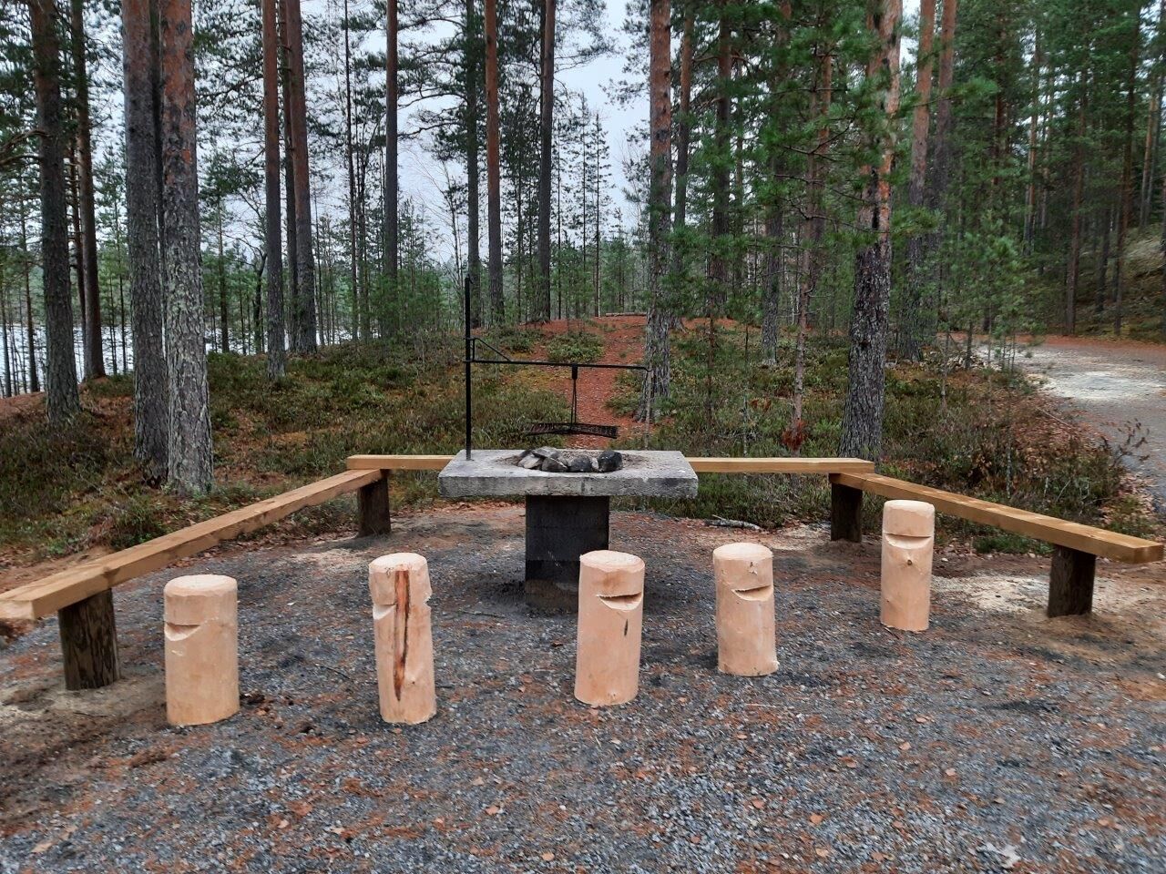
After returning from the Kirveslammen Kierros Trail continue your trip to the Luupään Lenkki Trail: have a snack at the lovely Harjujärvi cooking shelter!

Escursioni e tracking


Non perdete le offerte e le ispirazioni per le vostre prossime vacanze
Il vostro indirizzo e-mail è stato aggiunto alla mailing list.