

© Passion Fotografie - Zermatt Tourismus

© Unbekannt - Zermatt Tourismus

© Unbekannt - Zermatt Tourismus

- Descrizione rapida
-
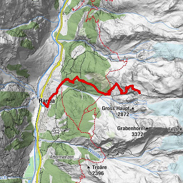
The Dom Hut (2,940 m) is a mountain refuge run by the Swiss Alpine Club (SAC) and equipped with ultra-modern facilities. Its strategic location makes it a popular choice for ascents of seven of the highest mountains in the Alps.
- Difficoltà
-
difficile
- Valutazione
-
- Percorso
-
Randa (1.406 m)0,0 kmTreff 4940,3 kmKirche St. Sebastian0,3 kmGere1,4 kmDomhütte SAC5,3 km
- La stagione migliore
-
genfebmaraprmaggiulugagosetottnovdic
- Punto più alto
- 2.931 m
- Destinazione
-
Dom Hut (2,940 m)
- Profilo altimetrico
-
 © outdooractive.com


- Autore
-
Il tour Hike to the Dom Hut (Nr. 62) è utilizzato da outdooractive.com fornito.
GPS Downloads


Info generali
Punto di ristoro
Flora
Fauna
Promettente
Altri tour nelle regioni
-
Oberwallis
1877
-
Mattertal
555
-
Täsch
195
")


