Inverno
Estate
Meteo
Webcam
Alloggi
Tour
Cronologia delle ricerche
Suggerimenti per la ricerca
Nessun risultato trovato
Ricerca
Tour
Casa
Estate Schweiz
Vallese
Tour
Champéry-Emaney
Regioni
Meteo
Webcam
Tour
Attrazioni
Laghi balneabili
Alloggi
Offerte
Fornitore di sport
Eventi
Stazioni sciistici
Sci di fondo
Snow parks
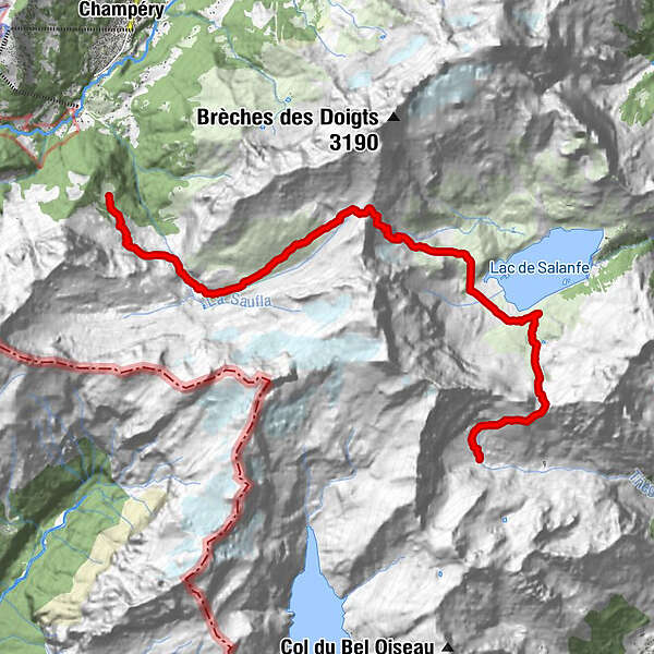
Champéry-Emaney
Escursionismo
Segnalibro
Mappa
mostra
nascondersi
Stampa
Dati percorsi
14,42
km
1.546 - 2.500
m
Distanz
1.422
hm
1.009
hm
L'ascesa
03:41
h
Durata
Hub007
creato am 31.07.2019
105
Chiamate
Valutazione
Tecnica
Forma fisica
Panorama
Avventura / Esperienza
Punto più alto
2.500 m
Scrivi una recensione
Valutazione complessiva
5
0
%
4
0
%
3
0
%
2
0
%
1
0
%
Valutazioni
(0)
0 Commenti
Scrivi una recensione
Errore
Si è verificato un errore. Si prega di riprovare.
Grazie per la vostra recensione
La valutazione è stata cancellata
Rapporto sul tour
GPS Downloads
GPX
GPS Exchange Format (XML)
KML
Google Earth, Google Maps
Codici di download QR per telefoni cellulari
Champéry-Emaney
Codici QR - Scarica il tour per i telefoni cellulari
GPX
KML
Altri tour nelle regioni
Portes du Soleil
970
Région Dents du Midi
577
Champéry
190
Tour popolari della zona
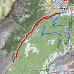
Morgins - Rainbow Waters Hike
intermedio
Escursionismo
16,32
km |
685
hm |
05:15
h
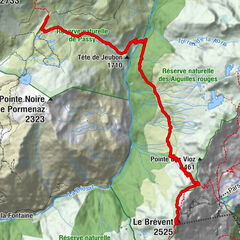
Von Basel zum Mont Blanc Etappe 25: Moede-Anterne – Le Brevent
intermedio
Escursionismo
9,51
km |
852
hm |
04:00
h
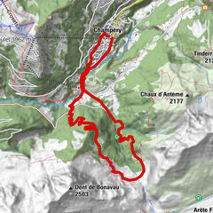
Champéry - Bonavau-Rossétan-Roc Coupé
Escursionismo
12,3
km |
621
hm |
05:00
h
Morgins - Chemin des Ponts du Vallon de They
facile
Escursionismo
4,79
km |
76
hm |
01:30
h
Nessuna voce trovata.
La ricerca non è attualmente disponibile.
Si prega di affinare la ricerca.
Risultati della ricerca locale
(<= 25km)
Altri risultati di ricerca
(> 25km)
%count% Risultati della ricerca
%name%
%type%
%elevation%
%population%
%lpButton%