Stations of the Cross Naters

Logo Stations of the Cross Naters
Dati percorsi
1,78km
680 - 768m
Distanz
77hm
78hm
L'ascesa
00:35h
 
Durata
Descrizione rapida

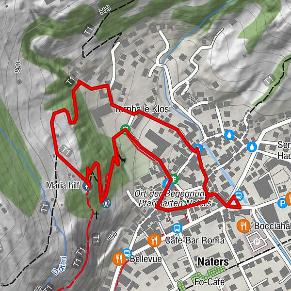
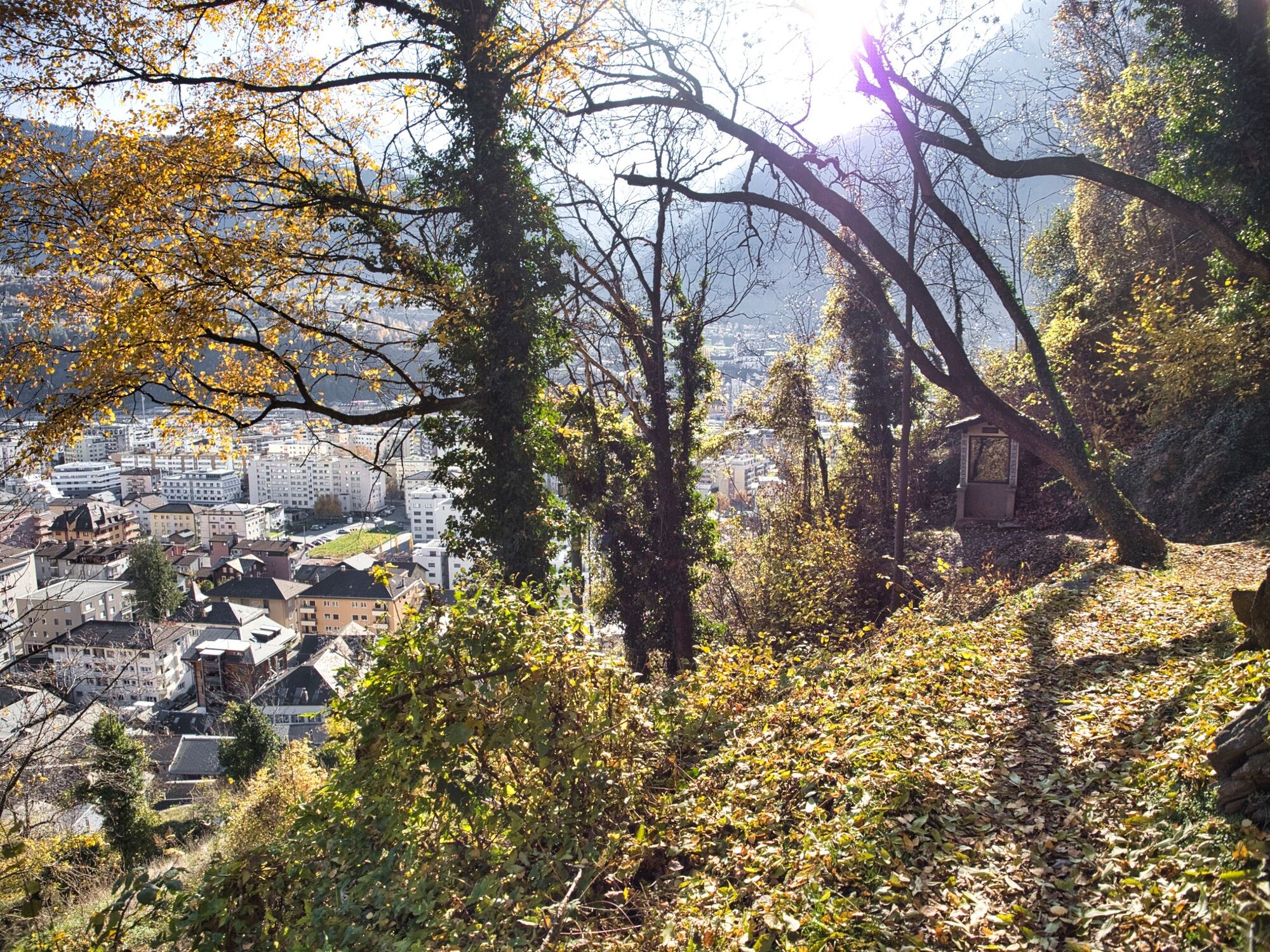
This short circular walk takes you through the old village of Naters and along the Way of the Cross up to the Maria Hilf Chapel.

Difficoltà
intermedio
Valutazione
Tecnica
Forma fisica
Panorama
Avventura / Esperienza
Percorso
Naters (673 m)
0,0 km
Kirche St. Mauritius
0,1 km
Briga (691 m)
0,2 km
Maria hilf
0,8 km

La stagione migliore
gen
feb
mar
apr
mag
giu
lug
ago
set
ott
nov
dic
Punto più alto
768 m
Destinazione

Naters, Marktplatz

Profilo altimetrico
© outdooractive.com

Autore
Il tour Stations of the Cross Naters è utilizzato da outdooractive.com fornito.

Valutazione complessiva

5

0

%

4

0

%

3

0

%

2

0

%

1

0

%

Errore
Si è verificato un errore. Si prega di riprovare.
Grazie per la vostra recensione

La valutazione è stata cancellata

GPS Downloads
  • GPX GPS Exchange Format (XML)
  • KML Google Earth, Google Maps
Codici di download QR per telefoni cellulari

Info generali

Culturale/Storico
Promettente
Altri tour nelle regioni

Tour popolari della zona

Höhenweg Saas-Fee - Grächen

Escursionismo
11,95km | 2668hm | 06:30h

Von Eischoll auf das Signalhorn

difficile Escursionismo
18,88km | 1264hm | 07:30h

Riederalp - ponte sospeso - rifugio Oberaletsch

difficile Escursionismo
25,06km | 1519hm | 12:10h

Panoramaweg über den Aletschgletscher

intermedio Escursionismo
17,73km | 608hm | 05:00h