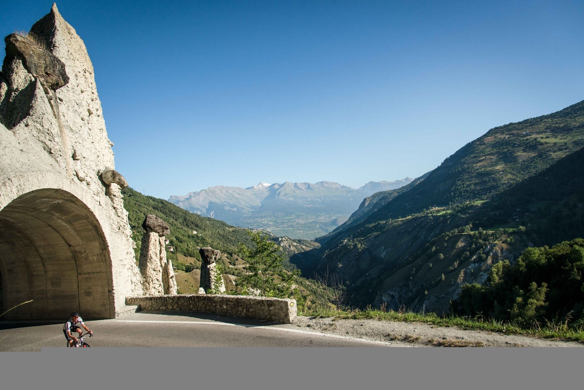
© Valais/Wallis Promotion - David Carlier - David Carlier
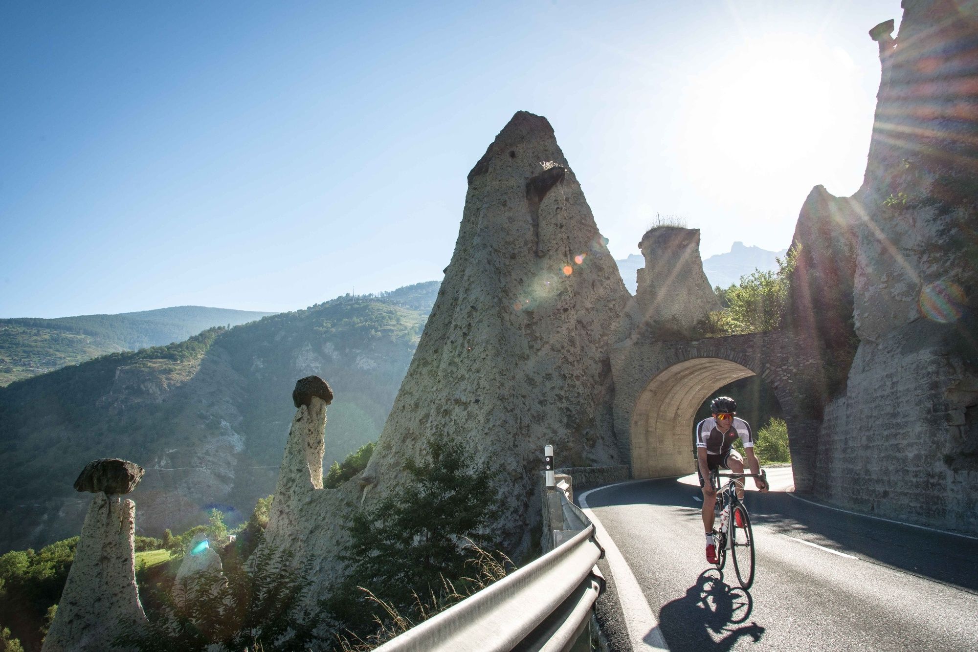
© Valais/Wallis Promotion - David Carlier
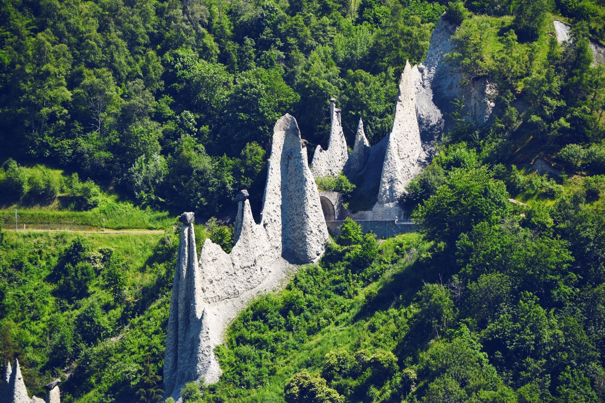
© Valais/Wallis Promotion - David Carlier - David Carlier
© Valais/Wallis Promotion - David Carlier - David Carlier

© Valais/Wallis Promotion - Delia Inniger

- Descrizione rapida
-
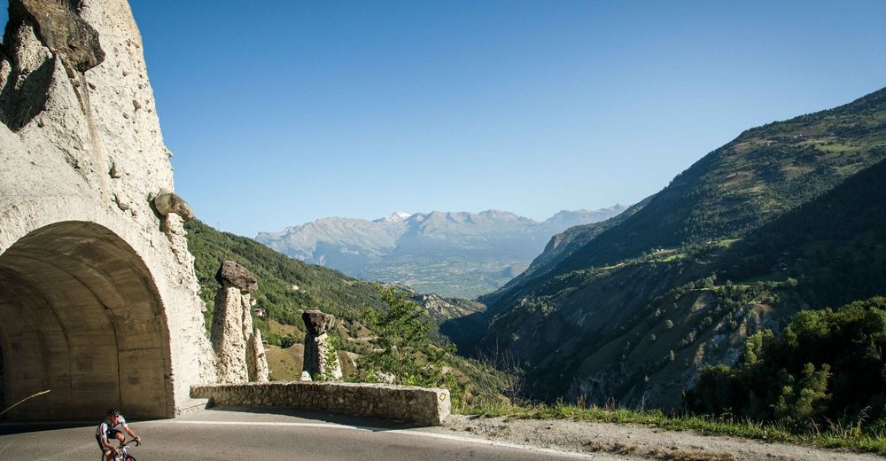
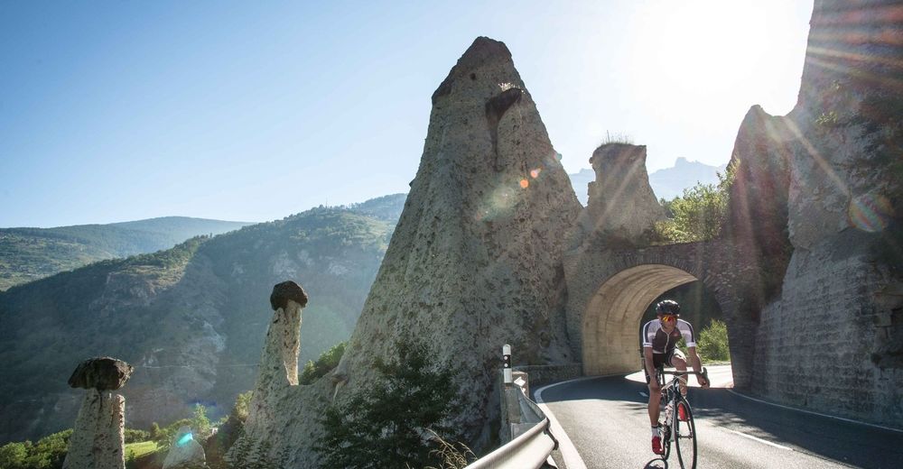
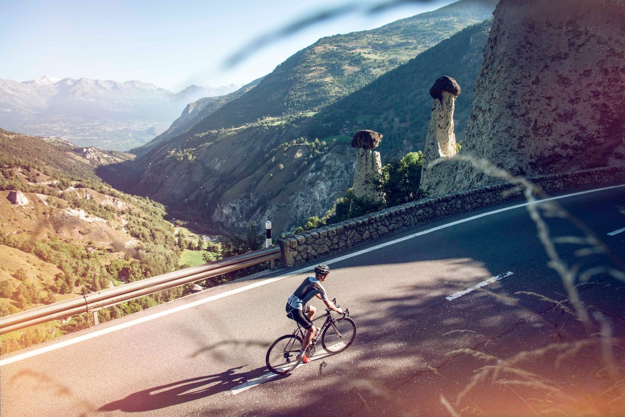
Set off from Bramois to discover Val d’Hérens with an initial climb to the village of St-Martin, followed by a short descent to Evolène and Les Haudères.
- Difficoltà
-
difficile
- Valutazione
-
- Percorso
-
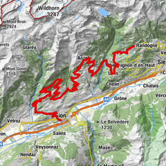
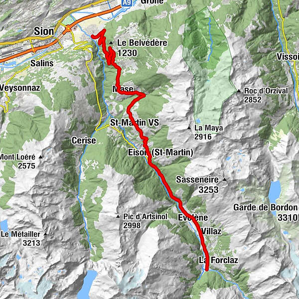
BrämisBornouet6,7 kmLes Barmes7,1 kmFontany7,8 kmVernamiège8,0 kmLes Prixes8,2 kmMase (1.345 m)10,2 kmLe Vieux Bourg10,2 kmLes Pérys10,9 kmSuen (St-Martin)13,6 kmSt-Martin VS (1.411 m)14,6 kmÉglise Saint-Martin14,8 kmTrogne (St-Martin) (1.478 m)15,5 kmLiez (St-Martin)16,5 kmPraz-Jean17,9 kmLa Villette19,7 kmEvolène (1.371 m)23,6 kmLa Fauchère (1.386 m)24,6 kmLa Confraric25,0 kmLa Tour VS25,6 kmBevernec25,6 kmMolignon26,4 kmLes Haudères (1.454 m)27,2 kmCafé-Restaurant la Cordée27,3 km
- La stagione migliore
-
genfebmaraprmaggiulugagosetottnovdic
- Punto più alto
- 1.451 m
- Destinazione
-
Les Haudères
- Profilo altimetrico
-
 © outdooractive.com

- Autore
-
Il tour Val d'Hérens - Scenic & side valleys è utilizzato da outdooractive.com fornito.
GPS Downloads


Info generali
Punto di ristoro
Culturale/Storico
Suggerimento
Flora
Fauna
Promettente
Altri tour nelle regioni
-
Unterwallis
83
-
St-Martin / Wallis
59
-
Hérémence
18