© BergSPA & Hotel Zamangspitze - Christoph Metzler

© BergSPA & Hotel Zamangspitze - Christoph Metzler

© BergSPA & Hotel Zamangspitze - Christoph Metzler
© BergSPA & Hotel Zamangspitze - Christoph Metzler

© BergSPA & Hotel Zamangspitze - Christoph Metzler

© BergSPA & Hotel Zamangspitze - Christoph Metzler

© BergSPA & Hotel Zamangspitze - Christoph Metzler


- Descrizione rapida
-
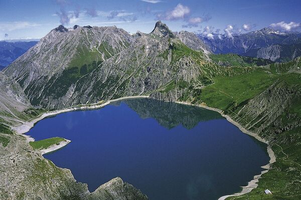
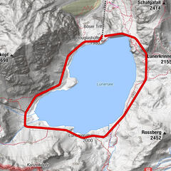
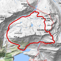
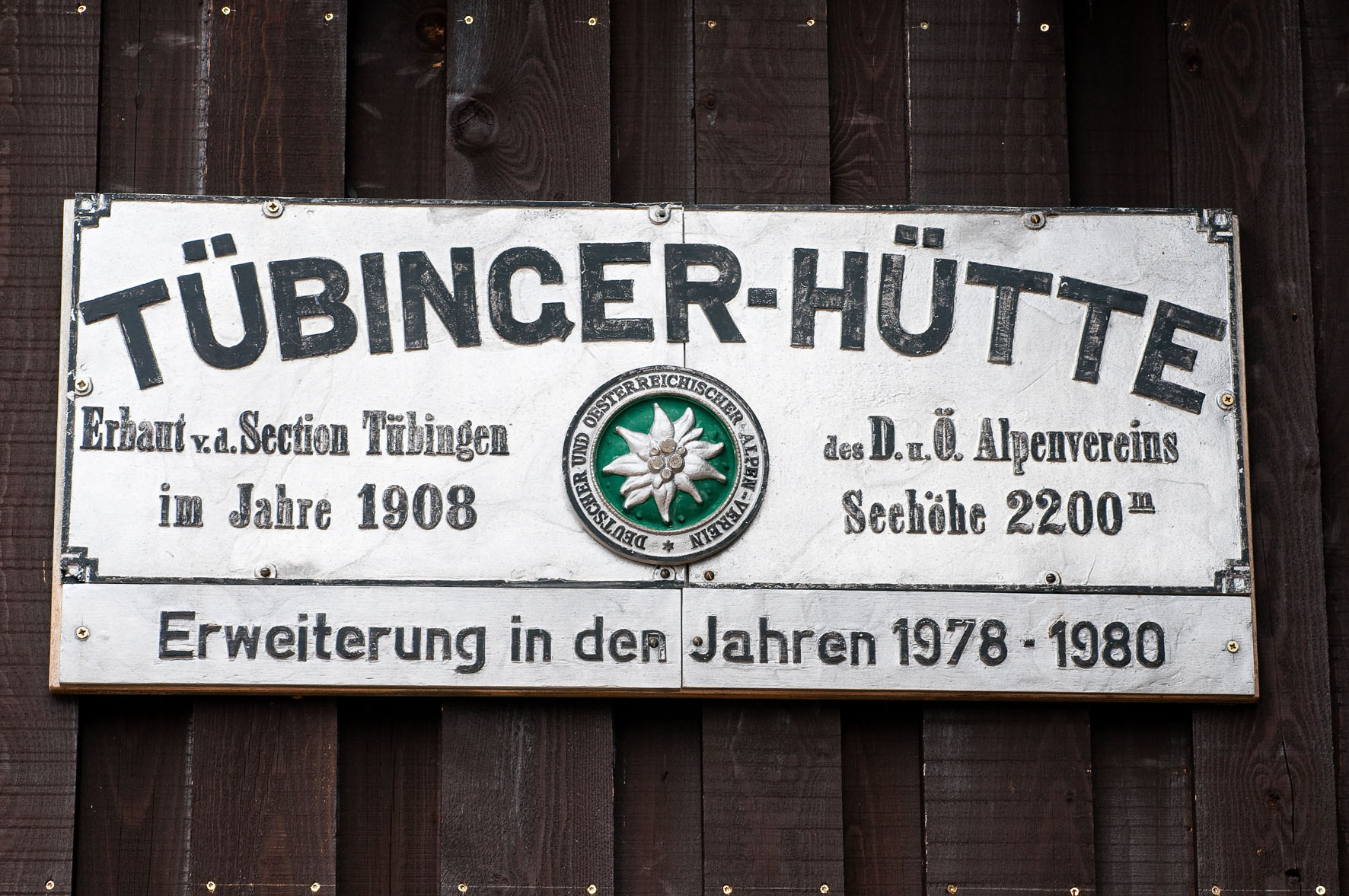
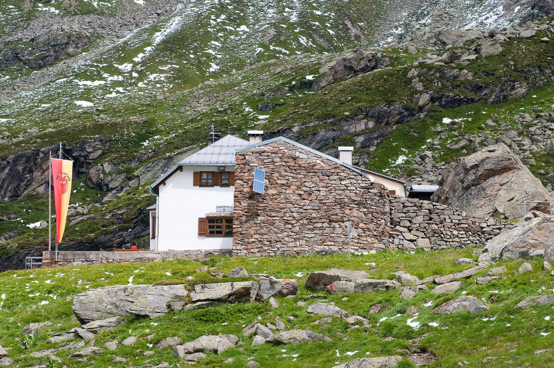
Versettla Bahn Mittelstation - Garneratal - Tübinger Hütte - zurück zur Versettla Bahn Mittelstation
- Difficoltà
-
facile
- Valutazione
-
- Percorso
-
Tübinger Hütte8,9 km
- La stagione migliore
-
genfebmaraprmaggiulugagosetottnovdic
- Punto più alto
- 2.175 m
- Destinazione
-
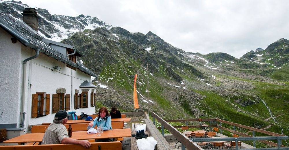
Tübinger Hütte
- Profilo altimetrico
-


-

-
AutoreIl tour Tübinger Hütte è utilizzato da outdooractive.com fornito.
GPS Downloads


Info generali
Punto di ristoro
Promettente
Altri tour nelle regioni
-
Montafon
1382
-
Silvretta Montafon Bergbahnen
454