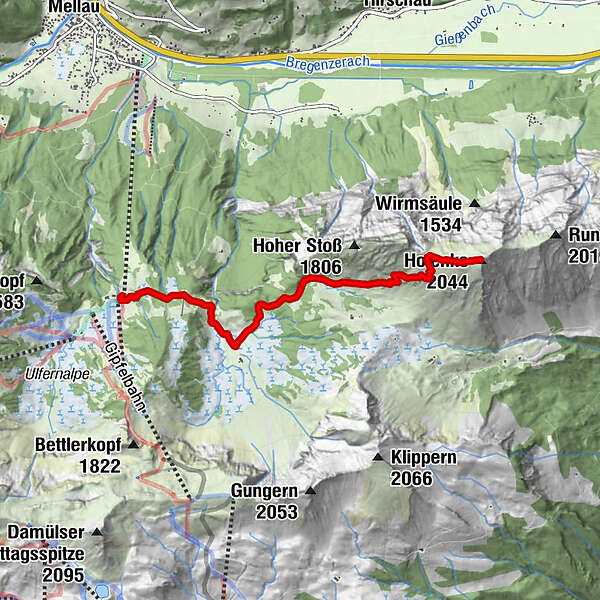
Kanisfluh, 2.044 m

Escursionismo
Mappa
Nascondere mappa
Stampa

Quale problema vorresti segnalare per il tour?

Dati percorsi
4,41km
1.395 - 2.010m
Distanz
589hm
589hm
L'ascesa
03:30h
 
Durata
GPS Downloads
  • GPX GPS Exchange Format (XML)
  • KML Google Earth, Google Maps
Codici di download QR per telefoni cellulari
Altri tour nelle regioni

Tour popolari della zona

Hoher Freschen

difficile Escursionismo
16,13km | 1005hm | 07:00h

Damüls | Auf das Portlahorn

intermedio Escursionismo
9,62km | 533hm | 04:05h

Panorama hike Dornbirn Karren

intermedio Escursionismo
3,43km | 472hm | 01:20h

Üble Schlucht / Laterns

intermedio Escursionismo
6,3km | 322hm | 02:30h