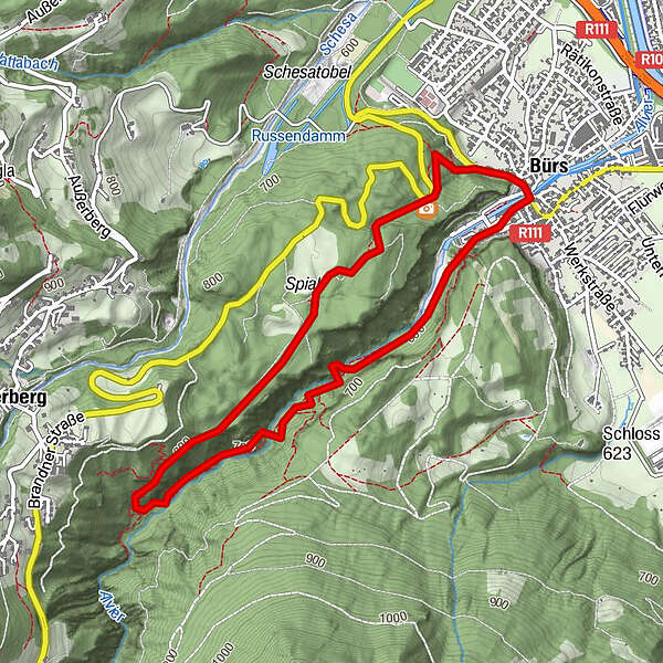
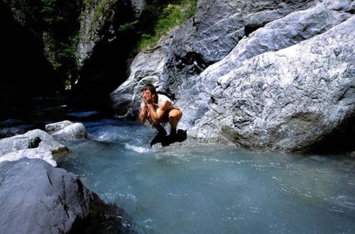
Bürser Schlucht - Am Eingang des Brandnertals

Escursionismo

Marco Mathis
Dati percorsi
4,7km
566
- 776m
195hm
02:00h
- Valutazione
-
- Punto di partenza
-
Bürs Ortsmitte
- Percorso
-
BürsBludenzKuhloch0,3 kmWegkapelle heilige Maria4,2 kmBludenz4,5 kmBürs4,6 km
- Punto più alto
- 776 m
GPS Downloads


Condizioni dei sentieri
Asfalto
Ghiaia
Prato
Foresta
Roccia
Esposta
Altri tour nelle regioni
-
St. Gallen - Bodensee
2067
-
Brandnertal
1568
-
Bürs
489


