
Dati percorsi
13,6km
749
- 1.961m
1.274hm
1.273hm
05:26h
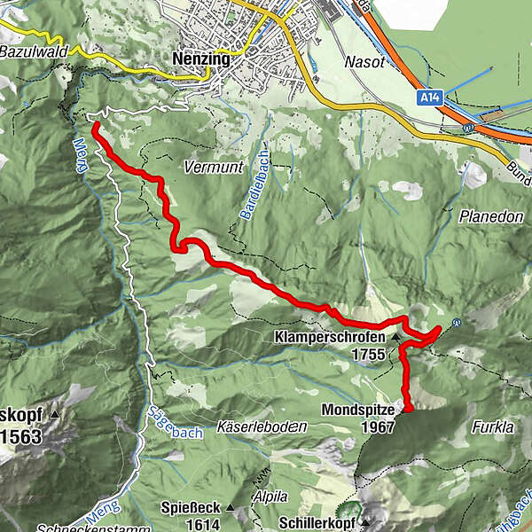
- Difficoltà
-
difficile
- Percorso
-
Stellveder0,0 kmSt. Martins-Kapelle1,8 kmMondspitze (1.967 m)6,7 kmSt. Martins-Kapelle11,7 kmStellveder13,5 km
- Punto più alto
- 1.961 m
- Fonte
- Bergfex Tour Generator
GPS Downloads


Altri tour nelle regioni
-
St. Gallen - Bodensee
2070
-
Brandnertal
1567
-
Nenzing
392


