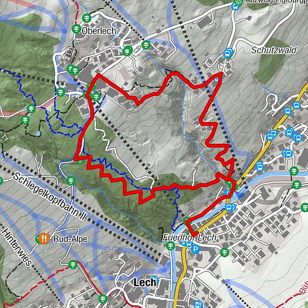
From Lech via the Bergbühne Spitzenegg and Wäldeleweg to Oberlech

Escursionismo

© Lech Zürs Tourismus GmbH - Lech Zuers Tourismus GmbH
- Descrizione rapida
-
From Lech via the Bergbühne Spitzenegg and Wäldeleweg to Oberlech.
- Difficoltà
-
facile
- Valutazione
-
- Percorso
-
Lech (1.444 m)0,0 kmBergbahn Lech - Oberlech0,0 kmOberlech1,8 km
- La stagione migliore
-
genfebmaraprmaggiulugagosetottnovdic
- Punto più alto
- 1.636 m
- Destinazione
-
Oberlech
- Profilo altimetrico
-

-

-
AutoreIl tour From Lech via the Bergbühne Spitzenegg and Wäldeleweg to Oberlech è utilizzato da outdooractive.com fornito.
GPS Downloads


Info generali
Punto di ristoro
Promettente
Altri tour nelle regioni


