© Verein Lechweg - Boxfish

- Descrizione rapida
-
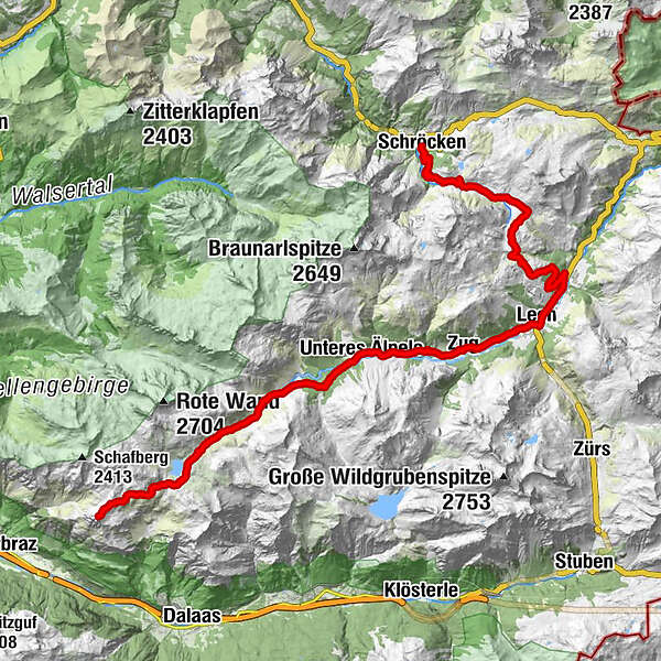
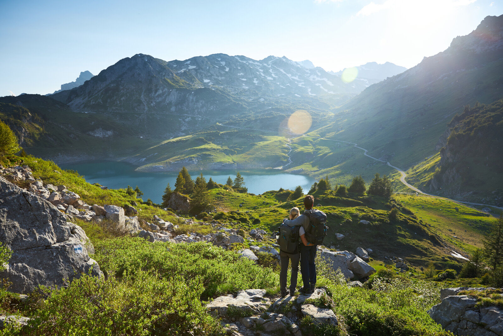
From the centre of Schröcken, take the wide gravel road up to Auenfeld. Via the Auenfeldsattel it goes now towards Oberlech and into the centre of Lech. Opposite the Hotel Post, you have to turn right over a bridge, then immediately turn left towards Zug. A paved road leads you now approx. 1 hour through Zug to the junction Spullersee/Formarinsee. Here you turn right to get to Lake Formarinsee. Through a beautiful landscape along the Lech, the road remains paved and becomes steeper on the last 600 meters. A narrow path leads uphill in a moderate gradient to the Freiburger Hütte and on to the Roggelskopf. Return along the same route to Lech in the centre and take the bus back to Warth-Schröcken.
The tour can also be started in Warth. Here it goes over the Alte Salzstraße to the Hochtannbergpass and via the Salobersattel you get to the Auenfeld and further, as described above.
- Difficoltà
-
difficile
- Valutazione
-
- Percorso
-
TannbergSchröcken (1.269 m)0,0 kmMaterialseilbahn Körbersee0,1 kmUntere Auenfeldalpe5,1 kmAbzweigung Burgplateau10,5 kmGotikkirche Hl. Nikolaus13,0 kmLech (1.444 m)13,3 kmZug16,0 kmSebastianskirche16,2 kmKlösterle16,8 kmGasthof Auerhahn16,8 kmMaterialseilbahn Göppinger Hütte19,6 kmGasthaus Älpele19,6 kmFormarinalpe26,2 kmFreiburger Hütte27,7 kmFreiburger Hütte34,2 kmFormarinalpe35,6 kmGasthaus Älpele42,1 kmMaterialseilbahn Göppinger Hütte42,2 kmKlösterle44,7 kmGasthof Auerhahn44,9 kmZug45,6 kmSebastianskirche45,7 kmLech (1.444 m)48,2 km
- La stagione migliore
-
genfebmaraprmaggiulugagosetottnovdic
- Punto più alto
- 2.153 m
- Destinazione
-
Village square Warth/Village square Schröcken
- Profilo altimetrico
-

-

-
AutoreIl tour Bike & Hike Roggelskopf (2.284 m) è utilizzato da outdooractive.com fornito.
GPS Downloads


Info generali
Punto di ristoro
Suggerimento
Promettente
Altri tour nelle regioni
 Lech Zuers Tourismus by Hanno Mackowitz")