Schwarzenberg | Bödele - Kehlegg - Weißenfluhalpe

Mountainbike
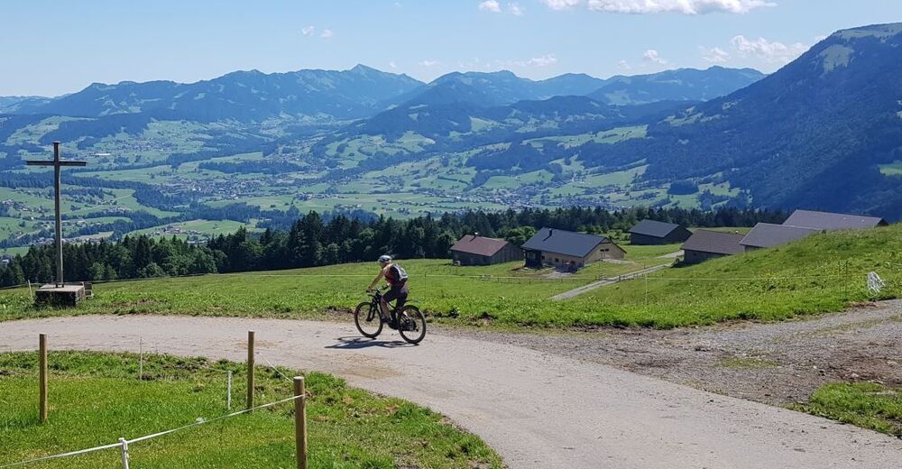
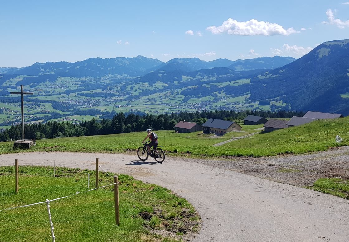
© Schwarzenberg Tourismus - Christine Kleber
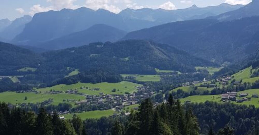
© Schwarzenberg Tourismus - Christine Kleber

- Descrizione rapida
-
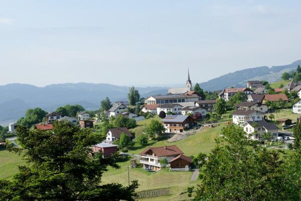
This cycle tour offers you the chance to lap Schwarzenberg’s very own mountain, the Hochälpele. On top of that, you can enjoy the breath-taking view towards the Bregenzerwald, and get a panoramic view of the lovely Rhine Valley.
- Difficoltà
-
intermedio
- Valutazione
-
- Percorso
-
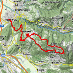
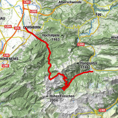
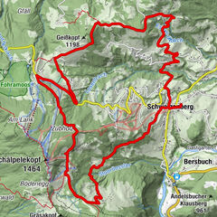
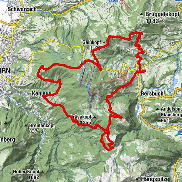
Pfarrkirche Schwarzenberg - Heiligste Dreifaltigkeit0,1 kmAdler0,1 kmHotel Gasthof Hirschen Schwarzenberg0,2 kmSchwarzenberg (696 m)0,3 kmKapelle Hl. Theresia2,3 kmJakob Bader Maurer Kapelle (1657)2,7 kmEixer8,4 kmWeißtanne9,4 kmBödele10,1 kmDornbirn (437 m)13,5 kmSchwendealpe13,7 kmSchauner14,3 kmPfidajona16,2 kmPfidajonaköpfle16,3 kmKehlegg (794 m)17,0 kmGsth. Firstblick17,0 kmWeißenfluh (1.367 m)25,4 kmAlpe Weißenfluh (1.368 m)25,5 kmBregenzer Hütte26,5 kmVorsäß Klausberg29,0 kmHotel Gasthof Hirschen Schwarzenberg32,7 kmSchwarzenberg (696 m)32,7 kmAdler32,7 kmPfarrkirche Schwarzenberg - Heiligste Dreifaltigkeit32,7 km
- La stagione migliore
-
genfebmaraprmaggiulugagosetottnovdic
- Punto più alto
- 1.366 m
- Destinazione
-
Villag square Schwarzenberg
- Profilo altimetrico
-


- Autore
-
Il tour Schwarzenberg | Bödele - Kehlegg - Weißenfluhalpe è utilizzato da outdooractive.com fornito.
GPS Downloads


Altri tour nelle regioni