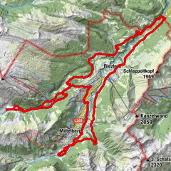
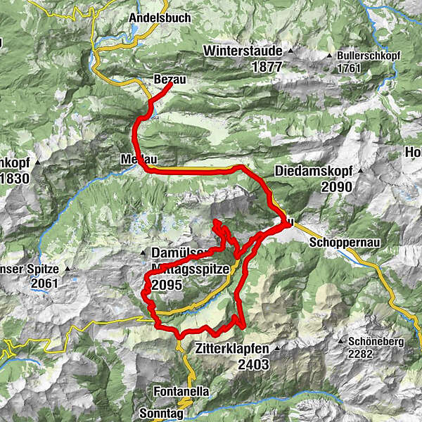
Bezau | Faschina - Ugaalpe - Edelweißhütte - Au - Bezau

Mountainbike

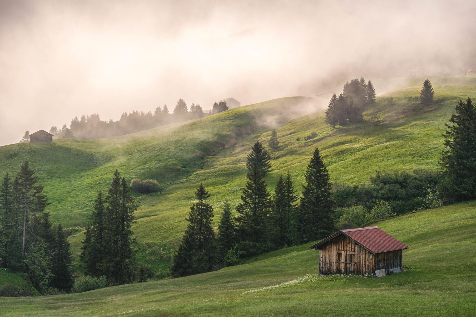
© Bregenzerwald Tourismus - Michael Meusburger

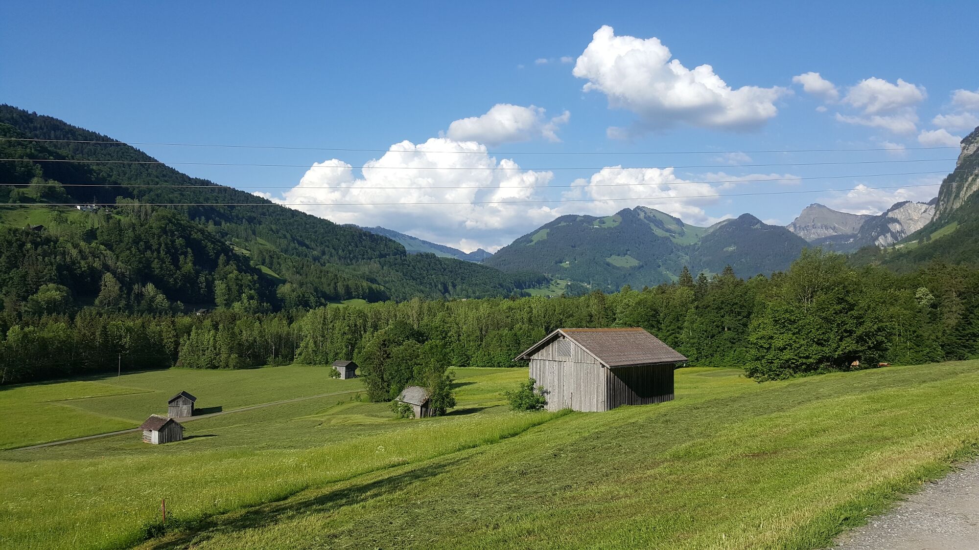
© Bregenzerwald Tourismus - Jens Scheibe

© Bregenzerwald Tourismus - Nadine Lerho

- Descrizione rapida
-
Bezau - Au - Faschina - Ugaalpe - Mittelargen - Edelweißhütte - Au - Bezau
- Difficoltà
-
difficile
- Valutazione
-
- Percorso
-
BezauKlosterkirche BezauGasthof HirschenDost Kebap0,4 kmKatrina0,4 kmEllenbogen0,9 kmReuthe1,8 kmKlaus3,3 kmIn der Mellen4,0 kmZimmerau4,4 kmÜbermellen4,7 kmRistorante Pizzeria Sandro4,8 kmPlatz4,9 kmPfarrkirche Mellau5,0 kmMellau5,0 kmMoos5,0 kmNaze's Hus5,1 kmTempel5,2 kmAchsiedlung5,4 kmHinterbündt5,5 kmBrand6,7 kmSchnepfau10,3 kmBühlenvorsäß10,8 kmAu (800 m)14,1 kmLisse14,8 kmArgenzipfel15,6 kmFaschina27,5 kmDamüls (1.423 m)29,3 kmPizzeria da Ingo30,5 kmVordere Ugaalpe33,8 kmAlpengasthof Edelweiss40,3 kmArgenzipfel46,7 kmAu (800 m)47,4 kmLisse47,5 kmBühlenvorsäß51,0 kmSchnepfau51,6 kmBrand54,8 kmHinterbündt56,5 kmAchsiedlung56,5 kmNaze's Hus56,8 kmTempel56,8 kmMoos56,9 kmMellau56,9 kmPlatz56,9 kmPfarrkirche Mellau57,0 kmRistorante Pizzeria Sandro57,1 kmÜbermellen57,3 kmZimmerau57,6 kmIn der Mellen57,9 kmKlaus58,6 kmReuthe60,1 kmEllenbogen60,9 kmDost Kebap61,4 kmKatrina61,5 kmGasthof Hirschen61,9 kmKlosterkirche Bezau61,9 kmBezau61,9 km
- La stagione migliore
-
genfebmaraprmaggiulugagosetottnovdic
- Punto più alto
- 1.826 m
- Destinazione
-
Bezau
- Profilo altimetrico
-

- Autore
-
Il tour Bezau | Faschina - Ugaalpe - Edelweißhütte - Au - Bezau è utilizzato da outdooractive.com fornito.
GPS Downloads


Info generali
Punto di ristoro
Suggerimento
Fauna
Promettente
Altri tour nelle regioni