
- Descrizione rapida
-
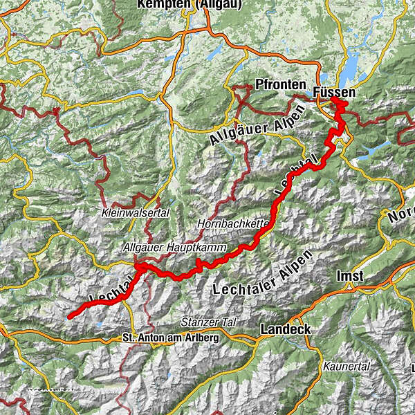
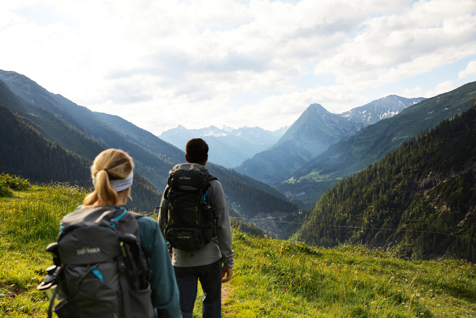
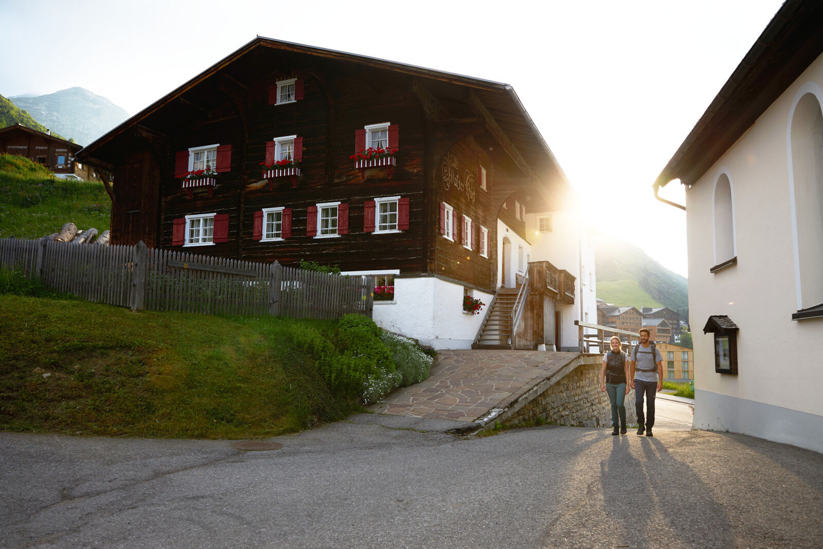
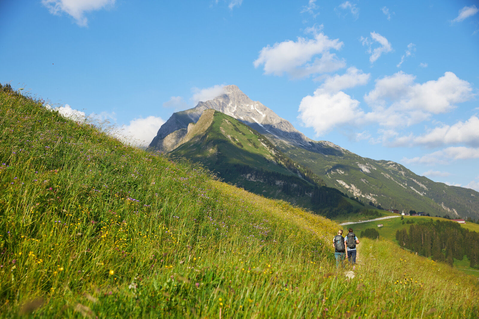
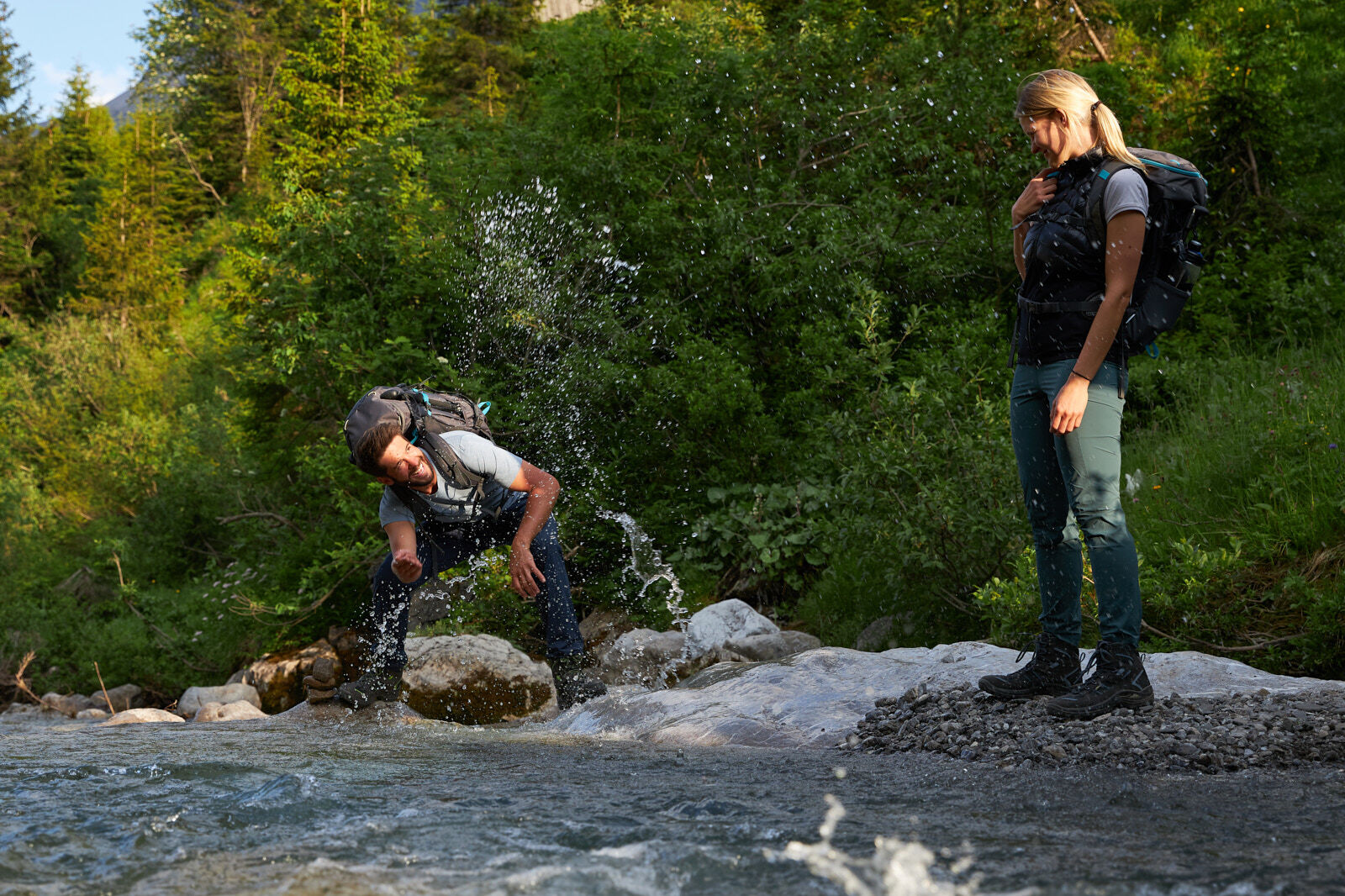
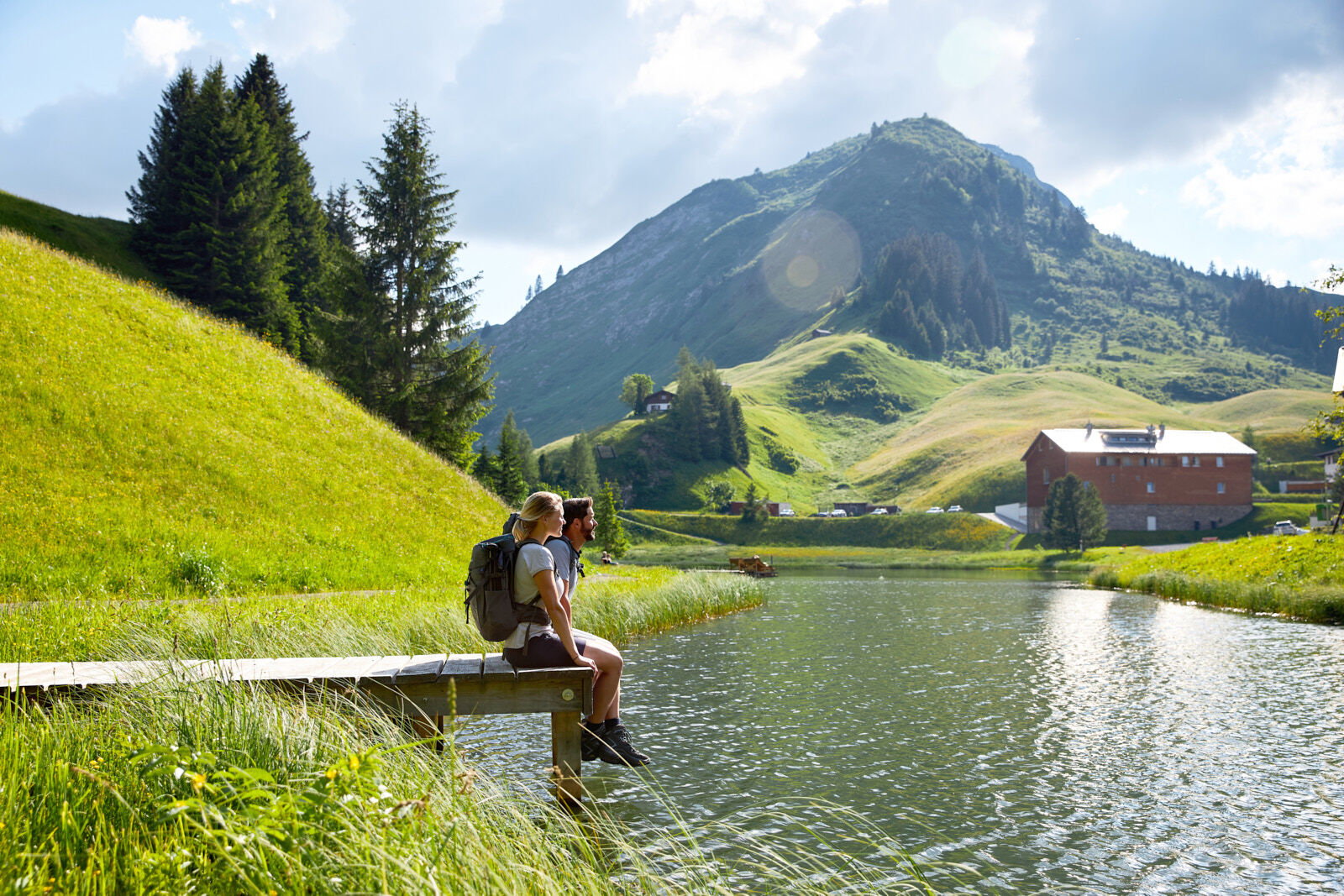
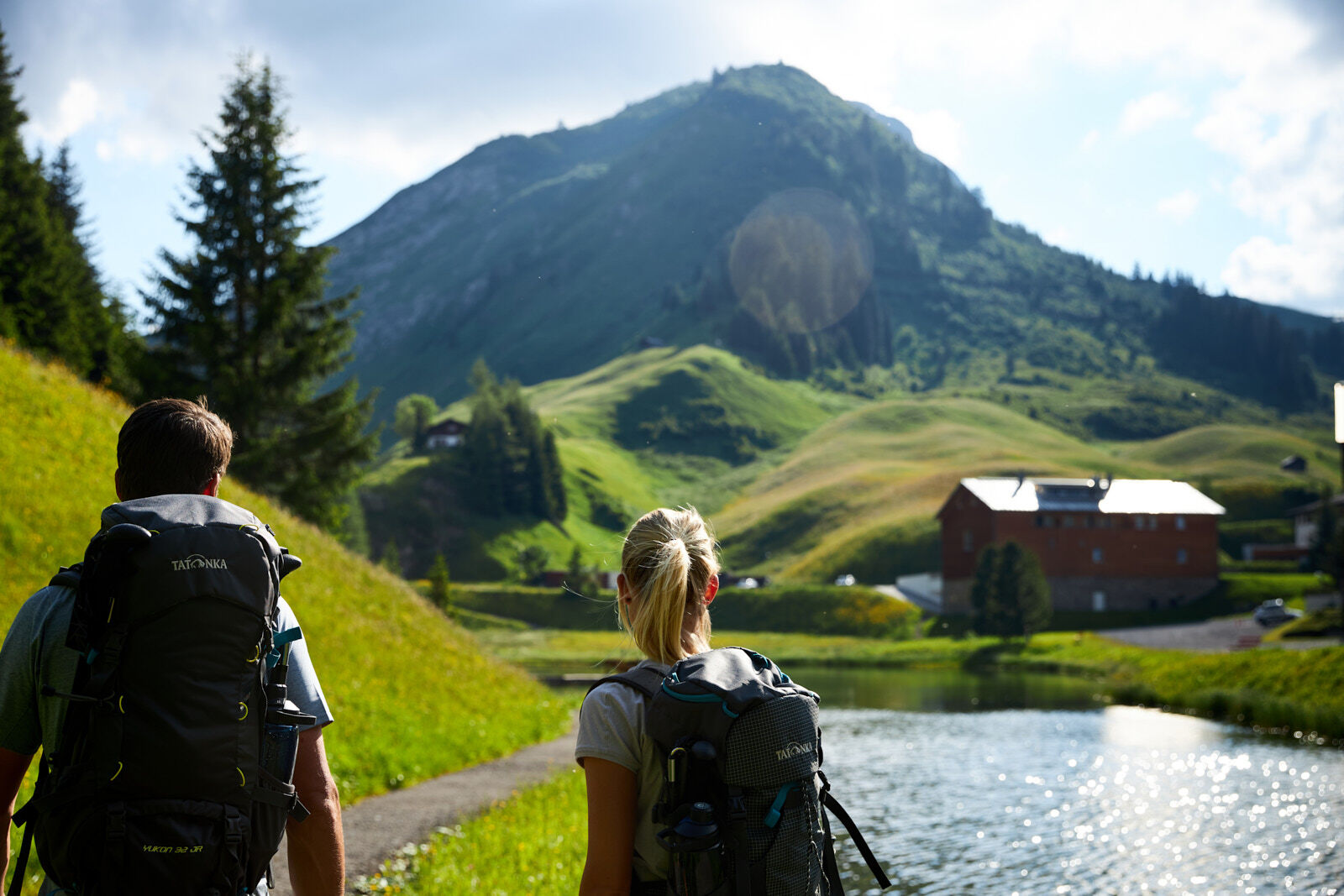
The Lechweg is a medium-difficult long-distance hiking trail through our Alpine region, which is also one of the last wild river landscapes in Europe. An untamed Lech, people shaped by the landscape and fabulous stories are waiting for you! The Lechweg connects five regions and two countries on more than 125 kilometres: Austria with the Vorarlberg Arlberg region and the Tyrolean nature park region Lechtal und Reutte, as well as the southern Allgäu in Germany. The Lech springs from its source near Lake Formarin in Vorarlberg and, after an exciting and untamed course, flows through beautiful regions into the Lechfall in Füssen in the Allgäu. The numerous stages lead past one of the largest Capricorn colonies in Europe, a waterfall that, as if by magic, drains and springs again every year, and over Austria’s longest free-of-charge pedestrian bridge. Not to be forgotten are at the end of the path the Bavarian royal palaces! Turquoise blue and crystal clear water, sanded rock slabs and small wooden bridges are a real treat for the eyes.
- Difficoltà
-
difficile
- Valutazione
-
- Percorso
-
Formarinalpe0,2 kmZug11,0 kmLech (1.444 m)14,5 kmTeschenberg22,5 kmBildegg24,9 kmWarth (1.495 m)25,1 kmPfarrkirche St. Sebastian25,3 kmKitzeliftle25,5 kmGehren27,2 kmHl. Nikolaus27,3 kmSt. Wendelin28,7 kmLechleiten28,9 kmPrenten37,7 kmWelzau38,9 kmSerble39,3 kmKnopplig39,3 kmSt. Oswald39,5 kmSteeg (1.124 m)39,9 kmHotel Post40,1 kmDickenau40,2 kmHägerauer Wasserfall41,1 kmDürnau43,5 kmHolzgau (1.114 m)45,5 kmSimms Wasserfall47,0 kmCafe Uta47,4 kmStockach51,6 kmWaldkapelle51,7 kmLechtaler Hexenkessel52,6 kmSeesumpf-Kapelle54,3 kmFriedhofskapelle55,2 kmObergiblen55,8 kmObergrünau56,1 kmUntergrünau57,9 kmGrießau61,8 kmHäselgehr (1.006 m)64,6 kmPfarrkirche St. Martin65,5 kmDoserwasserfall66,2 kmVorderhornbach (973 m)76,8 kmPfarrkirche Vorderhornbach76,8 kmStanzach (940 m)80,3 kmBlockau81,1 kmForchach (910 m)85,1 kmDorfkirche92,4 kmWeißenbach am Lech (885 m)92,6 kmRieden95,0 kmKapelle zum hl. Georg95,2 kmHöfen (868 m)98,9 kmGraben100,1 kmPlatten100,5 kmWinkl101,8 kmHolz102,1 kmWängle (882 m)103,5 kmCostarieskapelle105,1 kmFrauenseestube107,0 kmHinterbichl107,9 kmBeobachtungsturm Vogel-Erlebnispfad Pflach110,0 kmHüttenbichl110,5 kmPflach (840 m)110,6 kmKappl111,6 kmKirche Hl. Drei Könige111,7 kmHotel - Gasthof zum Schwanen111,9 kmLobatboden117,9 kmStation 11126,4 kmStation 14 Heiliggrab-Kapelle126,4 kmStation 12126,4 kmHeiligkreuz-Kapelle126,4 kmStation 13126,4 kmKalvarienberg (953 m)126,4 kmStation 10126,5 kmKerkerkapelle126,5 kmStation 9126,5 kmStation 8126,6 kmStation 7126,6 kmStation 5126,7 kmStation 6126,7 kmStation 4126,8 kmMarienkapelle126,8 kmStation 3126,8 kmFüssen (808 m)126,9 kmLechfall127,5 km
- La stagione migliore
-
genfebmaraprmaggiulugagosetottnovdic
- Punto più alto
- 1.869 m
- Destinazione
-
Lechfall
- Profilo altimetrico
-


- Autore
-
Il tour Lechweg è utilizzato da outdooractive.com fornito.


Info generali
-
Lechtal
1415
-
Hinterhornbach
231