Round hiking trail Längenfeld / Huben - Längenfeld 200

Escursioni invernali


- Descrizione rapida
-
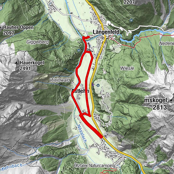
LÄNGENFELD -> Ötztaler Ache -> Astlehn -> Runhof -> Huben -> Runhof -> Astlehn -> LÄNGENFELD
- Difficoltà
-
intermedio
- Valutazione
-
- Percorso
-
Längenfeld (1.179 m)Maria Himmelfahrt3,0 kmAstlehn5,8 kmLängenfeld (1.179 m)7,7 km
- La stagione migliore
-
agosetottnovdicgenfebmaraprmaggiulug
- Punto più alto
- 1.189 m
- Destinazione
-
Campsite Ötztal in Längenfeld
- Profilo altimetrico
-


- Autore
-
Il tour Round hiking trail Längenfeld / Huben - Längenfeld 200 è utilizzato da outdooractive.com fornito.
GPS Downloads


Altri tour nelle regioni