© Alpbachtal Seenland Tourismus
Dati percorsi
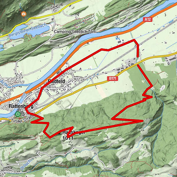
13,47km
506
- 1.122m
652hm
04:00h
- Descrizione rapida
-
Kombination aus Natur- und Kulturwanderung
- Valutazione
-
- Punto di partenza
-
Rattenberg - Schrebergärten
- Percorso
-
Hauskogel (1.009 m)6,5 kmFriedhofkapelle8,5 kmRattenberg8,9 kmRadfeld9,7 kmKapelle St. Leonhard in der Au10,7 km
- Punto più alto
- 1.122 m
- Riposo/Ritiro
-
Gasthöfe im Zentrum von Radfeld und Rattenberg
- Cartine
-
Mayr Wanderkarte
Ferienregion Alpbachtal und Tiroler Seenland
GPS Downloads


Condizioni dei sentieri
Asfalto
Ghiaia
Prato
Foresta
Roccia
Esposta
Altri tour nelle regioni
-
Alpbachtal
1502
-
Rattenberg - Radfeld
487