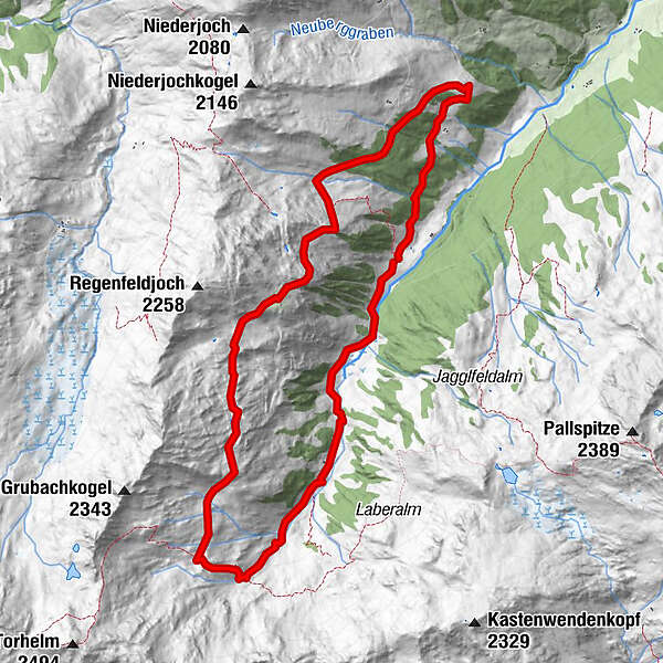
Almwanderung Tiefental-Öfeleralm-Foissachalm (Nr. 77/1)

Escursionismo

© Ferienregion Hohe Salve

© Ferienregion Hohe Salve
Dati percorsi
10,6km
1.438
- 2.035m
578hm
06:00h
- Valutazione
-
- Percorso
-
Oberkaralm (1.612 m)1,9 kmÖfeleralm (1.988 m)3,5 kmRegenfeldalm (1.970 m)6,0 kmFoissachalm (1.781 m)7,1 km
- Punto più alto
- 2.035 m
- Cartine
-
Ferienregion Hohe Salve, www.kelchsau.info
GPS Downloads


Altri tour nelle regioni
-
Zillertal Arena
1313
-
Gerlos
282