


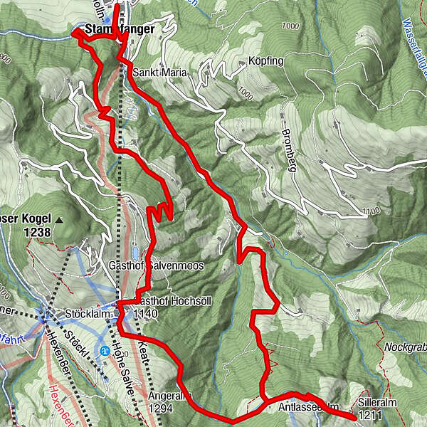
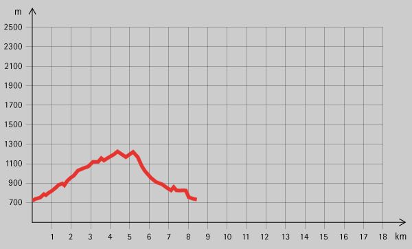
Dati percorsi
9,01km
- 1.828m
488hm
04:00h
- Descrizione rapida
-
Mittelschwere Tageswanderung für Jedermann
- Valutazione
-
- Punto di partenza
-
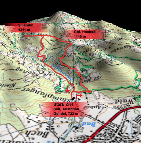
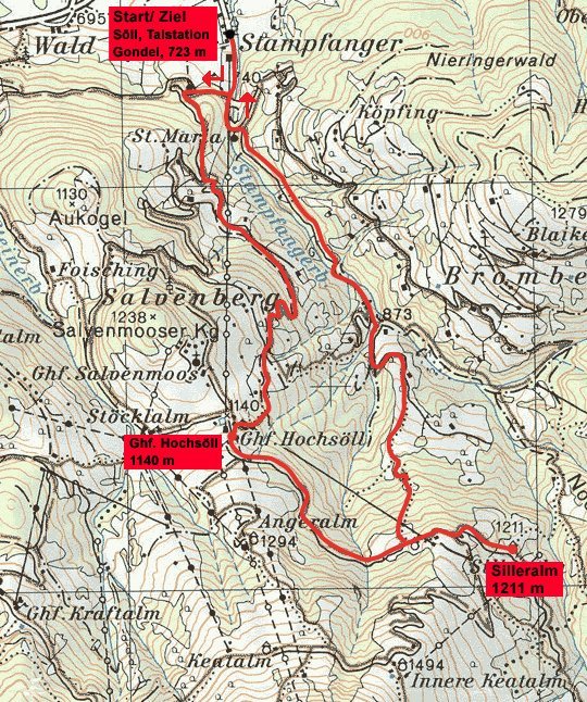
Söll, Talstation Gondel (723 m)
- Punto più alto
- 1.828 m
- Riposo/Ritiro
-
Gasthof Hochsöll, Silleralm
- Cartine
GPS Downloads


Condizioni dei sentieri
Asfalto
Ghiaia
Prato
Foresta
Roccia
Esposta
Altri tour nelle regioni
-
Region Hohe Salve
1788
-
Söll
608


