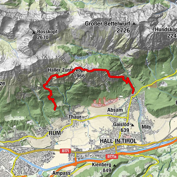
Von Thauer nach Hall - Über Haller Zunterkopf und Hochmhdkopf

Escursionismo
Dati percorsi
10,66km
780
- 1.930m
1.102hm
1.148hm
04:30h
- Descrizione rapida
-
Von Thauer nach Hall über Thaurer Zunterkopf, Haller Zunterkopf und Hochmahdkopf
- Difficoltà
-
intermedio
- Valutazione
-
- Punto di partenza
-
Parkplatz Thaurer Alm
- Percorso
-
Partscheil1,6 kmThaurer Zunterkopf (1.918 m)4,9 kmHaller Zunterkopf (1.966 m)6,0 kmHochmahdkopf (1.738 m)7,1 kmRädermacher (1.499 m)7,8 kmPfeiferler7,8 kmRunstboden9,0 km
- La stagione migliore
-
genfebmaraprmaggiulugagosetottnovdic
- Punto più alto
- 1.930 m
- Destinazione
-
Parkplatz Eingang Halltal
GPS Downloads


Condizioni dei sentieri
Asfalto
Ghiaia
Prato
(60%)
Foresta
(30%)
Roccia
(10%)
Esposta
Altri tour nelle regioni
-
Ferienregion Hall - Wattens
1494
-
Thaur
356


