
- Difficoltà
-
difficile
- Valutazione
-
- Percorso
-
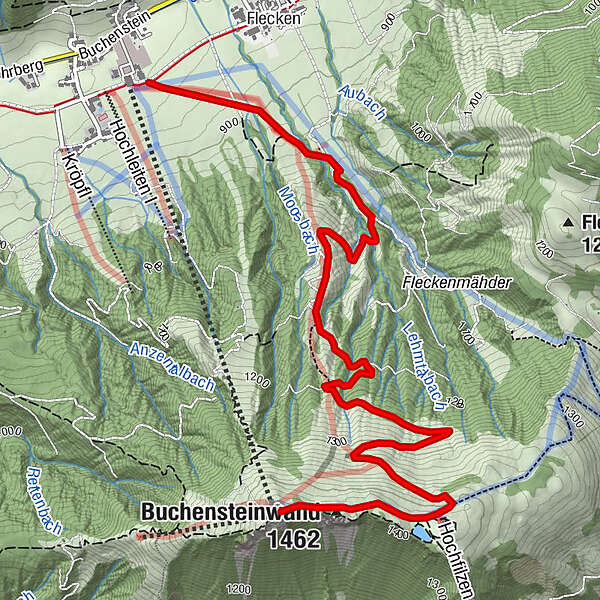
Kammbergalm3,8 kmam Speichersee Buchensteinwand4,4 kmBuchensteinwand (1.462 m)4,8 kmPanoramabahn5,0 kmAlpengasthof Buchensteinwand5,0 km
- Punto più alto
- 1.448 m
- Profilo altimetrico
-

- Autore
-
Il tour Hotel Unterlechner Aufstieg è utilizzato da outdooractive.com fornito.
GPS Downloads


Altri tour nelle regioni