© Ferienregion TirolWest - Zangerl Daniel
- Descrizione rapida
-
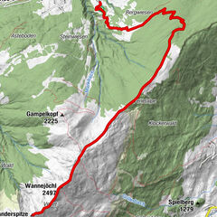
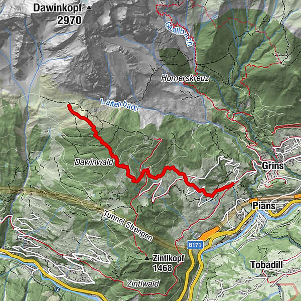
Unterhalb des Weilers Gmar führt die Tour durch Wald und über Wiesenhänge hinauf nach Dawin.
- Percorso
-
Baumgarten0,5 km
- Punto più alto
- 2.004 m
- Profilo altimetrico
-

- Autore
-
Il tour Grins - Dawin è utilizzato da outdooractive.com fornito.
GPS Downloads


Altri tour nelle regioni