Snowshoeing up to the Glungezerhut

Logo Snowshoeing up to the Glungezerhut
Dati percorsi
3,05km
2.043 - 2.601m
Distanz
551hm
10hm
L'ascesa
02:30h
 
Durata
Descrizione rapida

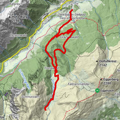
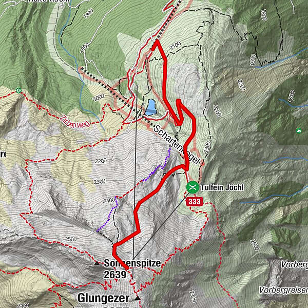
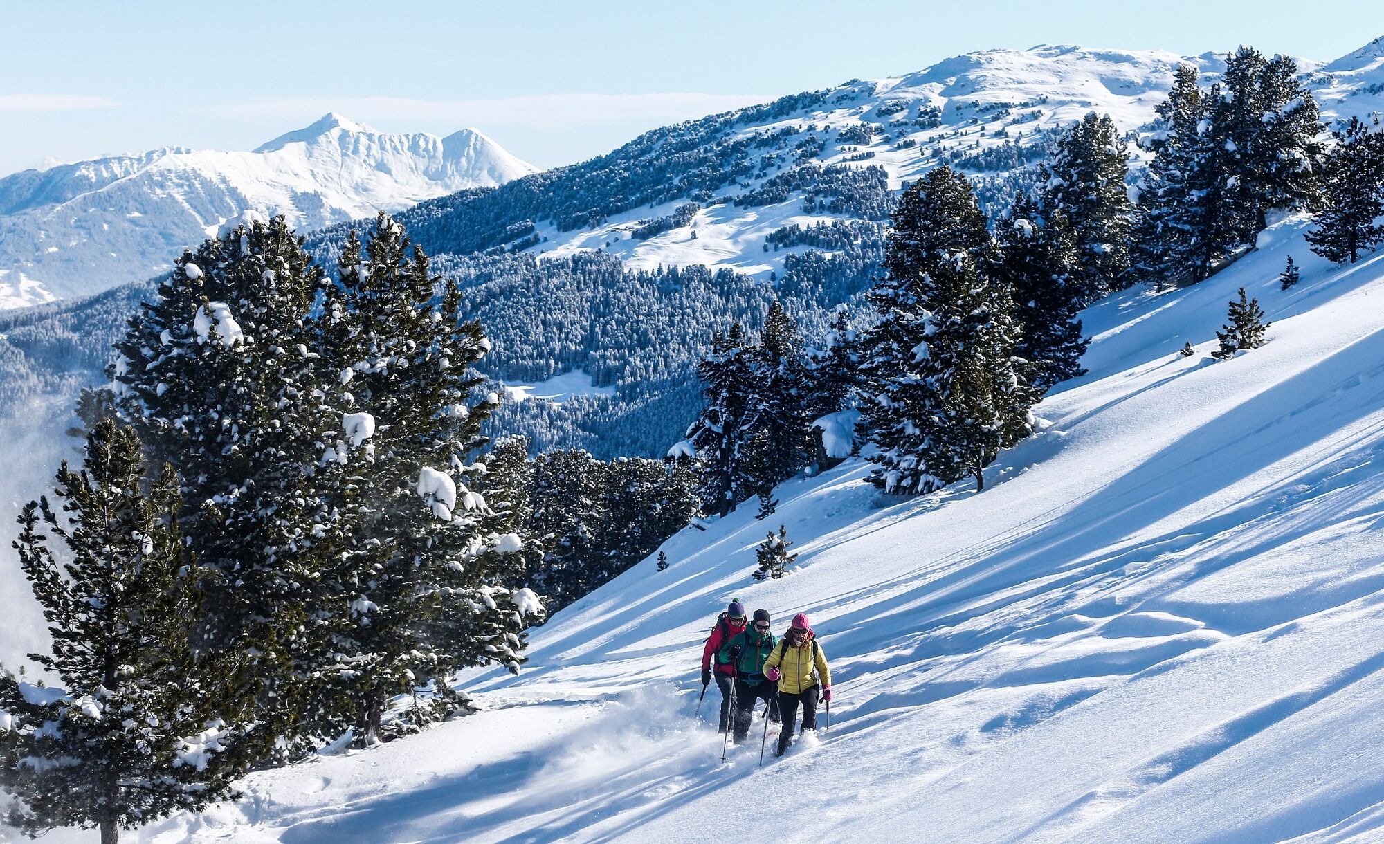
Beautiful snowshoe hiking to the Glungezer


Difficoltà
intermedio
Valutazione
Tecnica
Forma fisica
Panorama
Avventura / Esperienza
Percorso
Kombibahn Tulfein-Express
Glungezerhütte
3,0 km

La stagione migliore
ago
set
ott
nov
dic
gen
feb
mar
apr
mag
giu
lug
Punto più alto
2.601 m
Destinazione

Glungezerhütte

Profilo altimetrico

Autore
Il tour Snowshoeing up to the Glungezerhut è utilizzato da outdooractive.com fornito.

Valutazione complessiva

5

0

%

4

0

%

3

0

%

2

0

%

1

0

%

Errore
Si è verificato un errore. Si prega di riprovare.
Grazie per la vostra recensione

La valutazione è stata cancellata

GPS Downloads
  • GPX GPS Exchange Format (XML)
  • KML Google Earth, Google Maps
Codici di download QR per telefoni cellulari

Info generali

Punto di ristoro
Promettente
Altri tour nelle regioni

Tour popolari della zona

Schneeschuhwanderung Trunaalm (1.914 m)

intermedio Ciaspole
16,82km | 983hm | 06:00h

3. Schneeschuhwanderweg Waldraster Jöchl

Ciaspole
4,06km | 308hm | 01:55h