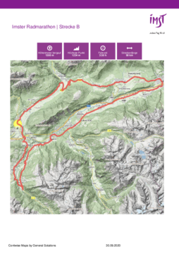
Dati percorsi
86,61km
621
- 1.232m
1.101hm
1.120hm
03:30h

- Descrizione rapida
-
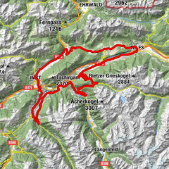
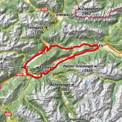
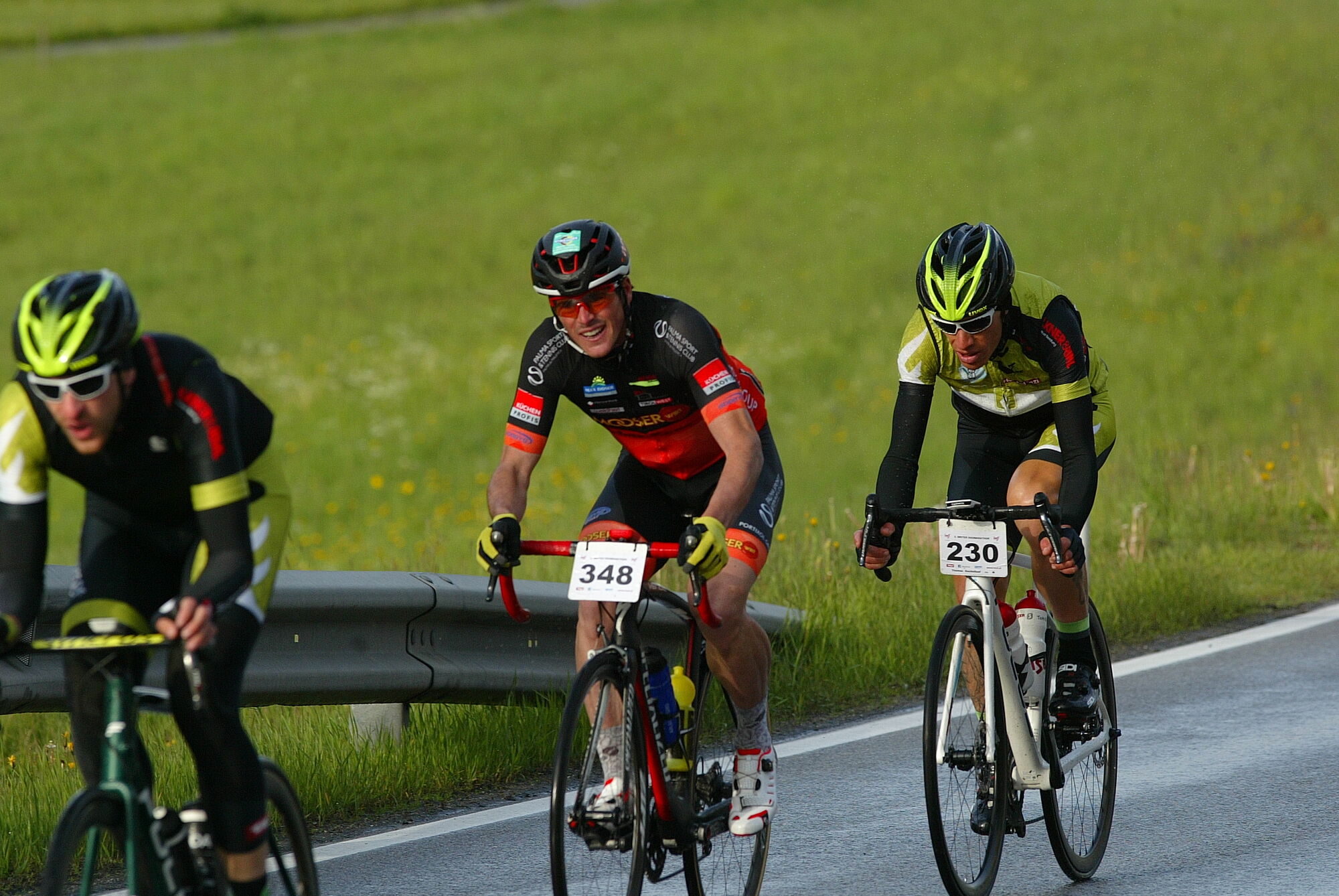
Beschreibung: Imst - Tarrenz - Nassereith - Holzleitensattel - Obsteig
- Mieming - Telfs - Rietz - Stams - Silz - Roppen - Obbruck - Wald -
Leins - Jerzens - Wenns - Arzl - Imst
- Difficoltà
-
intermedio
- Valutazione
-
- Percorso
-
Imst (827 m)Spielscheune0,1 kmJohanneskirche0,2 kmTrinelerkapelle0,8 kmRistorante La Strada2,6 kmTarrenz (836 m)3,2 kmSpielplatz Gasthof Sonne3,2 kmGasthaus Sonne3,3 kmWalchenbach4,6 kmDollinger6,1 kmDollinger6,2 kmDollinger Lager6,9 kmSchmankerltreff7,5 kmSee-Eck10,2 kmHolzleiten18,4 kmHotel Bergland20,9 kmStifterquelle21,7 kmObsteig (991 m)21,7 kmSt.Josef22,0 kmFronhausen24,2 kmKrebsbach24,6 kmBarwies25,3 kmObermieming26,0 kmGasthaus Post26,5 kmAffenhausen28,0 kmTelfs (634 m)34,1 kmStams (672 m)42,2 kmStaudach44,0 kmPizzeria Romantika45,7 kmSilz (654 m)46,0 kmPfarrkirche hll. Petrus und Paulus46,2 kmGasthof Bierwirt46,3 kmPizzeria Pronto46,3 kmÖlbergkapelle46,9 kmOilers 6951,3 kmAsiapalast Chinarestaurant51,3 kmÖtztal-Bahnhof53,0 kmÖtztaler Höhe53,4 kmTrankhütte57,0 kmRoppen (724 m)57,3 kmRoppen (706 m)57,9 kmObbruck58,4 kmJosefskapelle58,5 kmMarienkapelle59,2 kmWaldele59,7 kmMarkuskapelle59,8 kmWald62,2 kmRied64,6 kmUnterleins65,8 kmJerzens (1.107 m)69,8 kmPizzeria Zirm69,8 kmLammwirt70,0 kmSchönlarch71,3 kmPitztaler Hof75,7 kmWenns (962 m)75,7 kmBrennwald76,6 kmBlons78,2 kmArzl im Pitztal (880 m)80,7 kmPizzeria die Post80,8 kmOsterstein81,5 kmRochuskapelle83,5 kmKapelle Unser Herr im Elend84,1 kmBrennbichler Kirche84,2 kmImst (827 m)86,2 km
- La stagione migliore
-
genfebmaraprmaggiulugagosetottnovdic
- Punto più alto
- Imster Radmarathon | Strecke B (1.232 m)
- Infomateriale
-
GPS Downloads


Percorsi
Asfalto
Ghiaia
Foresta
Vie di montagna
Singletrail
Trial
Traffico
Altri tour nelle regioni