© Alpbachtal - Gabriele Grießenböck

© Alpbachtal - Gabriele Grießenböck


© Alpbachtal - Gabriele Grießenböck


- Descrizione rapida
-
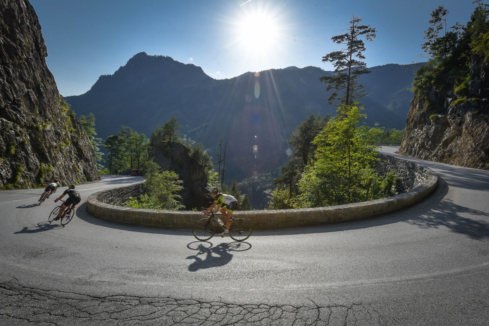
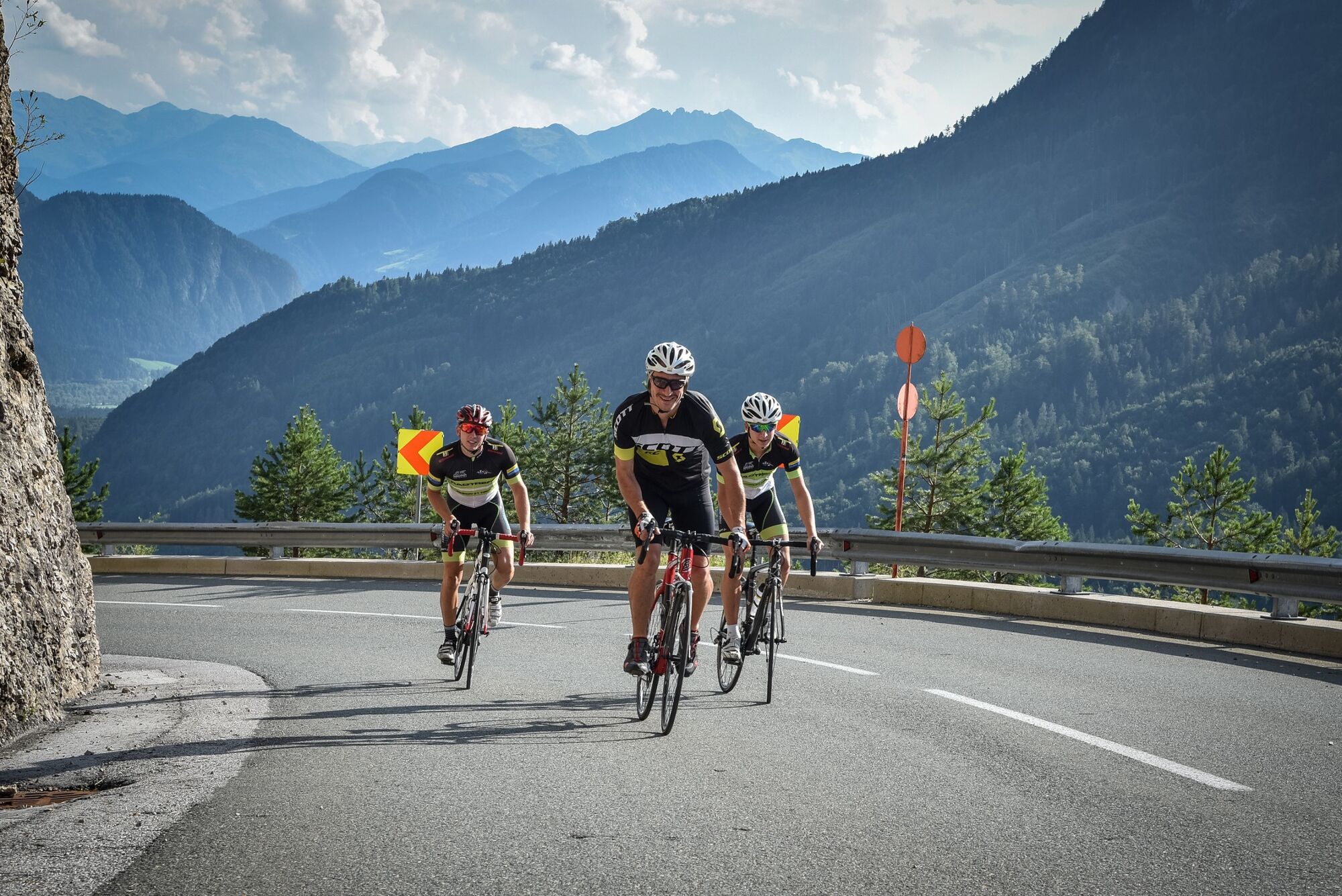
Challenging steep stretches and fast descents to increase bikers heart rates.
- Difficoltà
-
intermedio
- Valutazione
-
- Percorso
-
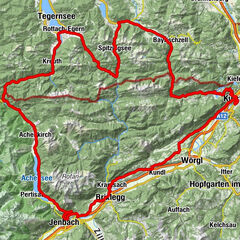
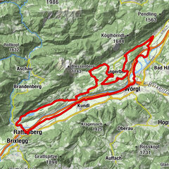
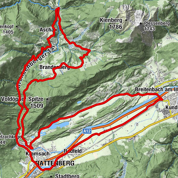
Rattenberg0,0 kmAmerling1,5 kmKramsach1,7 kmLändbühel1,9 kmWittberg (526 m)2,3 kmEbnat2,7 kmLiftstüberl3,0 kmRadetzkyweg3,1 kmMariatal (533 m)3,3 kmAschau11,9 kmPinegg13,7 kmKapelle Pinegg13,8 kmGasthof Gwercherwirt13,9 kmNeue Kapelle Pinegg14,1 kmHachakapelle16,4 kmNeuwirt20,4 kmHeiliger Georg20,5 kmAscherwirt20,6 kmBrandenberg20,6 kmEbnat26,8 kmKramsach27,3 kmAchenrain27,3 kmGenuss Schmied'n Stadlerhof28,6 kmFischerstube29,4 kmSeerose29,4 kmMoosen30,6 kmMosen (582 m)30,8 kmMoosenkapelle zum Heiligen Josef31,1 kmHaus (576 m)32,6 kmAntoniuskapelle34,5 kmAusserdorf35,6 kmBreitenbach am Inn36,1 kmKapelle St. Leonhard in der Au41,4 kmRadfeld42,3 kmSpitalkirche44,1 kmKlosterkirche hl. Augustinus44,2 kmRattenberg44,2 km
- La stagione migliore
-
genfebmaraprmaggiulugagosetottnovdic
- Punto più alto
- 957 m
- Destinazione
-
Rattenberg, town main square fountain
- Profilo altimetrico
-


-

-
AutoreIl tour Road bike 06 Brandenberg-Breitenbach è utilizzato da outdooractive.com fornito.
GPS Downloads


Info generali
Punto di ristoro
Promettente
Altri tour nelle regioni
-
Alpbachtal
44
-
Brandenberg
20