© Tannheimer Tal - Tourismusverband Tannheimer Tal

© Tannheimer Tal - Tourismusverband Tannheimer Tal

© Tannheimer Tal - Tourismusverband Tannheimer Tal

© Tannheimer Tal - Tourismusverband Tannheimer Tal

© Tannheimer Tal - Tourismusverband Tannheimer Tal

© Ferienregion Tannheimer Tal

© Ferienregion Tannheimer Tal

© Tannheimer Tal - TVB Tannheimer Tal

© Tannheimer Tal - TVB Tannheimer Tal
- Descrizione rapida
-
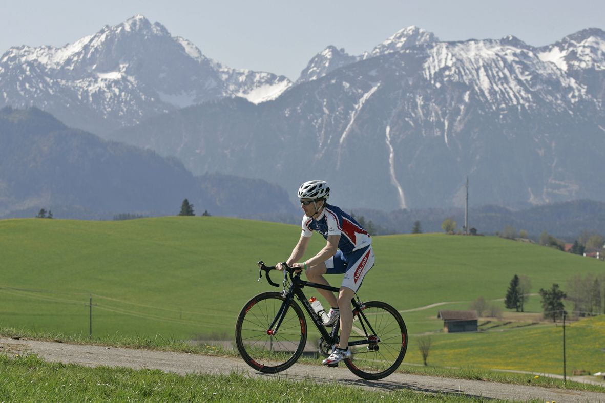
A beautiful tour to the neighbouring province of Vorarlberg
- Difficoltà
-
difficile
- Valutazione
-
- Percorso
-
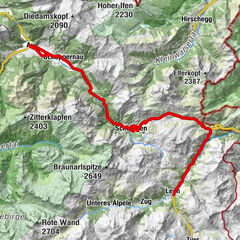
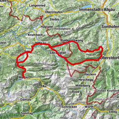
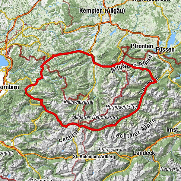
Tannheim (1.097 m)0,0 kmHaldensee2,8 kmSt. Jakobus2,8 kmHaller3,7 kmSchmittekapelle5,7 kmSchmitte5,9 kmNesselwängle (1.136 m)6,6 kmGaicht7,0 kmWeidekapelle7,2 kmRauth8,8 kmDorfkirche12,0 kmWeißenbach am Lech (885 m)12,0 kmForchach (910 m)15,2 kmBlockau18,7 kmBlockau19,4 kmStanzach (940 m)20,2 km14-Nothelfer Kapelle24,6 kmElmen (976 m)24,9 kmHäselgehr (1.006 m)31,3 kmGrießau34,3 kmElbigenalp (1.039 m)35,7 kmSonnenlift36,6 kmObergrünau37,7 kmObergiblen38,1 kmGasthof Post39,2 kmGrüner Baum39,3 kmAntoniuskapelle40,0 kmUnterstockach41,2 kmKapelle Maria Heimsuchung41,4 kmStockach42,1 kmKapelle Maria vom Guten Rat42,2 kmBildstock Maria la Salette43,1 kmHolzgau (1.114 m)43,4 kmDürnau45,0 kmSebastian-und-Rochus-Kirche46,8 kmFriedhofskapelle46,8 kmGasthof Schwarzer Adler47,1 kmDickenau48,0 kmSteeg (1.124 m)48,1 kmHinterellenbogen49,5 kmPrenten50,0 kmWarth (1.495 m)60,3 kmPfarrkirche St. Sebastian60,6 kmKitzeliftle60,9 kmNesslegg66,5 kmSchröcken (1.269 m)68,1 kmTannberg68,8 kmMaterialseilbahn Oberwaldalpe69,0 kmKapelle Unterer Giersboden69,7 kmUnterboden69,8 kmVorder Hopfreben72,5 kmTresoli75,2 kmHotel Gasthof Adler75,3 kmSchoppernau (852 m)75,7 kmHotel Restaurant Schiff78,2 kmRehmen78,6 kmNeugrund79,0 kmSägerstuben79,0 kmPfarrkirche St. Leonhard79,1 kmArgenau79,2 kmAu (800 m)79,9 kmSchnepfau84,5 kmBerghaus Kanisfluh85,9 kmSchnepfegg85,9 kmPfarrkirche Bizau88,8 kmBizau88,8 kmGasthof Schwanen88,9 kmReuthe90,0 kmEllenbogen90,4 kmBaien92,8 kmHof93,5 kmSchwarzenberg (636 m)94,4 kmZiegler (S-Line Gastronomie)94,4 kmLoch95,2 kmSchwarzenberg (696 m)96,1 kmAlte Mühle96,9 kmKapelle Wieden98,0 kmEgg99,7 kmGasthof Adler100,2 kmGroßdorf101,1 kmLingenau103,7 kmHittisau106,2 kmKänzele108,2 kmAach i.Allgäu114,4 kmOberstaufen118,3 kmSteinebach119,1 kmKapelle Steinebach119,2 kmWeißach120,7 kmHinterstaufen122,9 kmWasserscheide Rhein/Donau (775 m)122,9 kmKnechtenhofen124,5 kmKonstanzer124,8 kmSalmas125,7 kmLamprechts126,5 kmRatholz126,8 kmKapelle St. Martin und St. Wendelin126,8 kmThalkirchdorf126,8 kmWiedemannsdorf127,5 kmHintersee128,3 kmBühl a.Alpsee130,0 kmImmenstadt i.Allgäu (729 m)132,3 kmImmenstadt135,9 kmErlöserkirche136,4 kmAllgäu-Grill136,9 kmHofen139,0 kmSt. Martin139,5 kmBlaichach139,5 kmBua Thai140,3 kmRieden142,5 kmSt. Apollonia142,7 kmBinswangen144,0 kmSonthofen (741 m)144,2 kmTiefenbach144,6 kmReckenberg148,3 kmVorderhindelang149,5 kmBad Hindelang (825 m)151,0 kmBad Oberdorf152,5 kmKapelle St. Jakob155,4 kmHeilig Geist Kirche155,5 kmOberes Dorf155,6 kmOberjoch155,6 kmSteig158,7 kmNeu Kienzen159,4 kmKienzen159,4 kmWies159,5 kmPfarrkirche St. Wolfgang159,6 kmSchattwald (1.072 m)159,6 kmFricken160,0 kmZöblen (1.087 m)160,9 kmUntergschwend162,3 kmKapelle164,3 kmTannheim (1.097 m)165,1 km
- La stagione migliore
-
genfebmaraprmaggiulugagosetottnovdic
- Punto più alto
- 1.674 m
- Destinazione
-
Tannheim
- Profilo altimetrico
-

- Autore
-
Il tour Vorarlberg round è utilizzato da outdooractive.com fornito.
GPS Downloads


Info generali
Punto di ristoro
Flora
Fauna
Promettente
Altri tour nelle regioni