Road cycling tour: Timmelsjoch High Alpine Pass Road - Sölden - St. Leonhard

Ciclismo


- Descrizione rapida
-
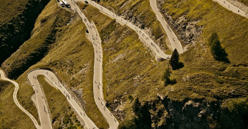
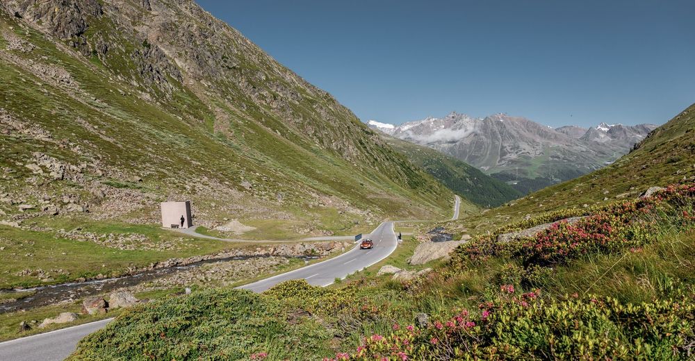
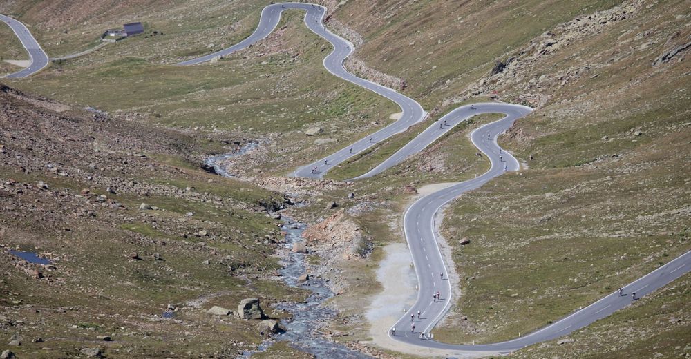
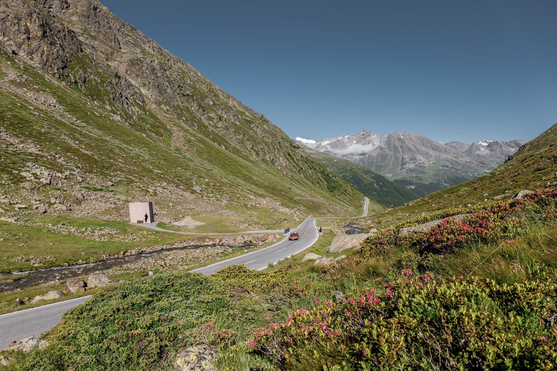
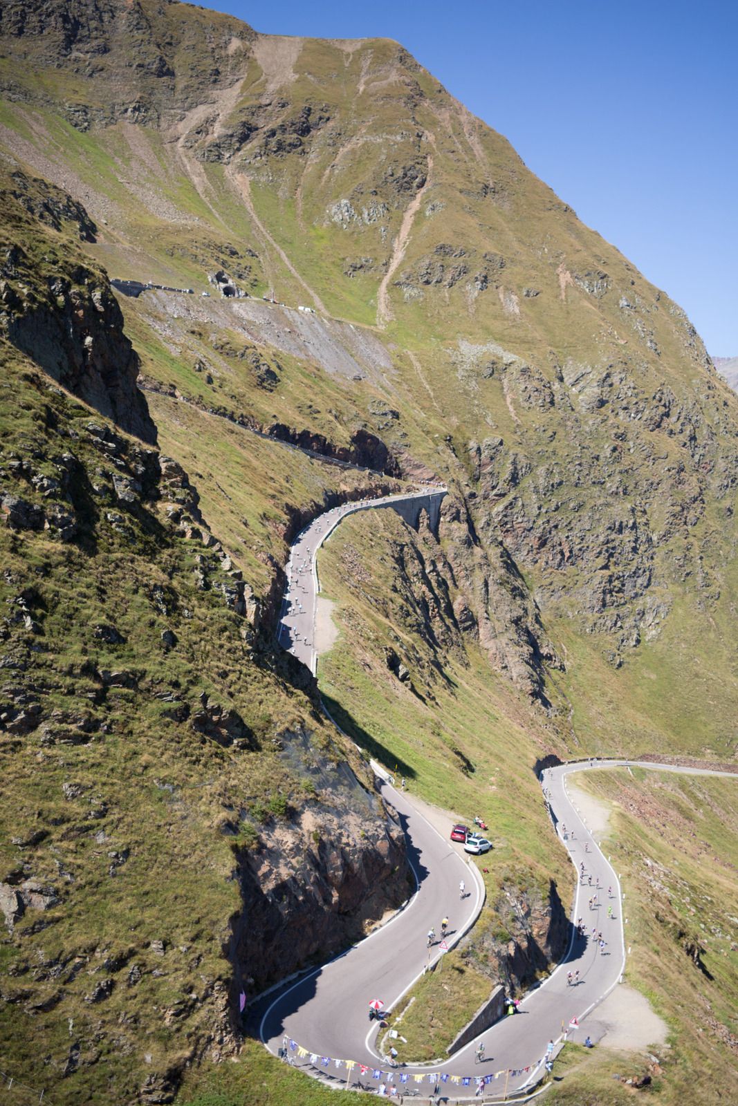
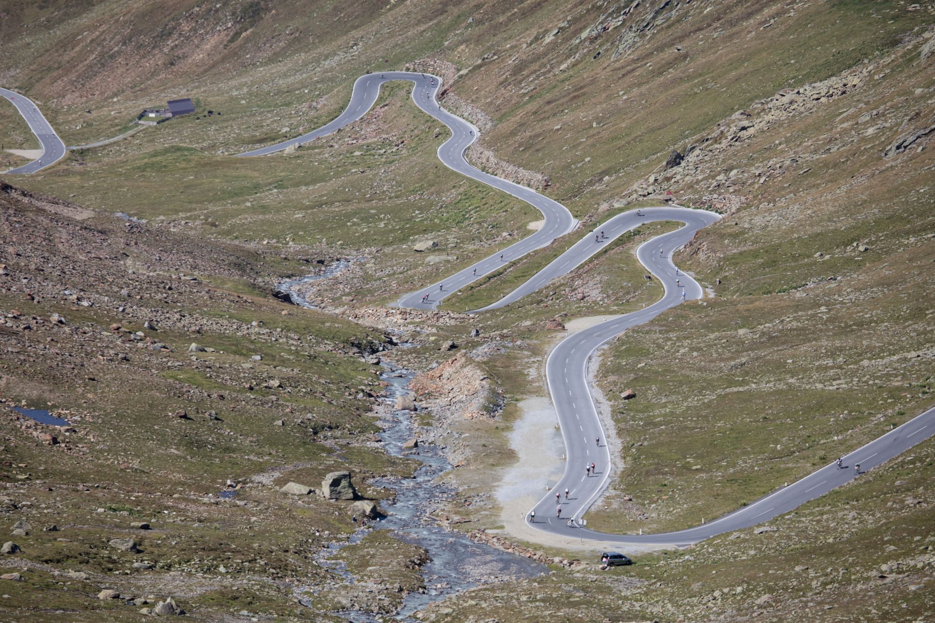
The Timmelsjoch High Alpine Road is undoubtedly one of the most renowned and popular pass roads in all of Europe. On this tour you can enjoy the truly breathtaking panoramic road in both directions.
- Difficoltà
-
difficile
- Valutazione
-
- Percorso
-
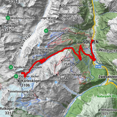
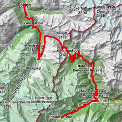
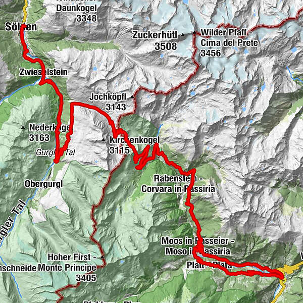
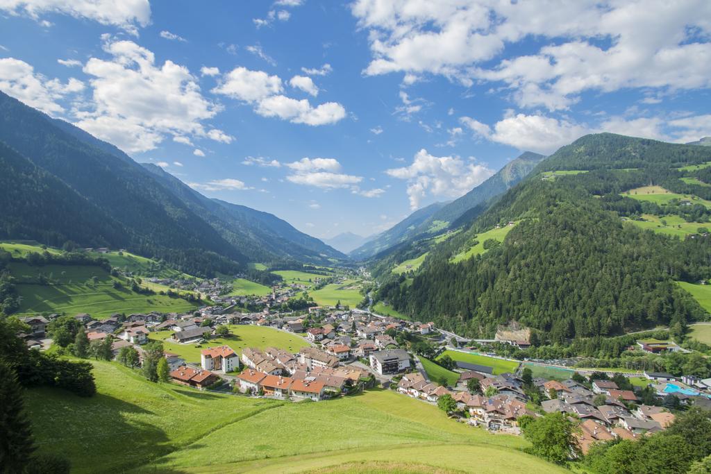
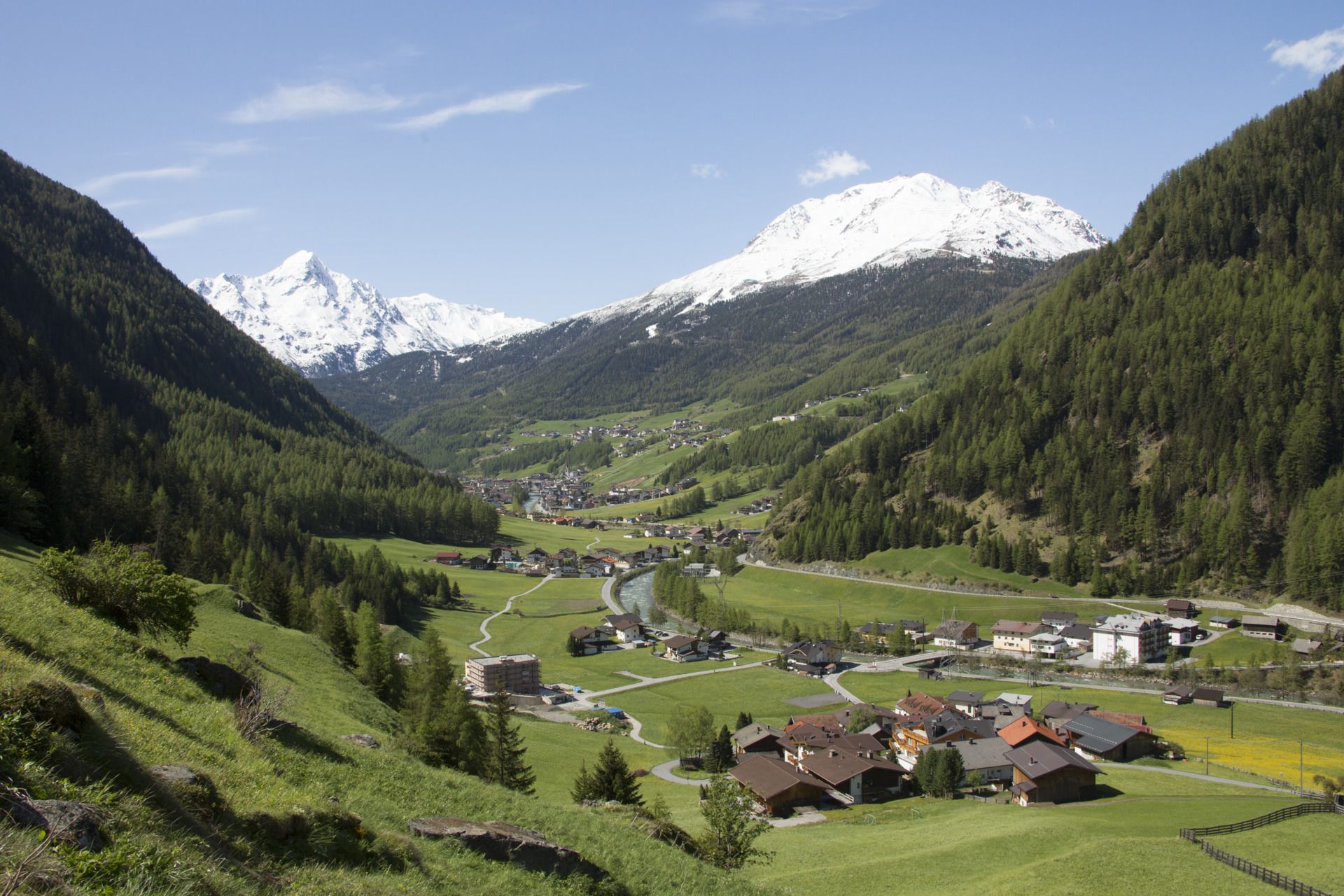
Mariä Heimsuchung0,2 kmSölden (1.368 m)0,4 kmPlatte1,9 kmPitze2,5 kmZwieselstein (1.470 m)4,4 kmBrückenwirt4,7 kmPill (556 m)10,8 kmUntergurgl10,8 kmHochgurgl (2.150 m)15,3 kmCrosspoint16,6 kmTotenstein20,8 kmRasthaus Timmelsjoch23,4 kmAlbergo Hochfirst32,1 kmGasthaus Schönau34,6 kmAlbergo - Gasthaus Saltnuss36,7 kmSalto (1.625 m)36,8 kmAl Gallo (1.288 m)41,7 kmCava di pietra41,9 kmGarnets45,0 kmMoso in Passiria (1.007 m)45,4 kmStuller Wasserfall47,3 kmMasi49,9 kmMaria Lourdes50,5 kmGomion (705 m)50,6 kmGasthof Alpenrose51,2 kmSan Leonardo in Passiria52,0 kmMagnuskapelle56,4 kmAlbergo Breiteben (1.035 m)56,5 kmPlata58,5 kmTannenhof (1.150 m)58,6 kmCascata Stieber60,0 kmMaria Assunta61,1 kmMooserwirt61,1 kmMoso in Passiria (1.007 m)61,2 kmGarnets61,9 kmCava di pietra64,9 kmAl Gallo (1.288 m)65,2 kmAlbergo - Gasthaus Saltnuss70,1 kmSalto (1.625 m)70,2 kmGasthaus Schönau72,2 kmAlbergo Hochfirst74,8 kmRasthaus Timmelsjoch83,5 kmTotenstein86,1 kmCrosspoint90,4 kmHochgurgl (2.150 m)91,7 kmUntergurgl95,2 kmPill (556 m)95,8 kmBrückenwirt102,1 kmZwieselstein (1.470 m)102,5 kmPitze104,3 kmPlatte105,0 kmSölden (1.368 m)106,6 km
- La stagione migliore
-
genfebmaraprmaggiulugagosetottnovdic
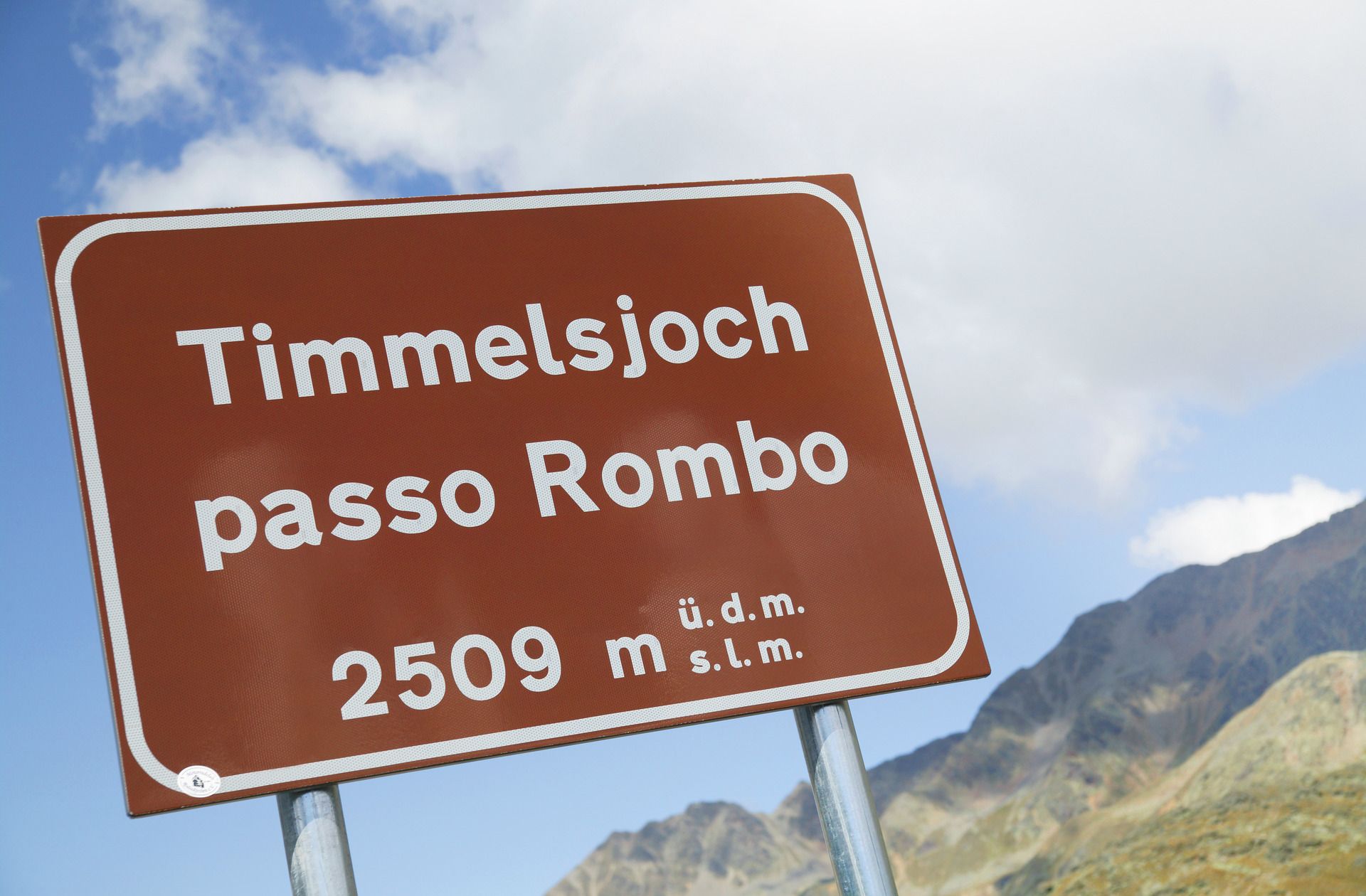
- Punto più alto
- 2.473 m
- Destinazione
-
Freizeit Arena Sölden
- Profilo altimetrico
-


- Autore
-
Il tour Road cycling tour: Timmelsjoch High Alpine Pass Road - Sölden - St. Leonhard è utilizzato da outdooractive.com fornito.
GPS Downloads


Info generali
Punto di ristoro
Culturale/Storico
Promettente
Altri tour nelle regioni