Day 2 - Alpbachtal/Wildschönau Mountainbike-Feeder Ride

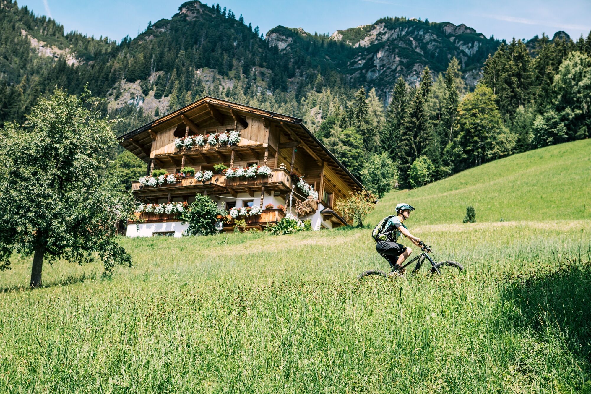
Mountainbike

© Alpbachtal - WOM Medien_Stefan Schopf
© Alpbachtal - Gabriele Grießenböck
© Alpbachtal - Josef Mück

- Descrizione rapida
-
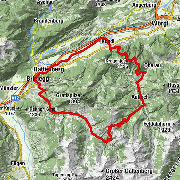
Day 2 – difficult: Alpbachtal/Wildschönau Mountainbike-Feeder Ride
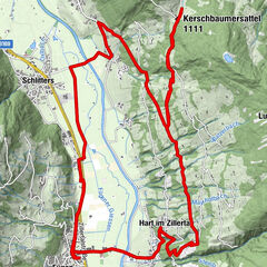
from Reith im Alpbachtal to Brixlegg along the Innradweg – bear right towards Rattenberg – Radfeld and Kundl – entrance to the Kundl Gorge/bridge and follow the mountain bike route no. 361 to the Kragenalm – Kragenjoch – Oberau – Mühltal – Auffach, continue along the route no. 351 to the Gernalm – route no. 360 through the Lueger Valley to Inneralpbach – back to Reith im Alpbachtal on the main road (L5)
- Difficoltà
-
difficile
- Valutazione
-
- Percorso
-
Reith im Alpbachtal (638 m)0,1 kmBischofsbrunn0,6 kmAlpsteg (619 m)0,8 kmPestkapelle1,7 kmMehrn (560 m)2,2 kmBrixlegg2,7 kmRattenberg5,2 kmBadl5,2 kmKlosterkirche hl. Augustinus5,4 kmSpitalkirche5,4 kmRadfeld6,7 kmBreitenbach am Inn13,0 kmKundl14,1 kmMariä Himmelfahrt14,2 kmKragenjoch (1.425 m)21,9 kmKragenjoch (1.387 m)22,5 kmGeorg Kapelle22,9 kmJausenstation Achentalalm23,1 kmJausenstation Boarstadl24,1 kmAm Egg (1.011 m)25,8 kmDorf26,8 kmMühltal (803 m)28,6 kmTegelanger (817 m)29,7 kmAuffach (860 m)30,6 kmPlatzl30,7 kmEchoplatze31,0 kmTalstner Niederalm37,1 kmGrasingalm (1.644 m)38,6 kmHubertuskapelle45,7 kmBuamkapelle46,3 kmConny Tiroler Wirtshaus47,1 kmInneralpbach47,2 kmSchulmeisterkapelle47,5 kmReither Anger (659 m)56,0 kmReith im Alpbachtal (638 m)56,3 km
- La stagione migliore
-
genfebmaraprmaggiulugagosetottnovdic
- Punto più alto
- 1.782 m
- Destinazione
-
Reith im Alpbachtal
- Profilo altimetrico
-

- Autore
-
Il tour Day 2 - Alpbachtal/Wildschönau Mountainbike-Feeder Ride è utilizzato da outdooractive.com fornito.
GPS Downloads


Info generali
Punto di ristoro
Promettente
Altri tour nelle regioni
-
Alpbachtal
293
-
Alpbach
121