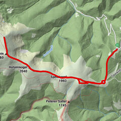
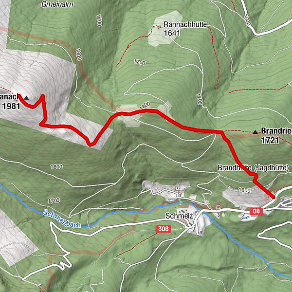
TÜPL Seetal auf die Hohe Ranach

Logo TÜPL Seetal auf die Hohe Ranach
Dati percorsi
6,5km
1.624 - 1.970m
Distanz
419hm
419hm
L'ascesa
02:30h
 
Durata
Descrizione rapida

einfache Wanderung für jeden geeignet

Difficoltà
facile
Valutazione
Tecnica
Forma fisica
Panorama
Avventura / Esperienza
Percorso
La stagione migliore
gen
feb
mar
apr
mag
giu
lug
ago
set
ott
nov
dic
Punto più alto
1.970 m

4,5
Valutazione complessiva

5

50

%

4

50

%

3

0

%

2

0

%

1

0

%

GPS Downloads
  • GPX GPS Exchange Format (XML)
  • KML Google Earth, Google Maps
Codici di download QR per telefoni cellulari

Condizioni dei sentieri

Asfalto
Ghiaia
Prato
Foresta
Roccia
Esposta

Tour popolari della zona

Vom Salzstiegl auf den Ameringkogel

intermedio Escursionismo
14,22km | 755hm | 05:00h

Great Lachtal - 5 summit hike

intermedio Escursionismo
17,62km | 720hm | 05:30h

Klippitztörl: Rundwanderung

intermedio Escursionismo
10,06km | 317hm | 03:30h

Vom Almidyll Sabathy (Sabathyhütte) auf den Zirbitzkogel

intermedio Escursionismo
7,7km | 656hm | 03:30h