Zetzweg on "The Hand“, Thannhausen

Logo Zetzweg on
Logo Zetzweg on
Dati percorsi
8,87km
591 - 1.255m
Distanz
673hm
675hm
L'ascesa
04:00h
 
Durata
Descrizione rapida

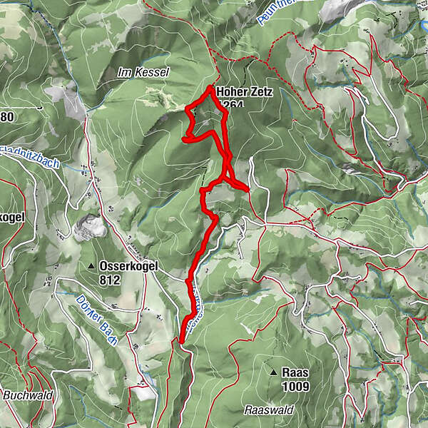
The hike starts at the "Die Hand" parking lot/junction and leads to the Hoher Zetz.

Difficoltà
intermedio
Valutazione
Tecnica
Forma fisica
Panorama
Avventura / Esperienza
Percorso
Wittgruberhof
2,8 km

La stagione migliore
gen
feb
mar
apr
mag
giu
lug
ago
set
ott
nov
dic
Punto più alto
1.255 m
Destinazione

Zetz cross

Profilo altimetrico

Autore
Il tour Zetzweg on "The Hand“, Thannhausen è utilizzato da outdooractive.com fornito.

Valutazione complessiva

5

0

%

4

0

%

3

0

%

2

0

%

1

0

%

Errore
Si è verificato un errore. Si prega di riprovare.
Grazie per la vostra recensione

La valutazione è stata cancellata

GPS Downloads
  • GPX GPS Exchange Format (XML)
  • KML Google Earth, Google Maps
Codici di download QR per telefoni cellulari

Info generali

Punto di ristoro
Promettente
Altri tour nelle regioni

Tour popolari della zona

Rettenbachklamm - Platte - Basilika Maria Trost

facile Escursionismo
6,34km | 208hm | 03:00h

Schöckl von Radegund aus

intermedio Escursionismo
5,44km | 619hm | 02:30h

Herberstein-Geierwand-Stubenbergsee

facile Escursionismo
10,65km | 301hm | 02:50h

Hochlantsch Hiking Tour

difficile Escursionismo
11,49km | 554hm | 04:30h