© Tourismusverband Region Murau - Irene Cester

© Tourismusverband Region Murau - Tom Lamm

- Descrizione rapida
-
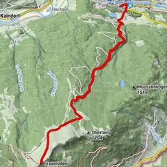
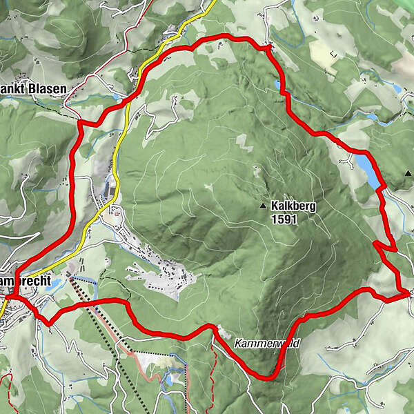
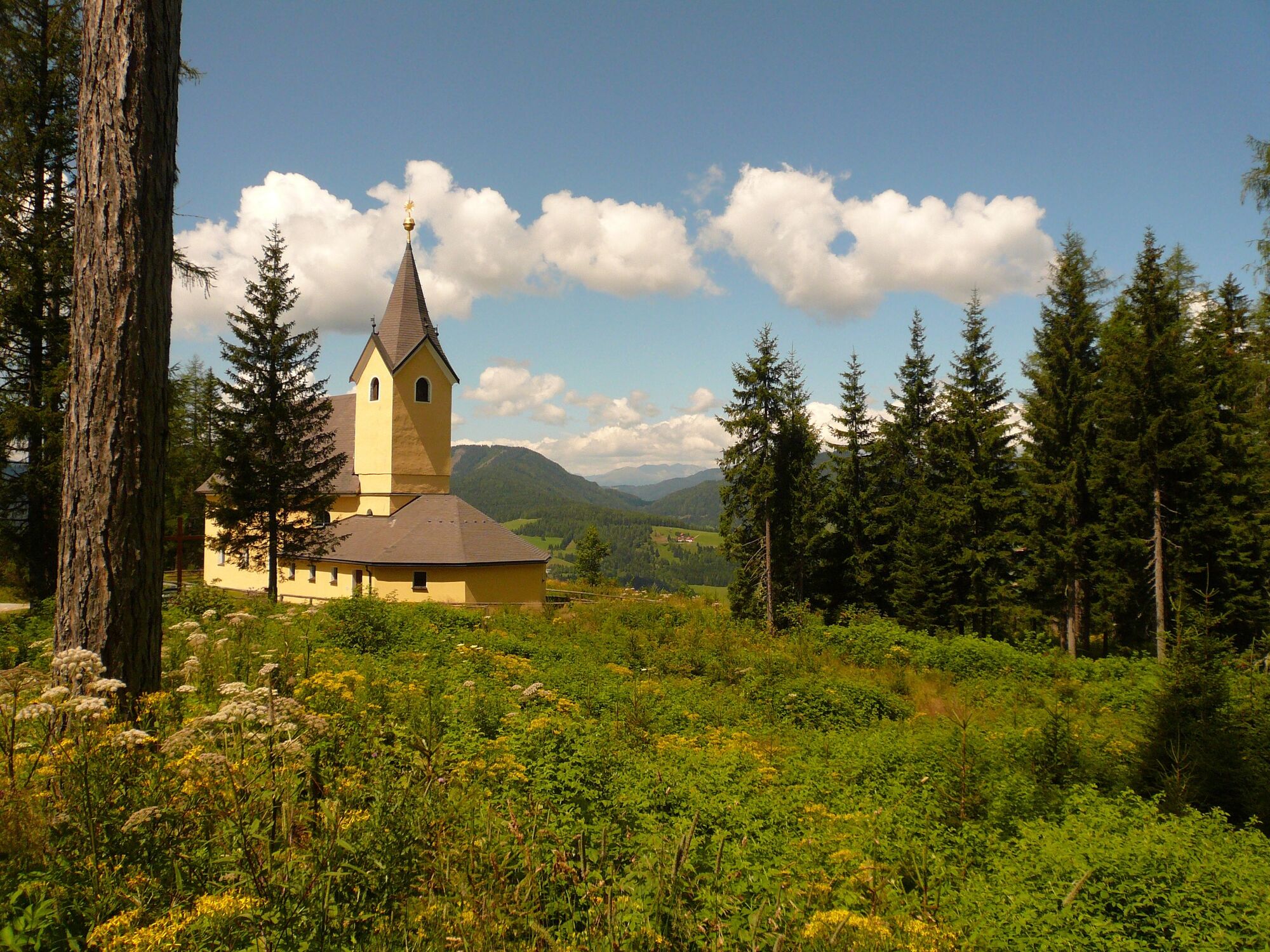
Long hike, mostly in the forest, leading to ponds, to the pilgrimage church Maria Schönanger and up to the back of the Kalkberg to Zeutschach.
- Difficoltà
-
difficile
- Valutazione
-
- Percorso
-
StifterlMarktcaféSankt Lambrecht0,0 kmTorwirt0,0 kmHeiligenstadt1,8 kmStraussenhof Wallner2,7 kmThajagraben3,5 kmZeutschach10,3 kmGasthaus Schönanger13,6 kmWallfahrtskirche Maria Schönanger13,7 kmEngelsbrunnen15,1 kmTorwirt16,9 kmSankt Lambrecht16,9 kmMarktcafé16,9 kmStifterl16,9 km
- La stagione migliore
-
genfebmaraprmaggiulugagosetottnovdic
- Punto più alto
- 1.332 m
- Destinazione
-
St. Lambrecht Abbey
- Profilo altimetrico
-


- Autore
-
Il tour Kalkberg-Runde è utilizzato da outdooractive.com fornito.
GPS Downloads


Info generali
Punto di ristoro
Promettente
Altri tour nelle regioni