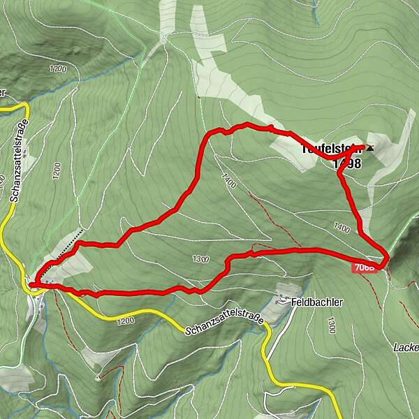
Teufelstein Winterwanderung

Logo Teufelstein Winterwanderung
Dati percorsi
6,13km
1.175 - 1.499m
Distanz
326hm
318hm
L'ascesa
01:54h
 
Durata
Difficoltà
facile
Valutazione
Tecnica
Forma fisica
Panorama
Avventura / Esperienza
Percorso
Schanzsattel (1.170 m)
0,0 km
Gasthaus auf der Schanz
0,0 km
Teufelsteinhütte
2,6 km
Gasthaus auf der Schanz
6,0 km
Schanzsattel (1.170 m)
6,1 km
La stagione migliore
gen
feb
mar
apr
mag
giu
lug
ago
set
ott
nov
dic
Punto più alto
1.499 m

1,0
Valutazione complessiva

5

0

%

4

0

%

3

0

%

2

0

%

1

100

%

GPS Downloads
  • GPX GPS Exchange Format (XML)
  • KML Google Earth, Google Maps
Codici di download QR per telefoni cellulari

Condizioni dei sentieri

Asfalto
Ghiaia
Prato
Foresta
Roccia
Esposta

Tour popolari della zona

Rote Wand- Steinbockparadies

intermedio Escursionismo
7,35km | 501hm | 04:00h

Hochlantsch Hiking Tour

difficile Escursionismo
11,49km | 554hm | 04:30h

Auf den Gipfel der Hohen Veitsch

intermedio Escursionismo
6,79km | 774hm | 03:30h

Rennfeld

facile Escursionismo
7,25km | 410hm | 03:00h