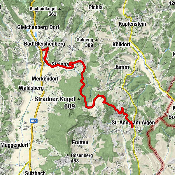
Backbone (Rückgrat) / Bad Gleichenberg-St. Anna

Escursionismo

© Erlebnisregion Thermen- & Vulkanland - Werner Resch

© Harry Schiffer - Steiermark Tourismus
- Descrizione rapida
-
We hike from the Gleichenberger Kogel to the Stradner Kogel and further to St. Anna. On this hike we witness the past - do you see the extinct volcanoes?
- Difficoltà
-
difficile
- Valutazione
-
- Percorso
-
Bad Gleichenberg (269 m)0,0 kmBad Gleichenberg0,1 kmSteinbach2,5 kmLounge 813,8 kmVorstatt7,7 kmSchemmingkapelle10,4 kmSchemming10,9 kmRutschen12,9 kmSt. Anna am Aigen13,0 kmPfarrkirche St. Anna13,1 km
- La stagione migliore
-
genfebmaraprmaggiulugagosetottnovdic
- Punto più alto
- 543 m
- Destinazione
-
Vinothek St. Anna am Aigen
- Profilo altimetrico
-


- Autore
-
Il tour Backbone (Rückgrat) / Bad Gleichenberg-St. Anna è utilizzato da outdooractive.com fornito.
GPS Downloads


Altri tour nelle regioni
-
Oststeiermark
2125
-
Bad Gleichenberg
371
-
Bad Gleichenberg
154