- Descrizione rapida
-
This hike is perfect for a short break in nature or for a leisurely walk with the whole family.
- Difficoltà
-
facile
- Valutazione
-
- Percorso
-
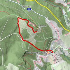
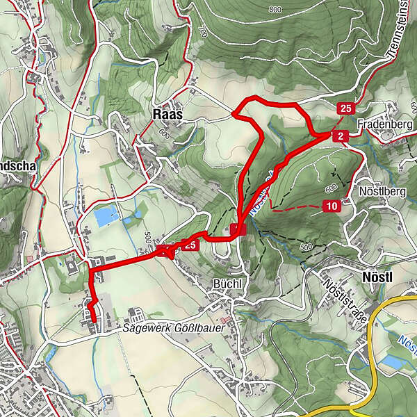
Gasthaus Ablasser0,1 kmOberfladnitz-Thannhausen0,3 kmRaas2,3 kmOberfladnitz-Thannhausen5,0 kmGasthaus Ablasser5,2 km
- La stagione migliore
-
genfebmaraprmaggiulugagosetottnovdic
- Punto più alto
- 634 m
- Destinazione
-
Municipal office Thannhausen
- Profilo altimetrico
-


-

-
AutoreIl tour Way of the Cross - Hike Thannhausen è utilizzato da outdooractive.com fornito.
GPS Downloads


Info generali
Culturale/Storico
Promettente
Altri tour nelle regioni
-
Oststeiermark
2126
-
Weiz/St. Ruprecht an der Raab
1521
-
Thannhausen
325