Prenten Höhenweg (Number 8)

Logo Prenten Höhenweg (Number 8)
Dati percorsi
5,66km
732 - 920m
Distanz
203hm
203hm
L'ascesa
00:35h
 
Durata
Descrizione rapida

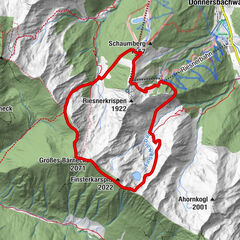
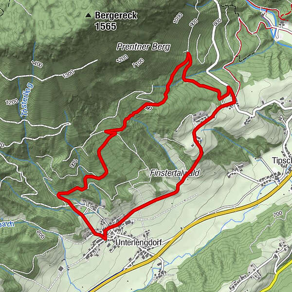
Along forest paths at the foot of the crest the Prenten Höhenweg leads with its starting and end point in Lengdorf.

Difficoltà
facile
Valutazione
Tecnica
Forma fisica
Panorama
Avventura / Esperienza
Percorso
Oberlengdorf
Prenten
3,6 km
Oberlengdorf
5,4 km

La stagione migliore
gen
feb
mar
apr
mag
giu
lug
ago
set
ott
nov
dic
Punto più alto
920 m
Destinazione

Lengdorf Dorfplatz

Profilo altimetrico

Autore
Il tour Prenten Höhenweg (Number 8) è utilizzato da outdooractive.com fornito.

Valutazione complessiva

5

0

%

4

0

%

3

0

%

2

0

%

1

0

%

Errore
Si è verificato un errore. Si prega di riprovare.
Grazie per la vostra recensione

La valutazione è stata cancellata

GPS Downloads
  • GPX GPS Exchange Format (XML)
  • KML Google Earth, Google Maps
Codici di download QR per telefoni cellulari

Info generali

Suggerimento

Tour popolari della zona

Summit Trail Riesneralm

intermedio Trailrunning
10,13km | 884hm | 02:35h

Ennswiesn-Trail (Number 4)

facile Trailrunning
10,68km | 94hm | 01:00h

Obermoser Trail

facile Trailrunning
9,98km | 375hm | 02:00h

Salza waterfall round (number 6)

facile Trailrunning
5,64km | 168hm | 00:25h