© Erlebnisregion Schladming-Dachstein - Roland Gutwenger

© Erlebnisregion Schladming-Dachstein - Roland Gutwenger

© Erlebnisregion Schladming-Dachstein - Roland Gutwenger

© Tourismusverband Grimming-Donnersbachtal - Roland Gutwenger
- Descrizione rapida
-
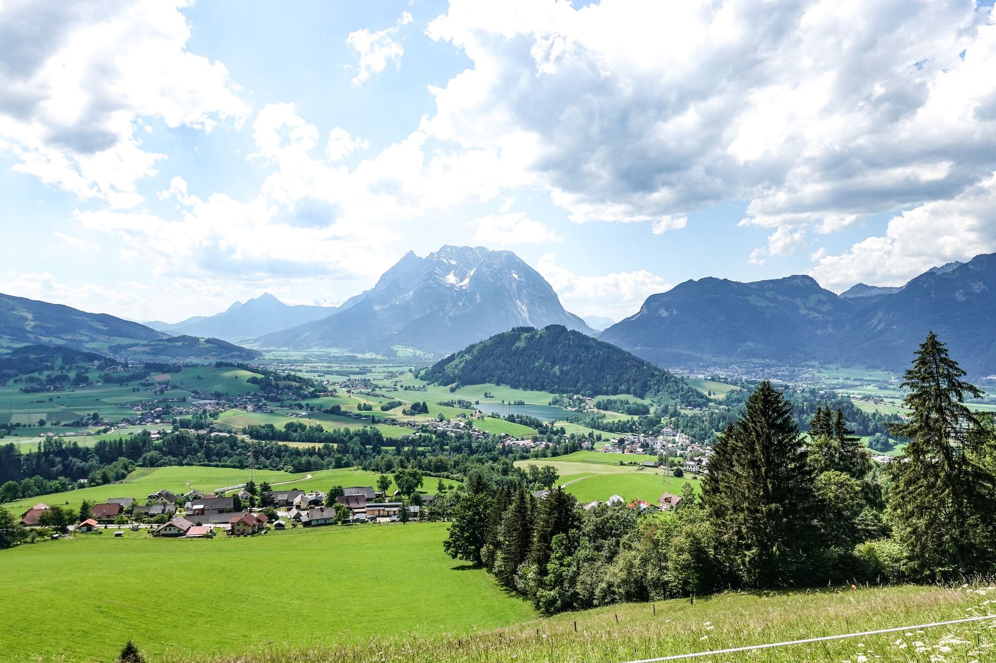
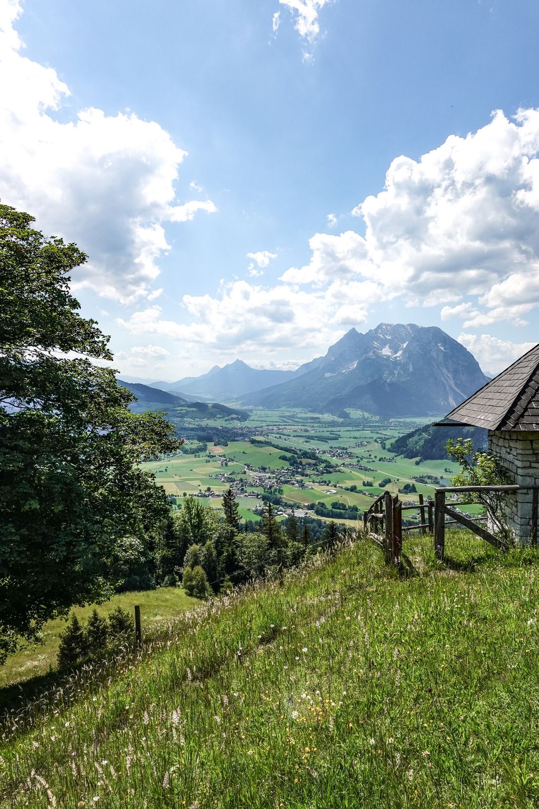
The further way to the perfect viewpoint Stalingradkapelle leads over the Kohlanger. As an encore, the Hohe Trett offers itself. Otherwise, it's best to descend to the chapel in the evening mood and enjoy the view.
- Difficoltà
-
intermedio
- Valutazione
-
- Percorso
-
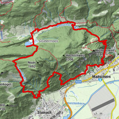
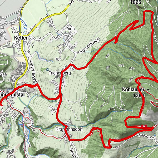
Aigen im Ennstal0,2 kmPfarrkirche Heiliger Florian0,2 kmTachenberg1,6 kmStalingradkreuz Kapelle8,8 kmMayerhofer Monika Bankerl9,5 kmRitzmannsdorf10,0 kmPfarrkirche Heiliger Florian12,0 kmAigen im Ennstal12,1 km
- La stagione migliore
-
genfebmaraprmaggiulugagosetottnovdic
- Punto più alto
- 1.348 m
- Destinazione
-
Parkingplace tennis court
- Profilo altimetrico
-


-

-
AutoreIl tour Kohlanger Trail è utilizzato da outdooractive.com fornito.
GPS Downloads


Info generali
Promettente
Altri tour nelle regioni