© Südsteiermark - Tourismusegionalverband Süd- und Weststeiermark

© Südsteiermark - Christina Trstenjak

© Südsteiermark - Christina Trstenjak

© Südsteiermark - Christina Trstenjak

- Descrizione rapida
-
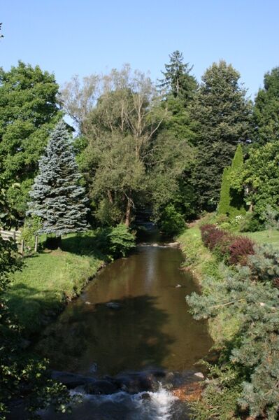
Along the Saggau and the Schwarze Sulm you will also explore the corn fields and sunflowers of the region.
- Difficoltà
-
facile
- Valutazione
-
- Percorso
-
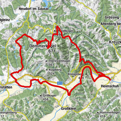
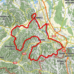
EibiswaldHasewend’s Kirchenwirt0,0 kmPfarrkirche Maria im Dorn0,1 kmHörmsdorf1,2 kmRomantikhof Kiefer1,5 kmPitschgau3,9 kmBischofegg6,2 kmUdelsdorf8,2 kmGasthaus Temmel-Kollar8,8 kmOberhaag8,9 kmUnterhaag10,6 kmSaggau14,6 kmGasthof Jauk15,3 kmPfarrkirche Heiliger Johannes der Täufer15,3 kmSankt Johann im Saggautal15,6 kmHarla17,6 kmOrtskapelle 'Maria Hilf'19,0 kmRadiga19,1 kmMesskapelle Schmerzhafte Mutter22,0 kmKleinklein22,1 kmGroßklein23,1 kmWippelsach24,7 kmMantrach27,3 kmGasthof Brand31,6 kmGleinstätten32,0 kmLandhaus Rath32,4 kmHaslach34,3 kmPölfing39,2 kmCafé-Gasthaus Köppl43,0 kmPfarrkirche Gegeißelten Heiland43,3 kmWies43,3 kmGasthof Zum Kirchenwirt43,3 kmWeinbau-Buschenschank Pichlippi46,4 kmPfarrkirche Maria im Dorn48,0 kmEibiswald48,0 kmHasewend’s Kirchenwirt48,1 km
- La stagione migliore
-
genfebmaraprmaggiulugagosetottnovdic
- Punto più alto
- 421 m
- Destinazione
-
Eibiswald
- Profilo altimetrico
-


- Autore
-
Il tour 2 Rivers Tour è utilizzato da outdooractive.com fornito.
GPS Downloads


Info generali
Punto di ristoro
Culturale/Storico
Promettente
Altri tour nelle regioni
-
Südsteiermark
236
-
Schilcherland Steiermark
93
-
Oberhaag
29