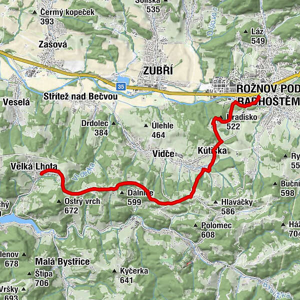
RSCZ07 - Rožnov pod Radhoštěm > Velká Lhota

Pellegrinaggio

© Fondazione Homo Viator - San Teobaldo - Rep. Ceca
- Descrizione rapida
-
The route, which begins at one of the oldest monasteries in Slovakia, Velká Skalka, continues through the pilgrimage site of Malá Skalka around the town of Trenčín towards the state border on the outskirts of Žítková.
- Percorso
-
Rosenau0,1 kmJižní město0,5 kmKútiska3,5 kmMěrov (561 m)6,6 kmV Javoří9,4 kmVelká Lhota11,5 km
- La stagione migliore
-
genfebmaraprmaggiulugagosetottnovdic
- Punto più alto
- 593 m
- Destinazione
-
Velká Lhota
- Profilo altimetrico
-
 © outdooractive.com
- Autore
-
Il tour RSCZ07 - Rožnov pod Radhoštěm > Velká Lhota è utilizzato da outdooractive.com fornito.
GPS Downloads


Altri tour nelle regioni
-
Ostmähren
23
-
Beskiden-Walachei
10