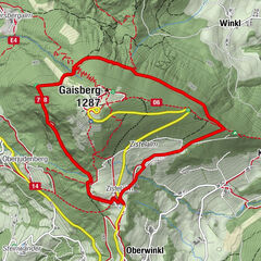
Filbling (Gipfel und Filblingsee)

Logo Filbling (Gipfel und Filblingsee)
Dati percorsi
6,6km
706 - 1.281m
Distanz
564hm
564hm
L'ascesa
03:25h
 
Durata
Descrizione rapida

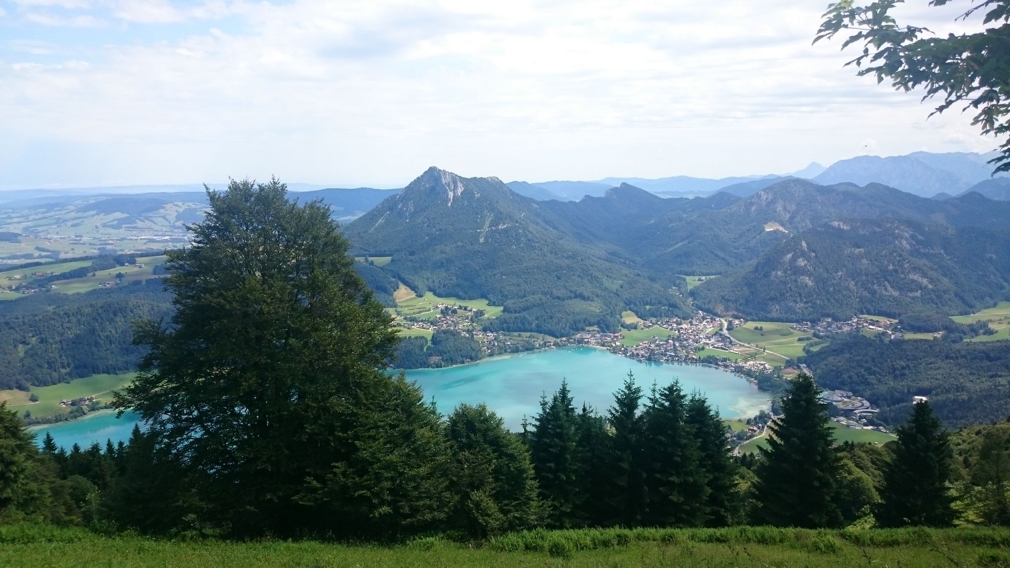
Einfache Wanderung auf einer teilweise steilen Forststraße bis zu einem Gipfel mit großartiger Aussicht

Difficoltà
facile
Valutazione
Tecnica
Forma fisica
Panorama
Avventura / Esperienza
Punto di partenza

Parkplatz, bzw. schräg gegenüber Tischlerei Wörndl


La stagione migliore
gen
feb
mar
apr
mag
giu
lug
ago
set
ott
nov
dic
Punto più alto
1.281 m
Destinazione

Gipfel Filbling


Fonte
Zouhar W.

4,2
Valutazione complessiva

5

57

%

4

21

%

3

14

%

2

0

%

1

7

%

GPS Downloads
  • GPX GPS Exchange Format (XML)
  • KML Google Earth, Google Maps
Codici di download QR per telefoni cellulari

Condizioni dei sentieri

Asfalto
Ghiaia
Prato
Foresta
Roccia
Esposta

Tour popolari della zona

Nockstein

facile Escursionismo
3,35km | 160hm | 02:00h

Gaisberg-Rundwanderweg

facile Escursionismo
5,37km | 109hm | 01:30h

Hintersee Rundwanderweg

facile Escursionismo
5,1km | 9hm | 01:20h

Schafberg von Sankt Wolfgang über die Dorneralm und Schafbergalpe a...

intermedio Escursionismo
7,72km | 1211hm | 02:32h