

© Foto Privat
Dati percorsi
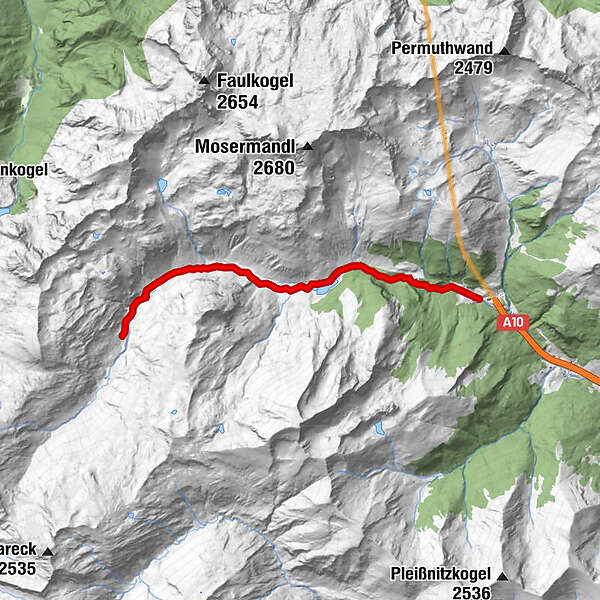
7,43km
1.350
- 1.673m
305hm
05:00h
- Valutazione
-
- Punto di partenza
-
Parkplatz Tauerntunnel Südportal (1.345 m).
- Percorso
-
Brünnwandquellen1,7 kmSchliereralm2,7 kmGruberalmhütte4,4 km
- Punto più alto
- 1.673 m
- Riposo/Ritiro
-
Almgasthof Schliereralm, Gruberalm, Hoislalm, Ilgalm, Königalm

GPS Downloads


Condizioni dei sentieri
Asfalto
Ghiaia
Prato
Foresta
Roccia
Esposta
Altri tour nelle regioni


