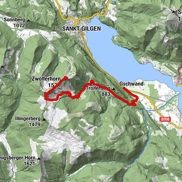
Bergstation Zwölferhorn nach Abersee am Wolfgangsee

Escursionismo
Dati percorsi
11,24km
544
- 1.484m
80hm
961hm
03:30h
- Descrizione rapida
-
Vom Zwölferhorn zum Wolfgangsee.
- Difficoltà
-
facile
- Valutazione
-
- Punto di partenza
-
Bergstation Zwölferhorn
- Percorso
-
Das Zwölfer0,0 kmZwölferhorn (1.521 m)0,4 kmArnikahütte0,5 kmPillsteinhöhe (1.478 m)1,7 kmIllingeralm2,9 kmBraunauer Hütte3,1 kmBrunn10,2 kmGschwand10,8 kmSeegasthof Gamsjaga11,2 km
- La stagione migliore
-
genfebmaraprmaggiulugagosetottnovdic
- Punto più alto
- 1.484 m
- Riposo/Ritiro
-
Annikahütte , Illingeralm, GH Gamsjaga
GPS Downloads


Condizioni dei sentieri
Asfalto
Ghiaia
Prato
Foresta
Roccia
Esposta
Altri tour nelle regioni