Bad Gastein: Zittrauer Tisch und Miesbichlscharte

Escursionismo

- Difficoltà
-
difficile
- Valutazione
-
- Percorso
-
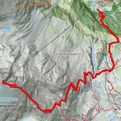
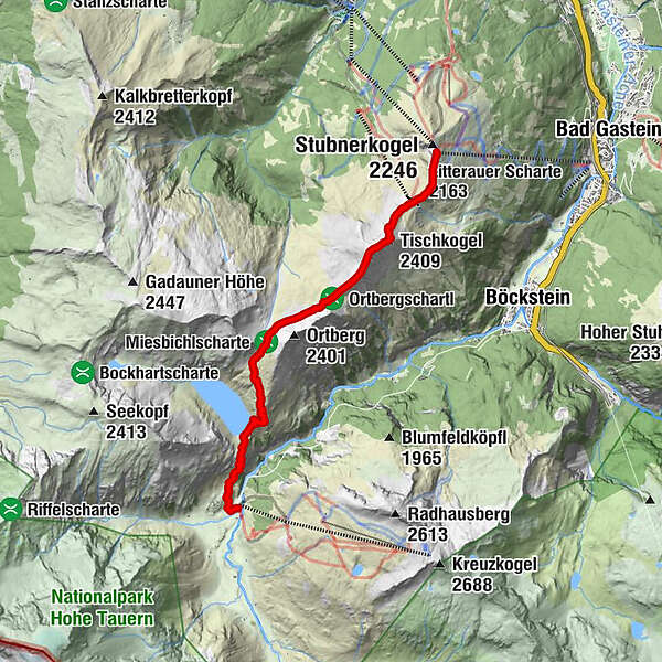
Gipfelrestaurant Stubnerkogel0,1 kmAussichtsplattform Glocknerblick0,3 kmZitterauer Scharte (2.163 m)0,9 kmTischkogel (2.409 m)1,8 kmZitterauer Tisch (2.463 m)2,1 kmZitterauer Alpe4,0 kmBockhartseehütte6,9 kmValeriehaus8,2 kmNaßfeld8,2 kmRestaurant Talstation8,2 kmSportgastein8,2 km
- La stagione migliore
-
genfebmaraprmaggiulugagosetottnovdic
- Punto più alto
- 2.412 m
- Destinazione
-
Sportgastein/Naßfeld
- Profilo altimetrico
-

-

-
AutoreIl tour Bad Gastein: Zittrauer Tisch und Miesbichlscharte è utilizzato da outdooractive.com fornito.
GPS Downloads


Info generali
Punto di ristoro
Culturale/Storico
Flora
Fauna
Promettente
Altri tour nelle regioni