

© Pongau

© Pongau

© Pongau
Dati percorsi
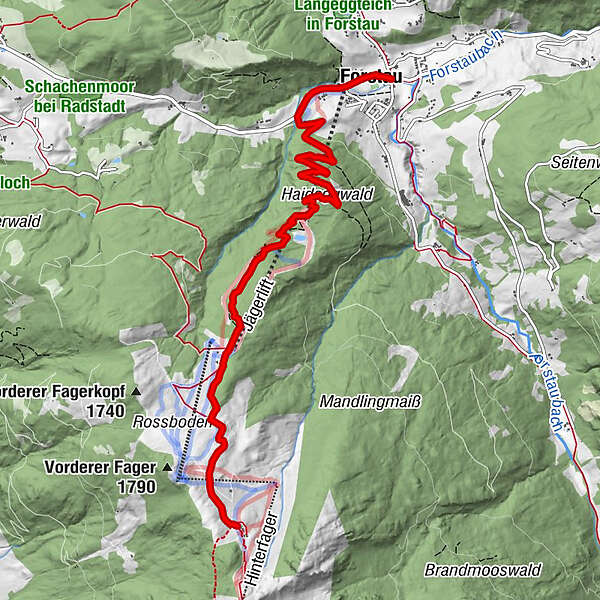
7,28km
905
- 1.747m
812hm
03:00h
- Valutazione
-
- Percorso
-
Forstauer Wirt0,0 kmForstau0,2 kmUnterreith0,3 kmHeideggalm3,9 kmLechneralm5,5 kmTrinkeralm7,3 km
- Punto più alto
- 1.747 m
- Profilo altimetrico
-

- Autore
-
PongauIl tour Forstau - Fageralm è utilizzato da outdooractive.com fornito.
GPS Downloads


Altri tour nelle regioni
-
Schladming - Dachstein
3001
-
Obertauern
1648
-
Fageralm / Forstau
631


